
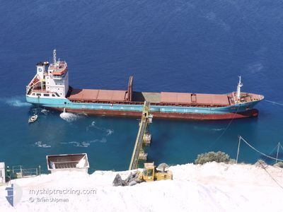
TEONA
General Cargo
Current Trip
| Time Travelled | 4 days |
|---|---|
| Remaining Time | --- |
| Distance Travelled | 730.44 nm |
| Remaining Distance | --- |
| AVG Speed | 10.1 Noeuds |
| MAX Speed | 13.4 Noeuds |
| AVG Wind | 24 knots |
| MAX Wind | 38.9 knots |
| MIN Temp | 1.7°C / 35.06°F |
| MAX Temp | 14.9°C / 58.82°F |
| Tirant d eau | 4.7 m |
| Position reçue | 3 m depuis |
Current Position
| Longitude | --- |
|---|---|
| Latitude | --- |
| Etat | At anchor |
| Vitesse | 0.3 Noeuds |
| Parcours | 228° |
| Zone | North Sea |
| Station | T-AIS |
| Position reçue | 3 m depuis |
Info
Information
The current position of TEONA is in North Sea with coordinates 52.52842° / 4.32883° as reported on 2024-11-25 06:59 by AIS to our vessel tracker app. The vessel's current speed is 0.3 Noeuds
The vessel TEONA (IMO: 9648843, MMSI: 314743000) is a General Cargo that was built in 2013 ( 11 Age ). It's sailing under the flag of [BB] Barbados.
In this page you can find informations about the vessels current position, last detected port calls, and current voyage information. If the vessels is not in coverage by AIS you will find the latest position.
The current position of TEONA is detected by our AIS receivers and we are not responsible for the reliability of the data. The last position was recorded while the vessel was in Coverage by the Ais receivers of our vessel tracking app.
The current draught of TEONA as reported by AIS is 4.7 meters
Weather
| Temperature | 13.1°C / 55.58°F |
|---|---|
| Wind Speed | 30 knots |
| Direction | 209° SSW |
| Pressure | 997.6 hPa |
| Humidity | 80.3 % |
| Cloud Coverage | 100 % |
Featured Company
Last Port Calls
| Port | Arrival | Departure | Time In Port |
|---|---|---|---|
| 2024-11-18 10:58 | 2024-11-20 17:54 | 2 d | |
| 2024-11-08 14:58 | 2024-11-11 00:31 | 2 d | |
| 2024-11-04 11:48 | 2024-11-07 17:32 | 3 d | |
| 2024-10-22 23:05 | 2024-10-24 16:48 | 1 d | |
| 2024-10-14 07:53 | 2024-10-18 04:41 | 3 d | |
| 2024-09-30 16:06 | 2024-10-05 21:23 | 5 d | |
| 2024-09-24 12:21 | 2024-09-30 13:20 | 6 d | |
| 2024-09-02 09:06 |
Last Trips
| Origin | Departure | Destination | Arrival | Distance | |
|---|---|---|---|---|---|
| 2024-11-11 02:31 | 2024-11-18 10:58 | 1624.20 nm | |||
| 2024-11-07 19:32 | 2024-11-08 16:58 | 232.30 nm | |||
| 2024-10-24 17:48 | 2024-11-04 13:48 | 2479.17 nm | |||
| 2024-10-18 05:41 | 2024-10-23 00:05 | 89.03 nm | |||
| 2024-10-05 23:23 | 2024-10-14 08:53 | 2004.78 nm | |||
| 2024-09-30 15:20 | 2024-09-30 18:06 | 26.36 nm | |||
| 2024-09-02 12:06 | 2024-09-24 14:21 | 4517.38 nm |
Events
| Heure | Evenement | Détails | Position/ Destination | Info |
|---|---|---|---|---|
| 2024-11-25 02:33 | Etat Changé | At anchor Default |
52.52792 / 4.32503
NLIJM
|
Vitesse: 0.7 kn Parcours: 207° |
| 2024-11-25 02:30 | Etat Changé | Default At anchor |
52.52793 / 4.32500
NLIJM
|
Vitesse: 0.9 kn Parcours: 211° |
| 2024-11-24 22:46 | Etat Changé | At anchor Default |
52.52779 / 4.32877
NLIJM
|
Vitesse: 0.4 kn Parcours: 199° |
| 2024-11-24 22:43 | Etat Changé | Default At anchor |
52.52792 / 4.32891
NLIJM
|
Vitesse: 0.7 kn Parcours: 192° |
| 2024-11-24 21:34 | Etat Changé | At anchor Default |
52.52812 / 4.32893
NLIJM
|
Vitesse: 1.2 kn Parcours: 201° |
| 2024-11-24 21:28 | Etat Changé | Default At anchor |
52.52771 / 4.32864
NLIJM
|
Vitesse: 1.2 kn Parcours: 201° |
| 2024-11-24 21:22 | Etat Changé | At anchor Default |
52.52795 / 4.32876
NLIJM
|
Vitesse: 1.2 kn Parcours: 199° |
| 2024-11-24 21:19 | Etat Changé | Default At anchor |
52.52800 / 4.32880
NLIJM
|
Vitesse: 0.3 kn Parcours: 198° |
| 2024-11-24 14:57 | Etat Changé | At anchor Default |
52.52832 / 4.32619
NLIJM
|
Vitesse: 0.7 kn Parcours: 199° |
| 2024-11-24 14:54 | Etat Changé | Default At anchor |
52.52839 / 4.32645
NLIJM
|
Vitesse: 1.5 kn Parcours: 200° |