

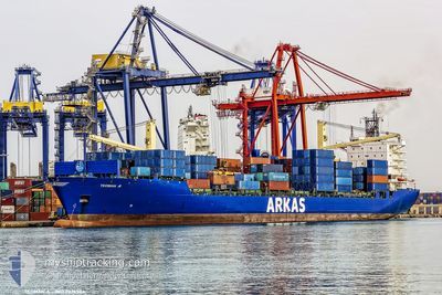
TEOMAN A
Container Ship

Current Trip
| Time Travelled | 3 days |
|---|---|
| Remaining Time | 13 h, 46 mins |
| Distance Travelled | 1285.44 nm |
| Remaining Distance | 147.95 nm |
| AVG Speed | 14.8 Noeuds |
| MAX Speed | 17.8 Noeuds |
| AVG Wind | 9.8 knots |
| MAX Wind | 29 knots |
| MIN Temp | 10.6°C / 51.08°F |
| MAX Temp | 17°C / 62.6°F |
| Tirant d eau | 10.8 m |
| Position reçue | 1 m depuis |
Current Position
| Longitude | --- |
|---|---|
| Latitude | --- |
| Etat | Under way using engine |
| Vitesse | 10.2 Noeuds |
| Parcours | 310.4° |
| Zone | Tyrrhenian Sea |
| Station | T-AIS |
| Position reçue | 1 m depuis |
Information
The current position of TEOMAN A is in Tyrrhenian Sea with coordinates 42.13379° / 10.14407° as reported on 2025-03-27 20:21 by AIS to our vessel tracker app. The vessel's current speed is 10.2 Noeuds and is heading at the port of GENOVA. The estimated time of arrival as calculated by MyShipTracking vessel tracking app is 2025-03-28 11:08 LT
The vessel TEOMAN A (IMO: 9226504, MMSI: 215179000) is a Container Ship that was built in 2001 ( 24 Age ). It's sailing under the flag of [MT] Malta.
In this page you can find informations about the vessels current position, last detected port calls, and current voyage information. If the vessels is not in coverage by AIS you will find the latest position.
The current position of TEOMAN A is detected by our AIS receivers and we are not responsible for the reliability of the data. The last position was recorded while the vessel was in Coverage by the Ais receivers of our vessel tracking app.
The current draught of TEOMAN A as reported by AIS is 10.8 meters
Weather
| Temperature | 12.9°C / 55.22°F |
|---|---|
| Wind Speed | 27 knots |
| Direction | 5° N |
| Pressure | 1009.1 hPa |
| Humidity | 79.9 % |
| Cloud Coverage | 100 % |


Featured Company
Last Port Calls
| Port | Arrival | Departure | Time In Port |
|---|---|---|---|
| 2025-03-22 14:34 | 2025-03-24 07:12 | 1 d | |
| 2025-03-15 06:56 | 2025-03-17 11:01 | 2 d | |
| 2025-03-11 12:21 | 2025-03-12 09:02 | 20 h | |
| 2025-03-05 18:44 | 2025-03-07 02:49 | 1 d | |
| 2025-03-04 13:05 | 2025-03-05 03:27 | 14 h | |
| 2025-03-02 12:19 | 2025-03-03 00:21 | 12 h | |
| 2025-02-28 12:09 | 2025-03-01 08:10 | 20 h | |
| 2025-02-24 01:29 | 2025-02-24 12:35 | 11 h | |
| 2025-02-19 00:47 | 2025-02-19 21:08 | 20 h | |
| 2025-02-15 17:53 | 2025-02-17 09:46 | 1 d |
Last Trips
| Origin | Departure | Destination | Arrival | Distance | |
|---|---|---|---|---|---|
| 2025-03-17 11:01 | 2025-03-22 14:34 | 697.82 nm | |||
| 2025-03-12 09:02 | 2025-03-15 06:56 | 250.44 nm | |||
| 2025-03-07 02:49 | 2025-03-11 12:21 | 1554.37 nm | |||
| 2025-03-05 03:27 | 2025-03-05 18:44 | 235.56 nm | |||
| 2025-03-03 00:21 | 2025-03-04 13:05 | 245.05 nm | |||
| 2025-03-01 08:10 | 2025-03-02 12:19 | 220.59 nm | |||
| 2025-02-24 12:35 | 2025-02-28 12:09 | 601.50 nm | |||
| 2025-02-19 21:08 | 2025-02-24 01:29 | 1659.36 nm | |||
| 2025-02-17 09:46 | 2025-02-19 00:47 | 623.26 nm | |||
| 2025-02-15 10:08 | 2025-02-15 17:53 | 98.26 nm |
Events
| Heure | Evenement | Détails | Position/ Destination | Info |
|---|---|---|---|---|
| 2025-03-27 19:20 | Etat Changé | Under way using engine Default |
42.02705 / 10.31775
ITGOA
|
Vitesse: 10.5 kn Parcours: 310° |
| 2025-03-27 19:12 | Etat Changé | Default Under way using engine |
42.01250 / 10.34142
ITGOA
|
Vitesse: 10.6 kn Parcours: 310.4° |
| 2025-03-27 18:50 | Etat Changé | Under way using engine Default |
41.96865 / 10.41052
ITGOA
|
Vitesse: 10.6 kn Parcours: 310° |
| 2025-03-27 18:39 | Etat Changé | Default Under way using engine |
41.94857 / 10.44231
ITGOA
|
Vitesse: 10.5 kn Parcours: 312° |
| 2025-03-27 18:28 | Etat Changé | Under way using engine Default |
41.92668 / 10.47653
ITGOA
|
Vitesse: 10.5 kn Parcours: 311° |
| 2025-03-27 18:12 | Dans la zone couverte |
41.92668 / 10.47653
Tyrrhenian Sea
ITGOA
|
Vitesse: 10.5 kn Parcours: 312° |
|
| 2025-03-26 19:17 | Etat Changé | Default Under way using engine |
38.92635 / 14.89025
ITGOA
|
Vitesse: 12.3 kn Parcours: 313.1° |
| 2025-03-26 19:12 | Hors de la zone couverte |
38.91359 / 14.90800
Tyrrhenian Sea
ITGOA
|
Vitesse: 12.3 kn Parcours: 313.1° |
|
| 2025-03-26 14:31 | Changement de zone | Italian part of the Tyrrhenian Sea Italian part of the Ionian Sea |
38.25323 / 15.67118
Tyrrhenian Sea
ITGOA
|
Vitesse: 15.7 kn Parcours: 57.1° |
| 2025-03-26 10:40 | Etat Changé | Under way using engine Default |
37.64854 / 16.32118
ITGOA
|
Vitesse: 16.7 kn Parcours: 296° |