
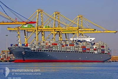
TENO
Container Ship
Current Trip
| Time Travelled | 1 day |
|---|---|
| Remaining Time | --- |
| Distance Travelled | 731.61 nm |
| Remaining Distance | --- |
| AVG Speed | 14.5 Noeuds |
| MAX Speed | 19.9 Noeuds |
| AVG Wind | 13.7 knots |
| MAX Wind | 22 knots |
| MIN Temp | 10.2°C / 50.36°F |
| MAX Temp | 16.9°C / 62.42°F |
| Tirant d eau | 13 m |
| Position reçue | 2 h, 5 m depuis |
Current Position
| Longitude | -7.56708° |
|---|---|
| Latitude | 58.62944° |
| Etat | Under way using engine |
| Vitesse | 18.3 Noeuds |
| Parcours | 260.2° |
| Zone | North Atlantic Ocean |
| Station | T-AIS |
| Position reçue | 2 h, 5 m depuis |
Info
Information
The current position of TENO is in North Atlantic Ocean with coordinates 58.62944° / -7.56708° as reported on 2024-05-16 22:52 by AIS to our vessel tracker app. The vessel's current speed is 18.3 Noeuds and is heading at the port of NEW YORK. The estimated time of arrival as calculated by MyShipTracking vessel tracking app is 2024-05-24 08:00 LT
The vessel TENO (IMO: 9447859, MMSI: 636092781) is a Container Ship that was built in 2011 ( 13 Age ). It's sailing under the flag of [LR] Liberia.
In this page you can find informations about the vessels current position, last detected port calls, and current voyage information. If the vessels is not in coverage by AIS you will find the latest position.
The current position of TENO is detected by our AIS receivers and we are not responsible for the reliability of the data. The last position was recorded while the vessel was in Coverage by the Ais receivers of our vessel tracking app.
The current draught of TENO as reported by AIS is 13 meters
Weather
| Temperature | 11.2°C / 52.16°F |
|---|---|
| Wind Speed | 11 knots |
| Direction | 5° N |
| Pressure | 1014.8 hPa |
| Humidity | 91 % |
| Cloud Coverage | 100 % |
Featured Company
Last Port Calls
| Port | Arrival | Departure | Time In Port |
|---|---|---|---|
| 2024-05-13 11:24 | 2024-05-15 02:41 | 1 d | |
| 2024-05-10 18:33 | 2024-05-12 15:00 | 1 d | |
| 2024-05-05 09:19 | 2024-05-06 11:30 | 1 d | |
| 2024-05-04 03:49 | 2024-05-04 18:51 | 15 h | |
| 2024-04-22 21:51 | 2024-04-23 21:37 | 23 h | |
| 2024-04-20 20:08 | 2024-04-21 08:51 | 12 h | |
| 2024-04-17 19:10 | 2024-04-19 23:13 | 2 d | |
| 2024-04-07 05:53 | 2024-04-08 13:29 | 1 d | |
| 2024-04-05 00:42 | 2024-04-06 04:22 | 1 d | |
| 2024-04-01 03:04 | 2024-04-01 18:55 | 15 h |
Most Visited Ports (Last year)
| Port | Arrivals | |
|---|---|---|
| 8 | ||
| 7 | ||
| 5 | ||
| 4 | ||
| 4 | ||
| 4 |
Last Trips
| Origin | Departure | Destination | Arrival | Distance | |
|---|---|---|---|---|---|
| 2024-05-12 17:00 | 2024-05-13 13:24 | 302.52 nm | |||
| 2024-05-06 13:30 | 2024-05-10 20:33 | 277.02 nm | |||
| 2024-05-04 19:51 | 2024-05-05 11:19 | 119.49 nm | |||
| 2024-04-23 17:37 | 2024-05-04 04:49 | 3388.89 nm | |||
| 2024-04-21 04:51 | 2024-04-22 17:51 | 296.24 nm | |||
| 2024-04-19 19:13 | 2024-04-20 16:08 | 262.45 nm | |||
| 2024-04-08 15:29 | 2024-04-17 15:10 | 3738.52 nm | |||
| 2024-04-06 06:22 | 2024-04-07 07:53 | 306.30 nm | |||
| 2024-04-01 20:55 | 2024-04-05 02:42 | 283.20 nm | |||
| 2024-03-30 17:10 | 2024-04-01 05:04 | 161.91 nm |
Events
| Heure | Evenement | Détails | Position/ Destination | Info |
|---|---|---|---|---|
| 2024-05-16 22:58 | Etat Changé | Default Under way using engine |
58.62446 / -7.62252
USNYC
|
Vitesse: 18.3 kn Parcours: 260.2° |
| 2024-05-16 22:52 | Hors de la zone couverte |
58.62944 / -7.56708
North Atlantic Ocean
USNYC
|
Vitesse: 18.3 kn Parcours: 260.2° |
|
| 2024-05-16 22:51 | Etat Changé | Under way using engine Default |
58.63055 / -7.55464
USNYC
|
Vitesse: 18.3 kn Parcours: 260° |
| 2024-05-16 22:35 | Dans la zone couverte |
58.62944 / -7.56708
North Atlantic Ocean
USNYC
|
Vitesse: 18.3 kn Parcours: 260.2° |
|
| 2024-05-16 17:19 | Etat Changé | Default Under way using engine |
58.73790 / -4.37277
USNYC
|
Vitesse: 13.3 kn Parcours: 271.1° |
| 2024-05-16 17:11 | Etat Changé | Under way using engine Default |
58.73560 / -4.31839
USNYC
|
Vitesse: 13.8 kn Parcours: 270° |
| 2024-05-16 17:11 | Hors de la zone couverte |
58.73560 / -4.31839
North Atlantic Ocean
USNYC
|
Vitesse: 13.3 kn Parcours: 271.1° |
|
| 2024-05-16 16:58 | Etat Changé | Default Under way using engine |
58.73518 / -4.22505
USNYC
|
Vitesse: 17.3 kn Parcours: 268.4° |
| 2024-05-16 15:45 | Etat Changé | Under way using engine Default |
58.73717 / -3.55677
USNYC
|
Vitesse: 16.6 kn Parcours: 272° |
| 2024-05-16 15:43 | Etat Changé | Default Under way using engine |
58.73680 / -3.53978
USNYC
|
Vitesse: 16.4 kn Parcours: 272.3° |