

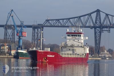
TASMAN
Cargo

Current Trip
SRSMA
| Time Travelled | 3 days |
|---|---|
| Remaining Time | --- |
| Distance Travelled | 748.66 nm |
| Remaining Distance | --- |
| AVG Speed | 9.8 Noeuds |
| MAX Speed | 11.3 Noeuds |
| AVG Wind | 13.3 knots |
| MAX Wind | 21.5 knots |
| MIN Temp | 3°C / 37.4°F |
| MAX Temp | 8.6°C / 47.48°F |
| Tirant d eau | 6 m |
| Position reçue | 3 m depuis |
Current Position
| Longitude | --- |
|---|---|
| Latitude | --- |
| Etat | Under way using engine |
| Vitesse | 9.7 Noeuds |
| Parcours | 211° |
| Zone | North Sea |
| Station | T-AIS |
| Position reçue | 3 m depuis |
Information
The current position of TASMAN is in North Sea with coordinates 55.34950° / 6.06963° as reported on 2025-03-28 01:44 by AIS to our vessel tracker app. The vessel's current speed is 9.7 Noeuds
The vessel TASMAN (IMO: 9849136, MMSI: 314477000) is a Cargo It's sailing under the flag of [BB] Barbados.
In this page you can find informations about the vessels current position, last detected port calls, and current voyage information. If the vessels is not in coverage by AIS you will find the latest position.
The current position of TASMAN is detected by our AIS receivers and we are not responsible for the reliability of the data. The last position was recorded while the vessel was in Coverage by the Ais receivers of our vessel tracking app.
The current draught of TASMAN as reported by AIS is 6 meters
Weather
| Temperature | 7.5°C / 45.5°F |
|---|---|
| Wind Speed | 20 knots |
| Direction | 209° SSW |
| Pressure | 1009.7 hPa |
| Humidity | 92.4 % |
| Cloud Coverage | 100 % |


Featured Company
Last Port Calls
| Port | Arrival | Departure | Time In Port |
|---|---|---|---|
| 2025-03-24 22:03 | 2025-03-24 22:49 | 46 m | |
| 2025-03-23 22:37 | 2025-03-24 15:18 | 16 h | |
| 2025-03-23 15:51 | 2025-03-23 16:12 | 20 m | |
| 2025-03-18 19:50 | 2025-03-22 06:16 | 3 d | |
| 2025-03-11 14:38 | 2025-03-14 17:32 | 3 d | |
| 2025-02-28 09:01 | 2025-03-02 17:25 | 2 d | |
| 2025-02-04 11:27 | 2025-02-15 16:47 | 11 d | |
| 2025-01-13 16:56 | 2025-01-13 20:32 | 3 h | |
| 2025-01-11 16:02 | 2025-01-11 16:48 | 46 m | |
| 2025-01-10 13:28 | 2025-01-11 08:55 | 19 h |
Last Trips
| Origin | Departure | Destination | Arrival | Distance | |
|---|---|---|---|---|---|
| 2025-03-24 15:18 | 2025-03-24 22:03 | 66.42 nm | |||
| 2025-03-23 16:12 | 2025-03-23 22:37 | 66.51 nm | |||
| 2025-03-22 06:16 | 2025-03-23 15:51 | 250.02 nm | |||
| 2025-03-14 17:32 | 2025-03-18 19:50 | 956.64 nm | |||
| 2025-03-02 17:25 | 2025-03-11 14:38 | 2385.99 nm | |||
| 2025-02-15 16:47 | 2025-02-28 09:01 | 2538.87 nm | |||
| 2025-01-13 20:32 | 2025-02-04 11:27 | 4704.05 nm | |||
| 2025-01-11 16:48 | 2025-01-13 16:56 | 516.96 nm | |||
| 2025-01-11 08:55 | 2025-01-11 16:02 | 66.41 nm | |||
| 2025-01-10 06:54 | 2025-01-10 13:28 | 65.57 nm |
Events
| Heure | Evenement | Détails | Position/ Destination | Info |
|---|---|---|---|---|
| 2025-03-28 01:20 | Changement de zone | German part of the North Sea Danish part of the North Sea |
55.40318 / 6.12510
North Sea
SRSMA
|
Vitesse: 9.6 kn Parcours: 211.8° |
| 2025-03-28 01:20 | Etat Changé | Under way using engine Default |
55.40318 / 6.12510
SRSMA
|
Vitesse: 9.5 kn Parcours: 207° |
| 2025-03-28 01:04 | Etat Changé | Default Under way using engine |
55.43937 / 6.16375
SRSMA
|
Vitesse: 9.4 kn Parcours: 210.5° |
| 2025-03-28 00:44 | Etat Changé | Under way using engine Default |
55.48598 / 6.21280
SRSMA
|
Vitesse: 9.3 kn Parcours: 211° |
| 2025-03-28 00:27 | Etat Changé | Default Under way using engine |
55.52329 / 6.25120
SRSMA
|
Vitesse: 9.1 kn Parcours: 207.2° |
| 2025-03-27 11:31 | Changement de zone | Danish part of the North Sea Danish part of the Skaggerak |
57.19377 / 8.47030
North Sea
SRSMA
|
Vitesse: 10 kn Parcours: 218.7° |
| 2025-03-27 01:44 | Changement de zone | Danish part of the Skaggerak Danish part of the Kattegat |
57.80445 / 10.94863
Skaggerak
SRSMA
|
Vitesse: 9.6 kn Parcours: 299.5° |
| 2025-03-27 01:10 | Changement de zone | Danish part of the Kattegat Swedish part of the Kattegat |
57.75843 / 11.09865
Kattegat
SRSMA
|
Vitesse: 10.2 kn Parcours: 299.8° |
| 2025-03-26 23:07 | Démarrage | 2.95 nm, South West of SANDVIK |
57.59683 / 11.69062
SRSMA
|
Vitesse: 5.9 kn Parcours: 273.5° |
| 2025-03-26 23:03 | Etat Changé | Under way using engine At anchor |
57.59740 / 11.69617
SRSMA
|
Vitesse: Parcours: 245° |