
SYNTHESE 18
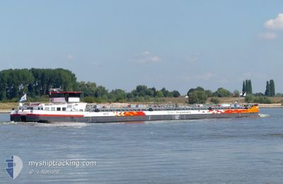
Tanker
Current Trip
FAR FAR AWAY
| Time Travelled | 1 day |
|---|---|
| Remaining Time | --- |
| Distance Travelled | 89.79 nm |
| Remaining Distance | --- |
| AVG Speed | 6 Noeuds |
| MAX Speed | 8 Noeuds |
| AVG Wind | 2.1 knots |
| MAX Wind | 4 knots |
| MIN Temp | 2°C / 35.6°F |
| MAX Temp | 7.1°C / 44.78°F |
| Tirant d eau | 2.5 m |
| Position reçue | 10 h, 27 m depuis |
Current Position
| Longitude | --- |
|---|---|
| Latitude | --- |
| Etat | Under way using engine |
| Vitesse | 8 Noeuds |
| Parcours | 232.9° |
| Zone | North Sea |
| Station | T-AIS |
| Position reçue | 10 h, 27 m depuis |
Info
Information
The current position of SYNTHESE 18 is in North Sea with coordinates 49.71917° / 6.61117° as reported on 2025-12-14 11:59 by AIS to our vessel tracker app. The vessel's current speed is 8 Noeuds
The vessel SYNTHESE 18 (MMSI: 253242513) is a Tanker It's sailing under the flag of [LU] Luxembourg.
In this page you can find informations about the vessels current position, last detected port calls, and current voyage information. If the vessels is not in coverage by AIS you will find the latest position.
The current position of SYNTHESE 18 is detected by our AIS receivers and we are not responsible for the reliability of the data. The last position was recorded while the vessel was in Coverage by the Ais receivers of our vessel tracking app.
The current draught of SYNTHESE 18 as reported by AIS is 2.5 meters
Weather
| Temperature | 2.7°C / 36.86°F |
|---|---|
| Wind Speed | 4 knots |
| Direction | 137° SE |
| Pressure | 1022.6 hPa |
| Humidity | 93.7 % |
| Cloud Coverage | 9 % |
Featured Company
Last Port Calls
| Port | Arrival | Departure | Time In Port |
|---|---|---|---|
| 2025-12-13 04:31 | 2025-12-13 04:44 | 12 m | |
| 2025-12-12 05:33 | 2025-12-12 07:19 | 1 h | |
| 2025-12-11 19:26 | 2025-12-11 20:40 | 1 h | |
| 2025-12-10 23:02 | 2025-12-11 15:18 | 16 h | |
| 2025-12-09 21:11 | 2025-12-10 16:19 | 19 h | |
| 2025-12-08 22:17 | 2025-12-09 14:32 | 16 h | |
| 2025-12-07 15:25 | 2025-12-07 15:41 | 15 m | |
| 2025-12-06 20:27 | 2025-12-07 13:21 | 16 h | |
| 2025-12-06 18:10 | 2025-12-06 18:41 | 31 m | |
| 2025-12-06 08:06 | 2025-12-06 10:08 | 2 h |
Last Trips
| Origin | Departure | Destination | Arrival | Distance | |
|---|---|---|---|---|---|
| 2025-12-12 07:19 | 2025-12-13 04:31 | 97.34 nm | |||
| 2025-12-11 20:40 | 2025-12-12 05:33 | 43.75 nm | |||
| 2025-12-11 15:18 | 2025-12-11 19:26 | 20.99 nm | |||
| 2025-12-10 16:19 | 2025-12-10 23:02 | 54.37 nm | |||
| 2025-12-09 14:32 | 2025-12-09 21:11 | 32.04 nm | |||
| 2025-12-07 15:41 | 2025-12-08 22:17 | 283.58 nm | |||
| 2025-12-07 13:21 | 2025-12-07 15:25 | 9.99 nm | |||
| 2025-12-06 18:41 | 2025-12-06 20:27 | 9.23 nm | |||
| 2025-12-06 10:08 | 2025-12-06 18:10 | 35.87 nm | |||
| 2025-12-05 20:27 | 2025-12-06 08:06 | 34.72 nm |
Events
| Heure | Evenement | Détails | Position/ Destination | Info |
|---|---|---|---|---|
| 2025-12-14 17:28 | Arret | 14.52 nm, South of MERTERT |
49.46667 / 6.36833
FAR FAR AWAY
|
Vitesse: Parcours: -1° |
| 2025-12-14 12:02 | Etat Changé | Default Under way using engine |
49.71622 / 6.60266
FAR FAR AWAY
|
Vitesse: 8 kn Parcours: 232.9° |
| 2025-12-14 11:59 | Hors de la zone couverte |
49.71917 / 6.61117
North Sea
FAR FAR AWAY
|
Vitesse: 8 kn Parcours: 232.9° |
|
| 2025-12-14 11:55 | Démarrage | 2.1 nm, South of TRIER |
49.72576 / 6.61963
FAR FAR AWAY
|
Vitesse: 6 kn Parcours: 204.8° |
| 2025-12-14 11:45 | Etat Changé | Under way using engine Default |
49.72913 / 6.62204
FAR FAR AWAY
|
Vitesse: 1.2 kn Parcours: 205° |
| 2025-12-14 11:45 | Arret | 1.89 nm, South of TRIER |
49.72913 / 6.62204
FAR FAR AWAY
|
Vitesse: Parcours: 204° |
| 2025-12-14 11:32 | Etat Changé | Default Under way using engine |
49.73012 / 6.62272
FAR FAR AWAY
|
Vitesse: 5 kn Parcours: 179.1° |
| 2025-12-14 11:08 | Etat Changé | Under way using engine Default |
49.75740 / 6.62726
FAR FAR AWAY
|
Vitesse: 5 kn Parcours: 209° |
| 2025-12-14 11:03 | Etat Changé | Default Under way using engine |
49.76353 / 6.63064
FAR FAR AWAY
|
Vitesse: 5 kn Parcours: 218.2° |
| 2025-12-14 08:58 | Dans la zone couverte |
49.80599 / 6.85145
North Sea
FAR FAR AWAY
|
Vitesse: 7.5 kn Parcours: 166.1° |