
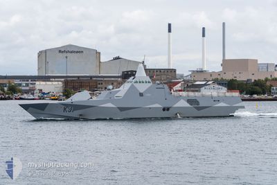
SWEDISH WARSHIP K31
Not available
Current Trip
Unknown
| Time Travelled | 3 days |
|---|---|
| Remaining Time | --- |
| Distance Travelled | 283.96 nm |
| Remaining Distance | --- |
| AVG Speed | 7.6 Noeuds |
| MAX Speed | 19.4 Noeuds |
| AVG Wind | 9.4 knots |
| MAX Wind | 21.6 knots |
| MIN Temp | 6.9°C / 44.42°F |
| MAX Temp | 10.3°C / 50.54°F |
| Tirant d eau | 0 m |
| Position reçue | 1 d depuis |
Current Position
| Longitude | 15.35243° |
|---|---|
| Latitude | 55.76059° |
| Etat | Under way using engine |
| Vitesse | 8.2 Noeuds |
| Parcours | 242.6° |
| Zone | Baltic Sea |
| Station | T-AIS |
| Position reçue | 1 d depuis |
Info
Information
The current position of SWEDISH WARSHIP K31 is in Baltic Sea with coordinates 55.76059° / 15.35243° as reported on 2024-05-02 13:39 by AIS to our vessel tracker app. The vessel's current speed is 8.2 Noeuds
The vessel SWEDISH WARSHIP K31 (MMSI: 265823000) is a Not available It's sailing under the flag of [SE] Sweden.
In this page you can find informations about the vessels current position, last detected port calls, and current voyage information. If the vessels is not in coverage by AIS you will find the latest position.
The current position of SWEDISH WARSHIP K31 is detected by our AIS receivers and we are not responsible for the reliability of the data. The last position was recorded while the vessel was in Coverage by the Ais receivers of our vessel tracking app.
Weather
| Temperature | 7.1°C / 44.78°F |
|---|---|
| Wind Speed | 21 knots |
| Direction | 63° ENE |
| Pressure | 1013.2 hPa |
| Humidity | 91.6 % |
| Cloud Coverage | 2 % |
Featured Company
Last Port Calls
| Port | Arrival | Departure | Time In Port |
|---|---|---|---|
| 2024-04-08 08:01 | 2024-04-29 14:42 | 21 d | |
| 2024-04-08 06:58 |
Most Visited Ports (Last year)
| Port | Arrivals | |
|---|---|---|
| 1 |
Last Trips
| Origin | Departure | Destination | Arrival | Distance | |
|---|---|---|---|---|---|
| 2024-04-08 08:58 | 2024-04-08 10:01 | 2.23 nm |
Events
| Heure | Evenement | Détails | Position/ Destination | Info |
|---|---|---|---|---|
| 2024-05-02 13:39 | Hors de la zone couverte |
55.76059 / 15.35243
Baltic Sea
|
Vitesse: 8.2 kn Parcours: 242.6° |
|
| 2024-05-02 13:39 | Detecté en mer | Swedish part of the Baltic Sea |
55.76059 / 15.35243
Baltic Sea
|
Vitesse: 8.2 kn Parcours: 242.6° |
| 2024-05-02 13:39 | Dans la zone couverte |
55.76059 / 15.35243
Baltic Sea
|
Vitesse: 8.2 kn Parcours: 242.6° |
|
| 2024-05-01 05:18 | Hors de la zone couverte |
55.26102 / 17.63859
Baltic Sea
|
Vitesse: 13.2 kn Parcours: 255.4° |
|
| 2024-04-30 22:44 | Dans la zone couverte |
55.58897 / 18.76705
Baltic Sea
|
Vitesse: 19.4 kn Parcours: 222.7° |
|
| 2024-04-30 10:25 | Hors de la zone couverte |
55.25444 / 18.23143
Baltic Sea
|
Vitesse: 9.8 kn Parcours: 37° |
|
| 2024-04-30 09:41 | Dans la zone couverte |
55.15746 / 18.05938
Baltic Sea
|
Vitesse: 13.2 kn Parcours: 48.6° |
|
| 2024-04-30 08:02 | Hors de la zone couverte |
55.18475 / 17.97615
Baltic Sea
|
Vitesse: 5.4 kn Parcours: 115° |
|
| 2024-04-30 04:20 | Detecté en mer | Polish part of the Baltic Sea |
55.58101 / 17.38837
Baltic Sea
|
Vitesse: 13 kn Parcours: 145.9° |
| 2024-04-29 17:51 | Dans la zone couverte |
56.06557 / 16.75727
Baltic Sea
|
Vitesse: 13.1 kn Parcours: 59.9° |