
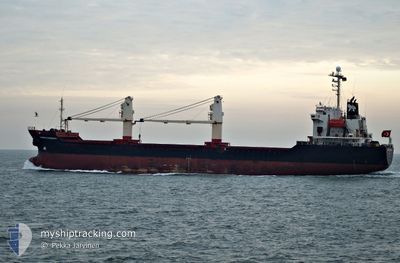
SUVARI KAPTAN
Bulk Carrier
Current Trip
| Time Travelled | 9 days |
|---|---|
| Remaining Time | --- |
| Distance Travelled | 838.62 nm |
| Remaining Distance | --- |
| AVG Speed | 11.7 Noeuds |
| MAX Speed | 13.9 Noeuds |
| AVG Wind | 13.6 knots |
| MAX Wind | 24.6 knots |
| MIN Temp | 28.2°C / 82.76°F |
| MAX Temp | 34.8°C / 94.64°F |
| Tirant d eau | 5.2 m |
| Position reçue | 8 d depuis |
Current Position
| Longitude | 57.36021° |
|---|---|
| Latitude | 25.24619° |
| Etat | Under way using engine |
| Vitesse | 12.5 Noeuds |
| Parcours | 106.1° |
| Zone | Gulf of Oman |
| Station | T-AIS |
| Position reçue | 8 d depuis |
Info
Information
The current position of SUVARI KAPTAN is in Gulf of Oman with coordinates 25.24619° / 57.36021° as reported on 2024-05-26 21:23 by AIS to our vessel tracker app. The vessel's current speed is 12.5 Noeuds
The vessel SUVARI KAPTAN (IMO: 9146118, MMSI: 371212000) is a Bulk Carrier that was built in 1997 ( 27 Age ). It's sailing under the flag of [PA] Panama.
In this page you can find informations about the vessels current position, last detected port calls, and current voyage information. If the vessels is not in coverage by AIS you will find the latest position.
The current position of SUVARI KAPTAN is detected by our AIS receivers and we are not responsible for the reliability of the data. The last position was recorded while the vessel was in Coverage by the Ais receivers of our vessel tracking app.
The current draught of SUVARI KAPTAN as reported by AIS is 5.2 meters
Weather
| Temperature | 29.5°C / 85.1°F |
|---|---|
| Wind Speed | 15 knots |
| Direction | 255° WSW |
| Pressure | 1006.5 hPa |
| Humidity | 80.1 % |
| Cloud Coverage | 2 % |
Featured Company
Last Port Calls
| Port | Arrival | Departure | Time In Port |
|---|---|---|---|
| 2024-05-24 19:00 | 2024-05-26 20:28 | 2 d | |
| 2024-05-11 10:19 | 2024-05-19 09:05 | 7 d | |
| 2024-04-26 14:23 | 2024-05-01 06:30 | 4 d | |
| 2024-04-13 13:26 | 2024-04-16 16:50 | 3 d |
Events
| Heure | Evenement | Détails | Position/ Destination | Info |
|---|---|---|---|---|
| 2024-05-30 01:02 | Arret | 16.22 nm, East of MUNDRA |
22.79250 / 69.97490
IN IXY
|
Vitesse: 0.2 kn Parcours: 256° |
| 2024-05-27 14:25 | Démarrage |
25.26333 / 58.00500
IN IXY
|
Vitesse: 5 kn Parcours: 51° |
|
| 2024-05-27 01:04 | Arret |
25.13167 / 57.99833
IN IXY
|
Vitesse: Parcours: -1° |
|
| 2024-05-26 21:28 | Etat Changé | Default Under way using engine |
25.24000 / 57.37667
IN IXY
|
Vitesse: 12.5 kn Parcours: 106.1° |
| 2024-05-26 21:23 | Hors de la zone couverte |
25.24619 / 57.36021
Gulf of Oman
IN IXY
|
Vitesse: 12.5 kn Parcours: 106.1° |
|
| 2024-05-26 19:38 | Changement de zone | Iranian part of the Gulf of Oman United Arab Emirates part of the Gulf of Oman |
25.33856 / 56.97814
Gulf of Oman
IN IXY
|
Vitesse: 12 kn Parcours: 102.9° |
| 2024-05-26 16:46 | Etat Changé | Under way using engine Moored |
25.38010 / 56.40959
IN IXY
|
Vitesse: 11 kn Parcours: 41.4° |
| 2024-05-26 16:28 | PORT DE DEPART |
|
25.36393 / 56.36818
IN IXY
|
Vitesse: 4.9 kn Parcours: 4° |
| 2024-05-26 16:25 | Démarrage |
25.36062 / 56.36898
[AE] KHORFAKKAN
|
Vitesse: 3.8 kn Parcours: 337° |
|
| 2024-05-26 15:38 | Changement d'ETA | 2024/05/29 12:00 2024/05/24 10:00 |
25.35919 / 56.36773
[AE] KHORFAKKAN
|
Vitesse: Parcours: 147° |