
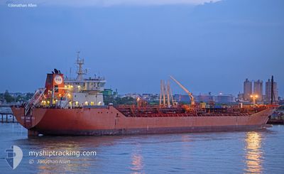
SUPER INFINITY
Oil/Chemical Tanker
Current Trip
| Time Travelled | 10 days |
|---|---|
| Remaining Time | 2 days |
| Distance Travelled | 1493.42 nm |
| Remaining Distance | 1492.92 nm |
| AVG Speed | 11.8 Noeuds |
| MAX Speed | 14.5 Noeuds |
| AVG Wind | 7.3 knots |
| MAX Wind | 21.4 knots |
| MIN Temp | 26.5°C / 79.7°F |
| MAX Temp | 29.8°C / 85.64°F |
| Tirant d eau | 6.8 m |
| Position reçue | 2 d depuis |
Current Position
| Longitude | 91.70858° |
|---|---|
| Latitude | 22.11532° |
| Etat | Under way using engine |
| Vitesse | 12.3 Noeuds |
| Parcours | 187.7° |
| Zone | Bay of Bengal |
| Station | T-AIS |
| Position reçue | 2 d depuis |
Info
Information
The current position of SUPER INFINITY is in Bay of Bengal with coordinates 22.11532° / 91.70858° as reported on 2024-06-26 04:30 by AIS to our vessel tracker app. The vessel's current speed is 12.3 Noeuds and is heading at the port of SINGAPORE. The estimated time of arrival as calculated by MyShipTracking vessel tracking app is 2024-07-01 06:44 LT
The vessel SUPER INFINITY (IMO: 9341342, MMSI: 356819000) is a Oil/Chemical Tanker that was built in 2009 ( 15 Age ). It's sailing under the flag of [PA] Panama.
In this page you can find informations about the vessels current position, last detected port calls, and current voyage information. If the vessels is not in coverage by AIS you will find the latest position.
The current position of SUPER INFINITY is detected by our AIS receivers and we are not responsible for the reliability of the data. The last position was recorded while the vessel was in Coverage by the Ais receivers of our vessel tracking app.
The current draught of SUPER INFINITY as reported by AIS is 6.8 meters
Weather
| Temperature | 28.5°C / 83.3°F |
|---|---|
| Wind Speed | 6 knots |
| Direction | 224° SW |
| Pressure | 1007.9 hPa |
| Humidity | 73.9 % |
| Cloud Coverage | 59 % |
Featured Company
Last Port Calls
| Port | Arrival | Departure | Time In Port |
|---|---|---|---|
| 2024-06-14 07:41 | 2024-06-18 20:04 | 4 d | |
| 2024-06-09 12:25 | 2024-06-11 02:05 | 1 d | |
| 2024-06-05 20:14 | |||
| 2024-06-01 01:57 | 2024-06-02 09:05 | 1 d | |
| 2024-05-30 11:51 | 2024-05-31 10:18 | 22 h | |
| 2024-05-27 12:04 | 2024-05-28 12:28 | 1 d | |
| 2024-05-20 14:53 | 2024-05-21 15:06 | 1 d | |
| 2024-05-14 07:40 | 2024-05-15 07:04 | 23 h | |
| 2024-05-08 08:14 | 2024-05-09 13:30 | 1 d | |
| 2024-05-04 11:46 | 2024-05-05 20:18 | 1 d |
Most Visited Ports (Last year)
| Port | Arrivals | |
|---|---|---|
| 11 | ||
| 4 | ||
| 3 | ||
| 2 | ||
| 2 | ||
| 1 |
Last Trips
| Origin | Departure | Destination | Arrival | Distance | |
|---|---|---|---|---|---|
| 2024-06-11 10:05 | 2024-06-14 15:41 | 328.42 nm | |||
| 2024-06-02 17:05 | 2024-06-09 20:25 | 411.82 nm | |||
| 2024-06-02 17:05 | 2024-06-06 04:14 | 174.08 nm | |||
| 2024-05-31 18:18 | 2024-06-01 09:57 | 162.85 nm | |||
| 2024-05-28 20:28 | 2024-05-30 19:51 | 215.33 nm | |||
| 2024-05-21 23:06 | 2024-05-27 20:04 | 1655.11 nm | |||
| 2024-05-15 15:04 | 2024-05-20 22:53 | 450.17 nm | |||
| 2024-05-09 21:30 | 2024-05-14 15:40 | 1422.05 nm | |||
| 2024-05-06 04:18 | 2024-05-08 16:14 | 472.21 nm | |||
| 2024-05-04 04:58 | 2024-05-04 19:46 | 14.52 nm |
Events
| Heure | Evenement | Détails | Position/ Destination | Info |
|---|---|---|---|---|
| 2024-06-26 04:33 | Etat Changé | Default Under way using engine |
22.10792 / 91.70760
SGSIN PWBGA
|
Vitesse: 12.3 kn Parcours: 187.7° |
| 2024-06-26 04:30 | Hors de la zone couverte |
22.11532 / 91.70858
Bay of Bengal
SGSIN PWBGA
|
Vitesse: 12.3 kn Parcours: 187.7° |
|
| 2024-06-26 04:06 | Démarrage | 5.51 nm, South West of CHITTAGONG |
22.19074 / 91.72968
SGSIN PWBGA
|
Vitesse: 3.2 kn Parcours: 285° |
| 2024-06-26 03:55 | Etat Changé | Under way using engine At anchor |
22.18906 / 91.73094
SGSIN PWBGA
|
Vitesse: 0.2 kn Parcours: 341° |
| 2024-06-26 03:54 | Etat Changé | At anchor Default |
22.18905 / 91.73099
SGSIN PWBGA
|
Vitesse: 0.1 kn Parcours: 347° |
| 2024-06-26 03:54 | Tirant d'eau modifié | 6.8 8.2 |
22.18814 / 91.73141
SGSIN PWBGA
|
Vitesse: 0.1 kn Parcours: 347° |
| 2024-06-26 03:54 | Changement de destination | SGSIN PWBGA BD CGP |
22.18814 / 91.73141
SGSIN PWBGA
|
Vitesse: 0.1 kn Parcours: 347° |
| 2024-06-26 03:54 | Changement d'ETA | 2024/07/01 00:01 2024/06/23 22:00 |
22.18814 / 91.73141
SGSIN PWBGA
|
Vitesse: 0.1 kn Parcours: 347° |
| 2024-06-26 03:21 | Etat Changé | Default At anchor |
22.18809 / 91.73138
BD CGP
|
Vitesse: Parcours: 351° |
| 2024-06-26 03:09 | Etat Changé | At anchor Default |
22.18811 / 91.73135
BD CGP
|
Vitesse: Parcours: 350° |