
STRATEGIC UNITY
Cargo
Current Trip
| Trip Time | 1 day |
|---|---|
| Trip Distance | 285.91 nm |
| AVG Speed | 9.8 Noeuds |
| MAX Speed | 12.2 Noeuds |
| Tirant d eau | 7.9 m |
| AVG Wind | 13.8 knots |
| MAX Wind | 25 knots |
| MIN Temp | 11.4°C / 52.52°F |
| MAX Temp | 18.2°C / 64.76°F |
| Position reçue | 3 d depuis |
Current Position
| Longitude | --- |
|---|---|
| Latitude | --- |
| Etat | Under way using engine |
| Vitesse | 11.2 Noeuds |
| Parcours | 228.2° |
| Zone | Gulf of Mexico |
| Station | T-AIS |
| Position reçue | 3 d depuis |
Info
Information
The current position of STRATEGIC UNITY is in Gulf of Mexico with coordinates 29.26947° / -94.22065° as reported on 2025-12-08 09:13 by AIS to our vessel tracker app. The vessel's current speed is 11.2 Noeuds and is currently inside the port of CORPUS CHRISTI.
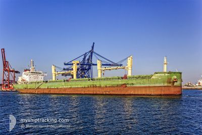
The vessel STRATEGIC UNITY (IMO: 9648099, MMSI: 563947000) is a Cargo It's sailing under the flag of [SG] Singapore.
In this page you can find informations about the vessels current position, last detected port calls, and current voyage information. If the vessels is not in coverage by AIS you will find the latest position.
The current position of STRATEGIC UNITY is detected by our AIS receivers and we are not responsible for the reliability of the data. The last position was recorded while the vessel was in Coverage by the Ais receivers of our vessel tracking app.
The current draught of STRATEGIC UNITY as reported by AIS is 7.9 meters
Weather
| Temperature | 14.5°C / 58.1°F |
|---|---|
| Wind Speed | 9 knots |
| Direction | 22° NNE |
| Pressure | 1018.8 hPa |
| Humidity | 59.5 % |
| Cloud Coverage | 10 % |
Featured Company
Last Port Calls
| Port | Arrival | Departure | Time In Port |
|---|---|---|---|
| 2025-12-08 21:03 | |||
| 2025-11-30 15:23 | 2025-12-07 17:28 | 7 d | |
| 2025-11-28 18:55 | 2025-11-28 22:59 | 4 h | |
| 2025-11-24 06:30 | 2025-11-28 16:23 | 4 d | |
| 2025-11-23 00:23 | 2025-11-24 02:03 | 1 d | |
| 2025-11-16 07:01 | 2025-11-17 10:21 | 1 d | |
| 2025-10-31 03:36 | 2025-11-04 19:56 | 4 d | |
| 2025-10-16 20:40 | 2025-10-20 23:37 | 4 d | |
| 2025-10-02 17:13 | 2025-10-07 17:26 | 5 d |
Most Visited Ports (Last year)
| Port | Arrivals | |
|---|---|---|
| 3 | ||
| 3 | ||
| 2 | ||
| 2 | ||
| 1 | ||
| 1 |
Last Trips
| Origin | Departure | Destination | Arrival | Distance | |
|---|---|---|---|---|---|
| 2025-12-07 17:28 | 2025-12-08 21:03 | 285.91 nm | |||
| 2025-11-28 22:59 | 2025-11-30 15:23 | 427.02 nm | |||
| 2025-11-28 16:23 | 2025-11-28 18:55 | 29.98 nm | |||
| 2025-11-24 02:03 | 2025-11-24 06:30 | 30.54 nm | |||
| 2025-11-17 10:21 | 2025-11-23 00:23 | 1304.82 nm | |||
| 2025-11-04 19:56 | 2025-11-16 07:01 | 2895.69 nm | |||
| 2025-10-20 23:37 | 2025-10-31 03:36 | 2264.43 nm | |||
| 2025-10-07 17:26 | 2025-10-16 20:40 | 102.60 nm | |||
| 2025-09-18 18:24 | 2025-10-02 17:13 | 67.04 nm |
Events
| Heure | Evenement | Détails | Position/ Destination | Info |
|---|---|---|---|---|
| 2025-12-09 03:31 | Arret |
27.81220 / -97.40390
[US] CORPUS CHRISTI
|
Vitesse: 0.1 kn Parcours: 90° |
|
| 2025-12-09 03:03 | Port d'arrivée |
|
27.81055 / -97.38291
[US] CORPUS CHRISTI
|
Vitesse: 10.6 kn Parcours: 269° |
| 2025-12-08 09:19 | Etat Changé | Default Under way using engine |
29.25781 / -94.23529
US CRP
|
Vitesse: 11.2 kn Parcours: 228.2° |
| 2025-12-08 09:13 | Etat Changé | Under way using engine Default |
29.26947 / -94.22065
US CRP
|
Vitesse: 11.2 kn Parcours: 227° |
| 2025-12-08 09:13 | Hors de la zone couverte |
29.26947 / -94.22065
Gulf of Mexico
US CRP
|
Vitesse: 11.2 kn Parcours: 228.2° |
|
| 2025-12-08 09:03 | Etat Changé | Default Under way using engine |
29.29039 / -94.19404
US CRP
|
Vitesse: 11.2 kn Parcours: 228.7° |
| 2025-12-08 02:31 | Tirant d'eau modifié | 7.9 9.1 |
29.90285 / -93.34217
US CRP
|
Vitesse: 8.3 kn Parcours: 184.9° |
| 2025-12-08 02:31 | Changement de destination | US CRP USLCH |
29.90285 / -93.34217
US CRP
|
Vitesse: 8.3 kn Parcours: 184.9° |
| 2025-12-08 02:31 | Changement d'ETA | 2025/12/09 01:00 2026/11/30 14:00 |
29.90285 / -93.34217
US CRP
|
Vitesse: 8.3 kn Parcours: 184.9° |
| 2025-12-08 02:15 | Etat Changé | Under way using engine Default |
29.93575 / -93.33914
USLCH
|
Vitesse: 8.5 kn Parcours: 186° |