

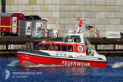
STRALSUND
Other Type

Current Trip
| Trip Time | 1 h, 19 mins |
|---|---|
| Trip Distance | 6.90 nm |
| AVG Speed | 5.6 Noeuds |
| MAX Speed | 5.6 Noeuds |
| Tirant d eau | 0.5 m |
| AVG Wind | 5 knots |
| MAX Wind | 5.2 knots |
| MIN Temp | 3.3°C / 37.94°F |
| MAX Temp | 5.8°C / 42.44°F |
| Position reçue | 5 d depuis |
Current Position
| Longitude | --- |
|---|---|
| Latitude | --- |
| Etat | Under way using engine |
| Vitesse | |
| Parcours | --- |
| Zone | North Sea |
| Station | T-AIS |
| Position reçue | 5 d depuis |
Information
The current position of STRALSUND is in North Sea with coordinates 53.78440° / 9.41411° as reported on 2025-03-17 17:23 by AIS to our vessel tracker app. The vessel's current speed is 0 Noeuds and is currently inside the port of GLUECKSTADT.
The vessel STRALSUND (MMSI: 211834370) is a Other Type It's sailing under the flag of [DE] Germany.
In this page you can find informations about the vessels current position, last detected port calls, and current voyage information. If the vessels is not in coverage by AIS you will find the latest position.
The current position of STRALSUND is detected by our AIS receivers and we are not responsible for the reliability of the data. The last position was recorded while the vessel was in Coverage by the Ais receivers of our vessel tracking app.
The current draught of STRALSUND as reported by AIS is 0.5 meters
Weather
| Temperature | 3.6°C / 38.48°F |
|---|---|
| Wind Speed | 5 knots |
| Direction | 75° ENE |
| Pressure | 1032 hPa |
| Humidity | 40.4 % |
| Cloud Coverage | 1 % |


Featured Company
Last Port Calls
| Port | Arrival | Departure | Time In Port |
|---|---|---|---|
| 2025-03-17 18:13 | |||
| 2025-02-09 16:32 | 2025-03-17 16:54 | ||
| 2025-01-13 13:54 | 2025-02-09 14:54 | 27 d | |
| 2025-01-13 13:23 |
Most Visited Ports (Last year)
| Port | Arrivals | |
|---|---|---|
| 26 |
Last Trips
| Origin | Departure | Destination | Arrival | Distance | |
|---|---|---|---|---|---|
| 2025-03-17 16:54 | 2025-03-17 18:13 | 6.90 nm | |||
| 2025-02-09 14:54 | 2025-02-09 16:32 | 11.96 nm | |||
| 2025-01-13 13:23 | 2025-01-13 13:54 | 2.39 nm |
Events
| Heure | Evenement | Détails | Position/ Destination | Info |
|---|---|---|---|---|
| 2025-03-17 17:23 | Hors de la zone couverte |
53.78440 / 9.41411
North Sea
[DE] GLUECKSTADT
|
Vitesse: Parcours: 208.8° |
|
| 2025-03-17 17:17 | Arret |
53.78444 / 9.41418
[DE] GLUECKSTADT
|
Vitesse: 0.1 kn Parcours: 511° |
|
| 2025-03-17 17:13 | Port d'arrivée |
|
53.78465 / 9.40900
[DE] GLUECKSTADT
|
Vitesse: 5.4 kn Parcours: 27.6° |
| 2025-03-17 17:11 | Démarrage | 0.43 nm, South of GLUECKSTADT |
53.77841 / 9.40720
GLUECKSTADT
|
Vitesse: 15.3 kn Parcours: 335.5° |
| 2025-03-17 17:09 | Arret | 0.57 nm, South of GLUECKSTADT |
53.77570 / 9.40918
GLUECKSTADT
|
Vitesse: 0.3 kn Parcours: 511° |
| 2025-03-17 16:31 | Démarrage | 0.47 nm, South of GLUECKSTADT |
53.77750 / 9.41507
GLUECKSTADT
|
Vitesse: 4.9 kn Parcours: 155.2° |
| 2025-03-17 16:29 | Arret | 0.35 nm, South of GLUECKSTADT |
53.77934 / 9.41415
GLUECKSTADT
|
Vitesse: 0.3 kn Parcours: 511° |
| 2025-03-17 16:04 | Démarrage | 0.81 nm, North West of GLUECKSTADT |
53.79683 / 9.40046
GLUECKSTADT
|
Vitesse: 4 kn Parcours: 335.4° |
| 2025-03-17 16:01 | Arret | 0.69 nm, North West of GLUECKSTADT |
53.79491 / 9.40173
GLUECKSTADT
|
Vitesse: 0.3 kn Parcours: 511° |
| 2025-03-17 15:54 | PORT DE DEPART |
|
53.78612 / 9.40671
GLUECKSTADT
|
Vitesse: 11.2 kn Parcours: 331.6° |