
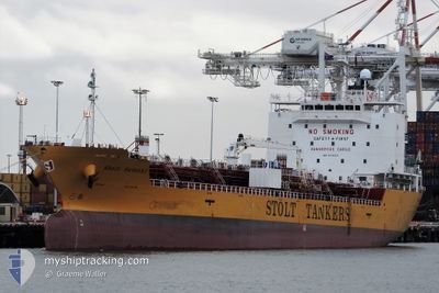
STOLT SATSUKI
Tanker
Current Trip
| Time Travelled | 20 h, 52 mins |
|---|---|
| Remaining Time | 18 h, 14 mins |
| Distance Travelled | 273.93 nm |
| Remaining Distance | 249.22 nm |
| AVG Speed | 13.7 Noeuds |
| MAX Speed | 14.9 Noeuds |
| AVG Wind | 23.3 knots |
| MAX Wind | 28 knots |
| MIN Temp | 11.2°C / 52.16°F |
| MAX Temp | 13.3°C / 55.94°F |
| Tirant d eau | 6.2 m |
| Position reçue | 2 m depuis |
Current Position
| Longitude | 148.17514° |
|---|---|
| Latitude | -40.65600° |
| Etat | Under way using engine |
| Vitesse | 14.5 Noeuds |
| Parcours | 107.4° |
| Zone | Bass Strait |
| Station | T-AIS |
| Position reçue | 2 m depuis |
Info
Information
The current position of STOLT SATSUKI is in Bass Strait with coordinates -40.65600° / 148.17514° as reported on 2024-09-23 10:28 by AIS to our vessel tracker app. The vessel's current speed is 14.5 Noeuds and is heading at the port of RISDON. The estimated time of arrival as calculated by MyShipTracking vessel tracking app is 2024-09-24 04:45 LT
The vessel STOLT SATSUKI (IMO: 9781114, MMSI: 563206800) is a Tanker It's sailing under the flag of [SG] Singapore.
In this page you can find informations about the vessels current position, last detected port calls, and current voyage information. If the vessels is not in coverage by AIS you will find the latest position.
The current position of STOLT SATSUKI is detected by our AIS receivers and we are not responsible for the reliability of the data. The last position was recorded while the vessel was in Coverage by the Ais receivers of our vessel tracking app.
The current draught of STOLT SATSUKI as reported by AIS is 6.2 meters
Weather
| Temperature | 11.6°C / 52.88°F |
|---|---|
| Wind Speed | 15 knots |
| Direction | 269° W |
| Pressure | 1017.1 hPa |
| Humidity | 65.8 % |
| Cloud Coverage | 47 % |
Featured Company
Last Port Calls
| Port | Arrival | Departure | Time In Port |
|---|---|---|---|
| 2024-09-21 07:18 | 2024-09-22 13:39 | 1 d | |
| 2024-09-16 03:12 | 2024-09-18 12:42 | 2 d | |
| 2024-09-05 15:00 | 2024-09-06 14:06 | 23 h | |
| 2024-08-22 03:31 | 2024-08-22 21:34 | 18 h | |
| 2024-08-21 15:15 | 2024-08-22 03:13 | 11 h | |
| 2024-08-20 15:51 | 2024-08-21 06:56 | 15 h | |
| 2024-08-19 20:37 | 2024-08-20 04:19 | 7 h | |
| 2024-08-18 08:56 | 2024-08-19 02:29 | 17 h | |
| 2024-08-09 03:43 | 2024-08-10 01:36 | 21 h | |
| 2024-07-30 02:07 | 2024-07-30 23:31 | 21 h |
Most Visited Ports (Last year)
| Port | Arrivals | |
|---|---|---|
| 6 | ||
| 5 | ||
| 5 | ||
| 4 | ||
| 3 | ||
| 2 |
Last Trips
| Origin | Departure | Destination | Arrival | Distance | |
|---|---|---|---|---|---|
| 2024-09-18 22:42 | 2024-09-21 17:18 | 527.21 nm | |||
| 2024-09-07 00:06 | 2024-09-16 13:12 | 903.17 nm | |||
| 2024-08-23 05:34 | 2024-09-06 01:00 | 3568.52 nm | |||
| 2024-08-22 11:13 | 2024-08-22 11:31 | 1.07 nm | |||
| 2024-08-21 14:56 | 2024-08-21 23:15 | 13.37 nm | |||
| 2024-08-20 12:19 | 2024-08-20 23:51 | 54.40 nm | |||
| 2024-08-19 10:29 | 2024-08-20 04:37 | 188.47 nm | |||
| 2024-08-10 09:36 | 2024-08-18 16:56 | 239.85 nm | |||
| 2024-07-31 07:31 | 2024-08-09 11:43 | 2145.52 nm | |||
| 2024-07-22 21:37 | 2024-07-30 10:07 | 1637.35 nm |
Events
| Heure | Evenement | Détails | Position/ Destination | Info |
|---|---|---|---|---|
| 2024-09-23 07:46 | Dans la zone couverte |
-40.44837 / 147.39350
Bass Strait
RISDON
|
Vitesse: 13.4 kn Parcours: 109.3° |
|
| 2024-09-23 05:02 | Hors de la zone couverte |
-40.12820 / 146.75607
Bass Strait
RISDON
|
Vitesse: 12.9 kn Parcours: 129.5° |
|
| 2024-09-23 04:27 | Dans la zone couverte |
-40.05243 / 146.62694
Bass Strait
RISDON
|
Vitesse: 13 kn Parcours: 129.4° |
|
| 2024-09-23 02:11 | Hors de la zone couverte |
-39.73359 / 146.14599
Bass Strait
RISDON
|
Vitesse: 13.3 kn Parcours: 147.6° |
|
| 2024-09-22 13:39 | PORT DE DEPART |
|
-37.86523 / 144.92149
RISDON
|
Vitesse: 9 kn Parcours: 144° |
| 2024-09-22 13:12 | Démarrage |
-37.82051 / 144.90619
[AU] MELBOURNE
|
Vitesse: 3.2 kn Parcours: 195° |
|
| 2024-09-22 13:08 | Tirant d'eau modifié | 6.2 6.5 |
-37.81779 / 144.90615
[AU] MELBOURNE
|
Vitesse: 1.5 kn Parcours: 175° |
| 2024-09-22 13:08 | Changement de destination | RISDON MELBOURNE |
-37.81779 / 144.90615
[AU] MELBOURNE
|
Vitesse: 1.5 kn Parcours: 175° |
| 2024-09-22 13:08 | Changement d'ETA | 2024/09/24 11:00 2024/09/21 04:00 |
-37.81779 / 144.90615
[AU] MELBOURNE
|
Vitesse: 1.5 kn Parcours: 175° |
| 2024-09-22 13:03 | Dans la zone couverte |
-37.81725 / 144.90613
Bass Strait
[AU] MELBOURNE
|
Vitesse: 0.1 kn Parcours: 46.2° |