
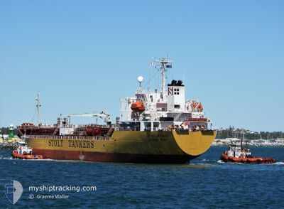
STOLT MOMIJI
Oil/Chemical Tanker
Current Trip
SG SIN PGBG
| Time Travelled | 5 days |
|---|---|
| Remaining Time | --- |
| Distance Travelled | 1194.14 nm |
| Remaining Distance | --- |
| AVG Speed | 10.1 Noeuds |
| MAX Speed | 14.8 Noeuds |
| AVG Wind | 11.9 knots |
| MAX Wind | 22.3 knots |
| MIN Temp | 25.3°C / 77.54°F |
| MAX Temp | 28.1°C / 82.58°F |
| Tirant d eau | 5 m |
| Position reçue | 1 m depuis |
Current Position
| Longitude | --- |
|---|---|
| Latitude | --- |
| Etat | At anchor |
| Vitesse | 0.1 Noeuds |
| Parcours | 18° |
| Zone | Singapore Strait |
| Station | T-AIS |
| Position reçue | 1 m depuis |
Info
Information
The current position of STOLT MOMIJI is in Singapore Strait with coordinates 1.19246° / 103.75147° as reported on 2024-12-24 23:01 by AIS to our vessel tracker app. The vessel's current speed is 0.1 Noeuds
The vessel STOLT MOMIJI (IMO: 9470545, MMSI: 563206300) is a Oil/Chemical Tanker that was built in 2010 ( 14 Age ). It's sailing under the flag of [SG] Singapore.
In this page you can find informations about the vessels current position, last detected port calls, and current voyage information. If the vessels is not in coverage by AIS you will find the latest position.
The current position of STOLT MOMIJI is detected by our AIS receivers and we are not responsible for the reliability of the data. The last position was recorded while the vessel was in Coverage by the Ais receivers of our vessel tracking app.
The current draught of STOLT MOMIJI as reported by AIS is 5 meters
Weather
| Temperature | 25.8°C / 78.44°F |
|---|---|
| Wind Speed | 10 knots |
| Direction | 20° NNE |
| Pressure | 1009.4 hPa |
| Humidity | 83.6 % |
| Cloud Coverage | 100 % |
Featured Company
Most Visited Ports (Last year)
| Port | Arrivals | |
|---|---|---|
| 7 | ||
| 5 | ||
| 4 | ||
| 4 | ||
| 3 | ||
| 3 |
Last Trips
| Origin | Departure | Destination | Arrival | Distance | |
|---|---|---|---|---|---|
| 2024-10-22 21:31 | 2024-12-18 07:24 | 1083.18 nm | |||
| 2024-10-13 08:00 | 2024-10-21 17:11 | 1152.12 nm | |||
| 2024-10-04 16:14 | 2024-10-12 14:42 | 1525.18 nm | |||
| 2024-10-02 22:16 | 2024-10-04 08:39 | 431.57 nm | |||
| 2024-10-01 10:50 | 2024-10-02 16:40 | 369.42 nm |
Events
| Heure | Evenement | Détails | Position/ Destination | Info |
|---|---|---|---|---|
| 2024-12-24 21:46 | Etat Changé | At anchor Default |
1.19244 / 103.75138
SG SIN PGBG
|
Vitesse: Parcours: 39° |
| 2024-12-24 21:43 | Etat Changé | Default At anchor |
1.19247 / 103.75133
SG SIN PGBG
|
Vitesse: Parcours: 40° |
| 2024-12-24 21:10 | Etat Changé | At anchor Default |
1.19270 / 103.75117
SG SIN PGBG
|
Vitesse: 0.1 kn Parcours: 63° |
| 2024-12-24 21:07 | Etat Changé | Default At anchor |
1.19276 / 103.75111
SG SIN PGBG
|
Vitesse: 0.1 kn Parcours: 70° |
| 2024-12-24 19:13 | Etat Changé | At anchor Default |
1.19348 / 103.75106
SG SIN PGBG
|
Vitesse: Parcours: 101° |
| 2024-12-24 19:07 | Etat Changé | Default At anchor |
1.19341 / 103.75105
SG SIN PGBG
|
Vitesse: 0.1 kn Parcours: 100° |
| 2024-12-24 19:01 | Etat Changé | At anchor Default |
1.19348 / 103.75089
SG SIN PGBG
|
Vitesse: 0.1 kn Parcours: 103° |
| 2024-12-24 18:55 | Etat Changé | Default At anchor |
1.19352 / 103.75082
SG SIN PGBG
|
Vitesse: 0.3 kn Parcours: 116° |
| 2024-12-24 16:04 | Etat Changé | At anchor Default |
1.19320 / 103.75088
SG SIN PGBG
|
Vitesse: 0.1 kn Parcours: 68° |
| 2024-12-24 16:01 | Etat Changé | Default At anchor |
1.19305 / 103.75097
SG SIN PGBG
|
Vitesse: Parcours: 64° |