

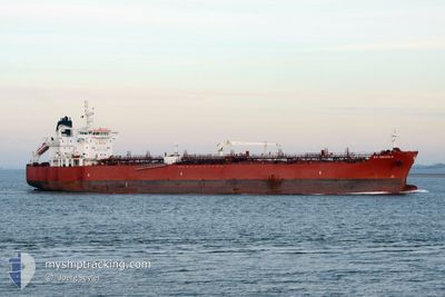
STI OSCEOLA
Tanker

Current Trip
NZ LYT
| Time Travelled | 14 days |
|---|---|
| Remaining Time | --- |
| Distance Travelled | 4067.93 nm |
| Remaining Distance | --- |
| AVG Speed | 11.9 Noeuds |
| MAX Speed | 13.7 Noeuds |
| AVG Wind | 14.2 knots |
| MAX Wind | 28.6 knots |
| MIN Temp | 16.6°C / 61.88°F |
| MAX Temp | 29.8°C / 85.64°F |
| Tirant d eau | 7.9 m |
| Position reçue | 12 d depuis |
Current Position
| Longitude | --- |
|---|---|
| Latitude | --- |
| Etat | Under way using engine |
| Vitesse | 12.4 Noeuds |
| Parcours | 328.9° |
| Zone | Tasman Sea |
| Station | T-AIS |
| Position reçue | 12 d depuis |
Information
The current position of STI OSCEOLA is in Tasman Sea with coordinates -39.04311° / 171.98200° as reported on 2025-02-16 15:01 by AIS to our vessel tracker app. The vessel's current speed is 12.4 Noeuds
The vessel STI OSCEOLA (IMO: 9707807, MMSI: 538006005) is a Tanker It's sailing under the flag of [MH] Marshall Is.
In this page you can find informations about the vessels current position, last detected port calls, and current voyage information. If the vessels is not in coverage by AIS you will find the latest position.
The current position of STI OSCEOLA is detected by our AIS receivers and we are not responsible for the reliability of the data. The last position was recorded while the vessel was in Coverage by the Ais receivers of our vessel tracking app.
The current draught of STI OSCEOLA as reported by AIS is 7.9 meters
Weather
| Temperature | 26.7°C / 80.06°F |
|---|---|
| Wind Speed | 22 knots |
| Direction | 54° NE |
| Pressure | 1013.6 hPa |
| Humidity | 82.1 % |
| Cloud Coverage | 83 % |


Featured Company
Last Port Calls
| Port | Arrival | Departure | Time In Port |
|---|---|---|---|
| 2025-02-14 02:16 | 2025-02-15 07:58 | 1 d | |
| 2025-02-11 21:36 | 2025-02-12 19:17 | 21 h | |
| 2025-02-07 14:53 | 2025-02-09 04:57 | 1 d | |
| 2025-01-17 12:32 | 2025-01-19 03:46 | 1 d | |
| 2025-01-15 23:57 | 2025-01-17 03:50 | 1 d | |
| 2025-01-03 03:44 | 2025-01-03 22:56 | 19 h | |
| 2025-01-02 08:34 |
Last Trips
| Origin | Departure | Destination | Arrival | Distance | |
|---|---|---|---|---|---|
| 2025-02-13 08:17 | 2025-02-14 15:16 | 310.99 nm | |||
| 2025-02-09 17:57 | 2025-02-12 10:36 | 675.23 nm | |||
| 2025-01-19 11:46 | 2025-02-08 03:53 | 5244.50 nm | |||
| 2025-01-17 11:50 | 2025-01-17 20:32 | 67.96 nm | |||
| 2025-01-04 09:26 | 2025-01-16 07:57 | 3625.70 nm | |||
| 2025-01-02 19:04 | 2025-01-03 14:14 | 170.27 nm |
Events
| Heure | Evenement | Détails | Position/ Destination | Info |
|---|