
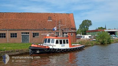
STENTOR
Tug
Current Trip
VANDERVELDEMARINENL
| Time Travelled | 3 h, 5 mins |
|---|---|
| Remaining Time | --- |
| Distance Travelled | 24.65 nm |
| Remaining Distance | --- |
| AVG Speed | 8.7 Noeuds |
| MAX Speed | 10.6 Noeuds |
| AVG Wind | 15.4 knots |
| MAX Wind | 17 knots |
| MIN Temp | 8.7°C / 47.66°F |
| MAX Temp | 9.2°C / 48.56°F |
| Tirant d eau | 1.7 m |
| Position reçue | 1 m depuis |
Current Position
| Longitude | --- |
|---|---|
| Latitude | --- |
| Etat | Under way using engine |
| Vitesse | 10.7 Noeuds |
| Parcours | 355.6° |
| Zone | North Sea |
| Station | T-AIS |
| Position reçue | 1 m depuis |
Info
Information
The current position of STENTOR is in North Sea with coordinates 53.11418° / 5.37672° as reported on 2025-12-11 09:01 by AIS to our vessel tracker app. The vessel's current speed is 10.7 Noeuds
The vessel STENTOR (MMSI: 244620046) is a Tug It's sailing under the flag of [NL] Netherlands.
In this page you can find informations about the vessels current position, last detected port calls, and current voyage information. If the vessels is not in coverage by AIS you will find the latest position.
The current position of STENTOR is detected by our AIS receivers and we are not responsible for the reliability of the data. The last position was recorded while the vessel was in Coverage by the Ais receivers of our vessel tracking app.
The current draught of STENTOR as reported by AIS is 1.7 meters
Weather
| Temperature | 8.7°C / 47.66°F |
|---|---|
| Wind Speed | 12 knots |
| Direction | 228° SW |
| Pressure | 1020.6 hPa |
| Humidity | 91.6 % |
| Cloud Coverage | 100 % |
Featured Company
Last Port Calls
| Port | Arrival | Departure | Time In Port |
|---|---|---|---|
| 2025-12-10 20:15 | 2025-12-11 06:57 | 10 h | |
| 2025-12-10 11:53 | 2025-12-10 13:42 | 1 h | |
| 2025-12-09 17:49 | 2025-12-10 06:38 | 12 h | |
| 2025-12-09 11:34 | 2025-12-09 12:07 | 33 m | |
| 2025-12-08 16:06 | 2025-12-08 16:40 | 33 m | |
| 2025-12-08 14:42 | 2025-12-08 14:51 | 8 m | |
| 2025-11-26 19:15 | 2025-12-08 14:08 | 11 d | |
| 2025-11-26 18:24 | 2025-11-26 18:41 | 16 m | |
| 2025-11-26 14:33 | 2025-11-26 15:31 | 58 m | |
| 2025-11-26 09:20 | 2025-11-26 12:37 | 3 h |
Last Trips
| Origin | Departure | Destination | Arrival | Distance | |
|---|---|---|---|---|---|
| 2025-12-10 13:42 | 2025-12-10 20:15 | 49.18 nm | |||
| 2025-12-10 06:38 | 2025-12-10 11:53 | 43.33 nm | |||
| 2025-12-09 12:07 | 2025-12-09 17:49 | 43.26 nm | |||
| 2025-12-08 16:40 | 2025-12-09 11:34 | 75.39 nm | |||
| 2025-12-08 14:51 | 2025-12-08 16:06 | 9.60 nm | |||
| 2025-12-08 14:08 | 2025-12-08 14:42 | 3.33 nm | |||
| 2025-11-26 18:41 | 2025-11-26 19:15 | 3.35 nm | |||
| 2025-11-26 15:31 | 2025-11-26 18:24 | 19.45 nm | |||
| 2025-11-26 12:37 | 2025-11-26 14:33 | 16.52 nm | |||
| 2025-11-26 07:14 | 2025-11-26 09:20 | 16.92 nm |
Events
| Heure | Evenement | Détails | Position/ Destination | Info |
|---|---|---|---|---|
| 2025-12-11 08:41 | Démarrage | 2.5 nm, North West of MAKKUM |
53.07082 / 5.33616
VANDERVELDEMARINENL
|
Vitesse: 7.6 kn Parcours: 344.1° |
| 2025-12-11 08:32 | Arret | 2.41 nm, North West of MAKKUM |
53.06864 / 5.33717
VANDERVELDEMARINENL
|
Vitesse: 0.1 kn Parcours: 511° |
| 2025-12-11 05:57 | PORT DE DEPART |
|
52.70627 / 5.30937
VANDERVELDEMARINENL
|
Vitesse: 6.9 kn Parcours: 54.8° |
| 2025-12-11 05:51 | Démarrage |
52.70008 / 5.29641
[NL] ENKHUIZEN
|
Vitesse: 6.1 kn Parcours: 59.3° |
|
| 2025-12-10 19:16 | Arret |
52.69964 / 5.29239
[NL] ENKHUIZEN
|
Vitesse: 0.2 kn Parcours: 511° |
|
| 2025-12-10 19:15 | Port d'arrivée |
|
52.69971 / 5.29202
[NL] ENKHUIZEN
|
Vitesse: 4.9 kn Parcours: 339.8° |
| 2025-12-10 19:12 | Démarrage | 0.31 nm, South of ENKHUIZEN |
52.69533 / 5.29527
VANDERVELDEMARINENL
|
Vitesse: 7.7 kn Parcours: 346.3° |
| 2025-12-10 19:06 | Arret | 0.58 nm, South of ENKHUIZEN |
52.69080 / 5.29547
VANDERVELDEMARINENL
|
Vitesse: Parcours: 511° |
| 2025-12-10 18:14 | Tirant d'eau modifié | 1.7 1 |
52.58662 / 5.21355
VANDERVELDEMARINENL
|
Vitesse: 8.5 kn Parcours: 10.7° |
| 2025-12-10 18:14 | Changement d'ETA | 2025/12/31 09:00 |
52.58662 / 5.21355
VANDERVELDEMARINENL
|
Vitesse: 8.5 kn Parcours: 10.7° |