

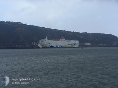
STENA EUROPE
Ro-Ro/Passenger Ship

Current Trip
| Trip Time | 1 h, 3 mins |
|---|---|
| Trip Distance | 17.91 nm |
| AVG Speed | 16.2 Noeuds |
| MAX Speed | 20.4 Noeuds |
| Tirant d eau | 6 m |
| AVG Wind | 10 knots |
| MAX Wind | 17.5 knots |
| MIN Temp | 12°C / 53.6°F |
| MAX Temp | 15.9°C / 60.62°F |
| Position reçue | Maintenant |
Current Position
| Longitude | --- |
|---|---|
| Latitude | --- |
| Etat | Under way using engine |
| Vitesse | |
| Parcours | 53° |
| Zone | Strait of Gibraltar |
| Station | T-AIS |
| Position reçue | Maintenant |
Information
The current position of STENA EUROPE is in Strait of Gibraltar with coordinates 36.13196° / -5.43707° as reported on 2025-02-22 19:49 by AIS to our vessel tracker app. The vessel's current speed is 0 Noeuds and is currently inside the port of ALGECIRAS.
The vessel STENA EUROPE (IMO: 7901760, MMSI: 209649000) is a Ro-Ro/Passenger Ship that was built in 1981 ( 44 Age ). It's sailing under the flag of [CY] Cyprus.
In this page you can find informations about the vessels current position, last detected port calls, and current voyage information. If the vessels is not in coverage by AIS you will find the latest position.
The current position of STENA EUROPE is detected by our AIS receivers and we are not responsible for the reliability of the data. The last position was recorded while the vessel was in Coverage by the Ais receivers of our vessel tracking app.
The current draught of STENA EUROPE as reported by AIS is 6 meters
Weather
| Temperature | 10.5°C / 50.9°F |
|---|---|
| Wind Speed | 5 knots |
| Direction | 269° W |
| Pressure | 1024.6 hPa |
| Humidity | 92.3 % |
| Cloud Coverage | --- |


Featured Company
Last Port Calls
| Port | Arrival | Departure | Time In Port |
|---|---|---|---|
| 2025-02-22 18:12 | |||
| 2025-02-22 14:04 | 2025-02-22 17:09 | 3 h | |
| 2025-02-22 10:14 | 2025-02-22 12:42 | 2 h | |
| 2025-02-22 05:55 | 2025-02-22 09:02 | 3 h | |
| 2025-02-22 03:02 | 2025-02-22 04:47 | 1 h | |
| 2025-02-21 22:04 | 2025-02-22 02:02 | 3 h | |
| 2025-02-21 17:59 | 2025-02-21 20:15 | 2 h | |
| 2025-02-21 14:13 | 2025-02-21 16:44 | 2 h | |
| 2025-02-21 10:07 | 2025-02-21 12:56 | 2 h | |
| 2025-02-21 06:15 | 2025-02-21 08:55 | 2 h |
Most Visited Ports (Last year)
| Port | Arrivals | |
|---|---|---|
| 718 | ||
| 711 | ||
| 77 | ||
| 23 | ||
| 1 | ||
| 1 |
Last Trips
| Origin | Departure | Destination | Arrival | Distance | |
|---|---|---|---|---|---|
| 2025-02-22 18:09 | 2025-02-22 19:12 | 17.91 nm | |||
| 2025-02-22 13:42 | 2025-02-22 15:04 | 19.66 nm | |||
| 2025-02-22 10:02 | 2025-02-22 11:14 | 19.64 nm | |||
| 2025-02-22 05:47 | 2025-02-22 06:55 | 19.12 nm | |||
| 2025-02-22 03:02 | 2025-02-22 04:02 | 19.15 nm | |||
| 2025-02-21 21:15 | 2025-02-21 23:04 | 19.28 nm | |||
| 2025-02-21 17:44 | 2025-02-21 18:59 | 19.39 nm | |||
| 2025-02-21 13:56 | 2025-02-21 15:13 | 18.69 nm | |||
| 2025-02-21 09:55 | 2025-02-21 11:07 | 19.26 nm | |||
| 2025-02-21 05:54 | 2025-02-21 07:15 | 18.59 nm |
Events
| Heure | Evenement | Détails | Position/ Destination | Info |
|---|---|---|---|---|
| 2025-02-22 18:25 | Arret |
36.13199 / -5.43705
[ES] ALGECIRAS
|
Vitesse: 0.2 kn Parcours: 53° |
|
| 2025-02-22 18:12 | Port d'arrivée |
|
36.14856 / -5.43240
[ES] ALGECIRAS
|
Vitesse: 9.7 kn Parcours: 219.1° |
| 2025-02-22 18:02 | Changement de zone | Spanish part of the Strait of Gibraltar Gibraltarian part of the Strait of Gibraltar |
36.13142 / -5.39842
Strait of Gibraltar
|
Vitesse: 19 kn Parcours: 330.9° |
| 2025-02-22 17:53 | Changement de zone | Gibraltarian part of the Strait of Gibraltar Spanish part of the Strait of Gibraltar |
36.08843 / -5.37237
Strait of Gibraltar
|
Vitesse: 19.1 kn Parcours: 359.1° |
| 2025-02-22 17:35 | Changement de zone | Spanish part of the Strait of Gibraltar Moroccan part of the Strait of Gibraltar |
35.99730 / -5.40831
Strait of Gibraltar
|
Vitesse: 20.1 kn Parcours: 31.8° |
| 2025-02-22 17:14 | Changement d'ETA | 2025/02/21 18:30 2025/02/21 14:30 |
35.90994 / -5.50231
MARTM<=>ESALG
|
Vitesse: 19.4 kn Parcours: 28.8° |
| 2025-02-22 17:09 | PORT DE DEPART |
|
35.88725 / -5.51703
MARTM<=>ESALG
|
Vitesse: 13.1 kn Parcours: 26° |
| 2025-02-22 17:07 | Etat Changé | Under way using engine Moored |
35.88148 / -5.52023
[MA] TANGER MED
|
Vitesse: 2.4 kn Parcours: 355° |
| 2025-02-22 17:03 | Démarrage |
35.88009 / -5.51713
[MA] TANGER MED
|
Vitesse: 3.1 kn Parcours: 97° |
|
| 2025-02-22 17:02 | Etat Changé | Moored Default |
35.87995 / -5.51662
[MA] TANGER MED
|
Vitesse: Parcours: 102° |