
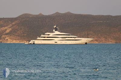
STARBURST IV
Pleasure Craft
Current Trip
| Time Travelled | 6 days |
|---|---|
| Remaining Time | 5 days |
| Distance Travelled | 808.65 nm |
| Remaining Distance | 2653.69 nm |
| AVG Speed | 12.7 Noeuds |
| MAX Speed | 13.7 Noeuds |
| AVG Wind | 7.6 knots |
| MAX Wind | 14.9 knots |
| MIN Temp | 17.1°C / 62.78°F |
| MAX Temp | 23.2°C / 73.76°F |
| Tirant d eau | 4 m |
| Position reçue | 3 d depuis |
Current Position
| Longitude | --- |
|---|---|
| Latitude | --- |
| Etat | Under way using engine |
| Vitesse | 12.4 Noeuds |
| Parcours | 246.7° |
| Zone | North Atlantic Ocean |
| Station | T-AIS |
| Position reçue | 3 d depuis |
Info
Information
The current position of STARBURST IV is in North Atlantic Ocean with coordinates 27.58008° / -17.36308° as reported on 2024-11-20 05:33 by AIS to our vessel tracker app. The vessel's current speed is 12.4 Noeuds and is heading at the port of FALMOUTH. The estimated time of arrival as calculated by MyShipTracking vessel tracking app is 2024-11-28 22:11 LT
The vessel STARBURST IV (IMO: 1012218, MMSI: 248149000) is a Pleasure Craft It's sailing under the flag of [MT] Malta.
In this page you can find informations about the vessels current position, last detected port calls, and current voyage information. If the vessels is not in coverage by AIS you will find the latest position.
The current position of STARBURST IV is detected by our AIS receivers and we are not responsible for the reliability of the data. The last position was recorded while the vessel was in Coverage by the Ais receivers of our vessel tracking app.
The current draught of STARBURST IV as reported by AIS is 4 meters
Weather
| Temperature | 22.6°C / 72.68°F |
|---|---|
| Wind Speed | 3 knots |
| Direction | 28° NNE |
| Pressure | 1016.9 hPa |
| Humidity | 75.4 % |
| Cloud Coverage | 9 % |
Featured Company
Last Port Calls
| Port | Arrival | Departure | Time In Port |
|---|---|---|---|
| 2024-11-17 06:46 | 2024-11-17 16:41 | 9 h | |
| 2024-11-12 10:51 | 2024-11-13 13:54 | 1 d | |
| 2024-09-29 16:52 | 2024-10-01 06:20 | 1 d | |
| 2024-09-25 22:49 | 2024-09-27 06:38 | 1 d | |
| 2024-09-18 07:28 | |||
| 2024-09-12 07:33 | 2024-09-12 12:17 | 4 h | |
| 2024-09-09 12:31 |
Events
| Heure | Evenement | Détails | Position/ Destination | Info |
|---|---|---|---|---|
| 2024-11-20 05:33 | Hors de la zone couverte |
27.58008 / -17.36308
North Atlantic Ocean
|
Vitesse: 12.4 kn Parcours: 246.7° |
|
| 2024-11-19 15:11 | Dans la zone couverte |
29.53533 / -14.60537
North Atlantic Ocean
|
Vitesse: 13.3 kn Parcours: 228° |
|
| 2024-11-19 12:28 | Hors de la zone couverte |
29.94494 / -14.09033
North Atlantic Ocean
|
Vitesse: 13.1 kn Parcours: 226.9° |
|
| 2024-11-19 12:18 | Dans la zone couverte |
29.96165 / -14.06934
North Atlantic Ocean
|
Vitesse: 12.9 kn Parcours: 227.2° |
|
| 2024-11-19 08:55 | Hors de la zone couverte |
30.47632 / -13.41911
North Atlantic Ocean
|
Vitesse: 13.3 kn Parcours: 227.8° |
|
| 2024-11-19 08:52 | Dans la zone couverte |
30.48298 / -13.41066
North Atlantic Ocean
|
Vitesse: 13.4 kn Parcours: 227.5° |
|
| 2024-11-19 07:22 | Hors de la zone couverte |
30.70791 / -13.12542
North Atlantic Ocean
|
Vitesse: 13.1 kn Parcours: 227.7° |
|
| 2024-11-19 07:19 | Detecté en mer | Spanish (Canary Islands) part of the North Atlantic Ocean |
30.71693 / -13.11390
North Atlantic Ocean
|
Vitesse: 13.1 kn Parcours: 226.7° |
| 2024-11-19 07:19 | Dans la zone couverte |
30.71693 / -13.11390
North Atlantic Ocean
|
Vitesse: 13.1 kn Parcours: 226.7° |
|
| 2024-11-18 22:47 | Hors de la zone couverte |
31.99376 / -11.48141
North Atlantic Ocean
|
Vitesse: 13.3 kn Parcours: 227.3° |