
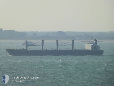
ASIA STAR
Bulk Carrier
Current Trip
| Time Travelled | 23 h, 50 mins |
|---|---|
| Remaining Time | --- |
| Distance Travelled | 57.06 nm |
| Remaining Distance | --- |
| AVG Speed | 5.2 Noeuds |
| MAX Speed | 12.5 Noeuds |
| AVG Wind | 14.8 knots |
| MAX Wind | 22.7 knots |
| MIN Temp | 14.7°C / 58.46°F |
| MAX Temp | 20°C / 68°F |
| Tirant d eau | 6 m |
| Position reçue | 4 m depuis |
Current Position
| Longitude | --- |
|---|---|
| Latitude | --- |
| Etat | At anchor |
| Vitesse | 0.1 Noeuds |
| Parcours | 334° |
| Zone | Sea of Marmara |
| Station | T-AIS |
| Position reçue | 4 m depuis |
Info
Information
The current position of ASIA STAR is in Sea of Marmara with coordinates 40.93616° / 28.85540° as reported on 2024-10-17 08:28 by AIS to our vessel tracker app. The vessel's current speed is 0.1 Noeuds
The vessel ASIA STAR (IMO: 9284477, MMSI: 538003048) is a Bulk Carrier that was built in 2003 ( 21 Age ). It's sailing under the flag of [MH] Marshall Is.
In this page you can find informations about the vessels current position, last detected port calls, and current voyage information. If the vessels is not in coverage by AIS you will find the latest position.
The current position of ASIA STAR is detected by our AIS receivers and we are not responsible for the reliability of the data. The last position was recorded while the vessel was in Coverage by the Ais receivers of our vessel tracking app.
The current draught of ASIA STAR as reported by AIS is 6 meters
Weather
| Temperature | 15.9°C / 60.62°F |
|---|---|
| Wind Speed | 16 knots |
| Direction | 11° N |
| Pressure | 1026.8 hPa |
| Humidity | 53.9 % |
| Cloud Coverage | 51 % |
Featured Company
Last Port Calls
| Port | Arrival | Departure | Time In Port |
|---|---|---|---|
| 2024-10-12 09:52 | 2024-10-16 08:42 | 3 d | |
| 2024-09-23 09:17 | 2024-10-09 11:24 | 16 d | |
| 2024-09-20 04:55 | 2024-09-20 15:08 | 10 h | |
| 2024-08-19 03:29 | 2024-08-28 11:18 | 9 d | |
| 2024-08-15 09:09 | 2024-08-17 13:29 | 2 d | |
| 2024-08-05 16:04 | 2024-08-09 06:45 | 3 d |
Most Visited Ports (Last year)
| Port | Arrivals | |
|---|---|---|
| 2 | ||
| 1 | ||
| 1 | ||
| 1 | ||
| 1 | ||
| 1 |
Last Trips
| Origin | Departure | Destination | Arrival | Distance | |
|---|---|---|---|---|---|
| 2024-10-09 14:24 | 2024-10-12 12:52 | 843.99 nm | |||
| 2024-08-28 19:18 | 2024-09-23 12:17 | 5713.21 nm | |||
| 2024-08-28 19:18 | 2024-09-20 06:55 | 5242.54 nm | |||
| 2024-08-17 21:29 | 2024-08-19 11:29 | 433.92 nm | |||
| 2024-08-09 12:15 | 2024-08-15 17:09 | 1404.09 nm | |||
| 2024-06-17 19:54 | 2024-08-05 21:34 | 8812.96 nm |
Events
| Heure | Evenement | Détails | Position/ Destination | Info |
|---|---|---|---|---|
| 2024-10-16 18:40 | Etat Changé | At anchor Default |
40.93658 / 28.85280
TR IST
|
Vitesse: 0.1 kn Parcours: 43° |
| 2024-10-16 18:36 | Etat Changé | Default At anchor |
40.93648 / 28.85298
TR IST
|
Vitesse: 0.2 kn Parcours: 42° |
| 2024-10-16 15:57 | Arret | 1.67 nm, South East of YESILKOY |
40.93713 / 28.85328
TR IST
|
Vitesse: Parcours: 44° |
| 2024-10-16 15:42 | Etat Changé | At anchor Under way using engine |
40.93838 / 28.85396
TR IST
|
Vitesse: 1 kn Parcours: 23° |
| 2024-10-16 10:54 | Tirant d'eau modifié | 6 6.7 |
40.80137 / 28.26282
TR IST
|
Vitesse: 10.6 kn Parcours: 80.7° |
| 2024-10-16 10:54 | Changement de destination | TR IST TR TEK |
40.80137 / 28.26282
TR IST
|
Vitesse: 10.6 kn Parcours: 80.7° |
| 2024-10-16 10:54 | Changement d'ETA | 2024/10/16 13:00 2024/10/12 08:00 |
40.80137 / 28.26282
TR IST
|
Vitesse: 10.6 kn Parcours: 80.7° |
| 2024-10-16 09:57 | Etat Changé | Under way using engine Default |
40.82243 / 28.04383
TR TEK
|
Vitesse: 12.5 kn Parcours: 143° |
| 2024-10-16 09:48 | Etat Changé | Default Under way using engine |
40.84865 / 28.01819
TR TEK
|
Vitesse: 12.4 kn Parcours: 143.6° |
| 2024-10-16 09:42 | Etat Changé | Under way using engine Default |
40.86493 / 28.00211
TR TEK
|
Vitesse: 12.5 kn Parcours: 144° |