

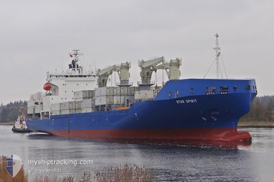
STAR SPIRIT
Cargo A

Current Trip
| Trip Time | 12 days |
|---|---|
| Trip Distance | 4795.37 nm |
| AVG Speed | 16.5 Noeuds |
| MAX Speed | 18.7 Noeuds |
| Tirant d eau | 8.7 m |
| AVG Wind | 12 knots |
| MAX Wind | 28.8 knots |
| MIN Temp | 10.8°C / 51.44°F |
| MAX Temp | 27.2°C / 80.96°F |
| Position reçue | 1 d depuis |
Current Position
| Longitude | --- |
|---|---|
| Latitude | --- |
| Etat | Under way using engine |
| Vitesse | 17.6 Noeuds |
| Parcours | 243.6° |
| Zone | Caribbean Sea |
| Station | T-AIS |
| Position reçue | 1 d depuis |
Information
The current position of STAR SPIRIT is in Caribbean Sea with coordinates 11.13188° / -75.22307° as reported on 2025-02-21 00:14 by AIS to our vessel tracker app. The vessel's current speed is 17.6 Noeuds and is currently inside the port of TURBO.
The vessel STAR SPIRIT (IMO: 9765847, MMSI: 355286000) is a Cargo A It's sailing under the flag of [PA] Panama.
In this page you can find informations about the vessels current position, last detected port calls, and current voyage information. If the vessels is not in coverage by AIS you will find the latest position.
The current position of STAR SPIRIT is detected by our AIS receivers and we are not responsible for the reliability of the data. The last position was recorded while the vessel was in Coverage by the Ais receivers of our vessel tracking app.
The current draught of STAR SPIRIT as reported by AIS is 8.7 meters
Weather
| Temperature | 27.4°C / 81.32°F |
|---|---|
| Wind Speed | 11 knots |
| Direction | 349° N |
| Pressure | 1009.1 hPa |
| Humidity | 85.2 % |
| Cloud Coverage | 20 % |


Featured Company
Last Port Calls
| Port | Arrival | Departure | Time In Port |
|---|---|---|---|
| 2025-02-21 13:52 | |||
| 2025-02-08 22:14 | 2025-02-09 12:27 | 14 h | |
| 2025-02-06 00:05 | 2025-02-07 21:15 | 1 d | |
| 2025-02-02 09:08 | 2025-02-02 23:20 | 14 h | |
| 2025-01-21 04:38 | 2025-01-21 20:52 | 16 h | |
| 2025-01-17 02:46 | 2025-01-20 00:28 | 2 d | |
| 2025-01-01 16:43 | 2025-01-03 16:18 | 1 d | |
| 2024-12-30 22:27 | 2024-12-31 17:34 | 19 h | |
| 2024-12-28 00:05 | 2024-12-28 20:37 | 20 h | |
| 2024-12-16 07:48 | 2024-12-17 04:18 | 20 h |
Most Visited Ports (Last year)
| Port | Arrivals | |
|---|---|---|
| 11 | ||
| 11 | ||
| 10 | ||
| 10 | ||
| 10 | ||
| 6 |
Last Trips
| Origin | Departure | Destination | Arrival | Distance | |
|---|---|---|---|---|---|
| 2025-02-09 13:27 | 2025-02-21 08:52 | 4795.37 nm | |||
| 2025-02-07 22:15 | 2025-02-08 23:14 | 395.58 nm | |||
| 2025-02-02 23:20 | 2025-02-06 01:05 | 1174.34 nm | |||
| 2025-01-21 14:52 | 2025-02-02 09:08 | 4324.95 nm | |||
| 2025-01-19 19:28 | 2025-01-20 22:38 | 417.25 nm | |||
| 2025-01-03 17:18 | 2025-01-16 21:46 | 5177.54 nm | |||
| 2024-12-31 18:34 | 2025-01-01 17:43 | 395.86 nm | |||
| 2024-12-28 20:37 | 2024-12-30 23:27 | 820.73 nm | |||
| 2024-12-16 22:18 | 2024-12-28 00:05 | 4316.06 nm | |||
| 2024-12-15 00:35 | 2024-12-16 01:48 | 417.90 nm |
Events
| Heure | Evenement | Détails | Position/ Destination | Info |
|---|---|---|---|---|
| 2025-02-21 13:52 | Port d'arrivée |
|
8.07772 / -76.77356
[CO] TURBO
|
Vitesse: 12.6 kn Parcours: 162° |
| 2025-02-21 00:15 | Etat Changé | Default Under way using engine |
11.12985 / -75.22707
COTRB
|
Vitesse: 17.6 kn Parcours: 243.6° |
| 2025-02-21 00:14 | Hors de la zone couverte |
11.13188 / -75.22307
Caribbean Sea
COTRB
|
Vitesse: 17.6 kn Parcours: 243.6° |
|
| 2025-02-21 00:07 | Etat Changé | Under way using engine Default |
11.14828 / -75.19035
COTRB
|
Vitesse: 17.6 kn Parcours: 244° |
| 2025-02-21 00:00 | Etat Changé | Default Under way using engine |
11.16219 / -75.16246
COTRB
|
Vitesse: 17.8 kn Parcours: 243.1° |
| 2025-02-20 22:27 | Changement de zone | Colombian part of the Caribbean Sea Bonaire part of the Caribbean Sea |
11.36691 / -74.75702
Caribbean Sea
COTRB
|
Vitesse: 17 kn Parcours: 242.3° |
| 2025-02-20 22:27 | Etat Changé | Under way using engine Default |
11.36691 / -74.75702
COTRB
|
Vitesse: 16.9 kn Parcours: 242° |
| 2025-02-20 22:10 | Dans la zone couverte |
11.36691 / -74.75702
Caribbean Sea
COTRB
|
Vitesse: 17 kn Parcours: 242.3° |
|
| 2025-02-19 22:55 | Etat Changé | Default Under way using engine |
14.10889 / -68.57350
COTRB
|
Vitesse: 16.8 kn Parcours: 248.7° |
| 2025-02-19 22:50 | Hors de la zone couverte |
14.11595 / -68.55418
Caribbean Sea
COTRB
|
Vitesse: 16.8 kn Parcours: 248.7° |