

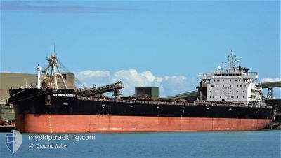
STAR NADZIYE
Cargo

Current Trip
ZA RCB
| Time Travelled | 1 day |
|---|---|
| Remaining Time | --- |
| Distance Travelled | 44.41 nm |
| Remaining Distance | --- |
| AVG Speed | 11.8 Noeuds |
| MAX Speed | 12.5 Noeuds |
| AVG Wind | 8.6 knots |
| MAX Wind | 12.8 knots |
| MIN Temp | 24.9°C / 76.82°F |
| MAX Temp | 26.3°C / 79.34°F |
| Tirant d eau | 7.3 m |
| Position reçue | 26 d depuis |
Current Position
| Longitude | --- |
|---|---|
| Latitude | --- |
| Etat | At anchor |
| Vitesse | 0.3 Noeuds |
| Parcours | 44° |
| Zone | Indian Ocean |
| Station | T-AIS |
| Position reçue | 26 d depuis |
Information
The current position of STAR NADZIYE is in Indian Ocean with coordinates -28.90736° / 32.16508° as reported on 2025-01-26 19:13 by AIS to our vessel tracker app. The vessel's current speed is 0.3 Noeuds
The vessel STAR NADZIYE (IMO: 9860025, MMSI: 538008467) is a Cargo It's sailing under the flag of [MH] Marshall Is.
In this page you can find informations about the vessels current position, last detected port calls, and current voyage information. If the vessels is not in coverage by AIS you will find the latest position.
The current position of STAR NADZIYE is detected by our AIS receivers and we are not responsible for the reliability of the data. The last position was recorded while the vessel was in Coverage by the Ais receivers of our vessel tracking app.
The current draught of STAR NADZIYE as reported by AIS is 7.3 meters
Weather
| Temperature | 26.1°C / 78.98°F |
|---|---|
| Wind Speed | 9 knots |
| Direction | 87° E |
| Pressure | 1013.3 hPa |
| Humidity | 71.3 % |
| Cloud Coverage | 8 % |


Featured Company
Last Port Calls
| Port | Arrival | Departure | Time In Port |
|---|---|---|---|
| 2025-02-18 04:32 | 2025-02-20 21:13 | 2 d | |
| 2025-01-30 00:32 | 2025-01-31 19:52 | 1 d | |
| 2025-01-07 03:22 | 2025-01-08 15:28 | 1 d | |
| 2025-01-02 19:55 | 2025-01-06 00:12 | 3 d | |
| 2024-12-03 15:48 | 2024-12-07 14:48 | 3 d |
Most Visited Ports (Last year)
| Port | Arrivals | |
|---|---|---|
| 1 | ||
| 1 | ||
| 1 | ||
| 1 | ||
| 1 | ||
| 1 |
Last Trips
| Origin | Departure | Destination | Arrival | Distance | |
|---|---|---|---|---|---|
| 2025-01-31 19:52 | 2025-02-18 04:32 | 4359.86 nm | |||
| 2025-01-08 15:28 | 2025-01-30 00:32 | 4445.73 nm | |||
| 2025-01-06 00:12 | 2025-01-07 03:22 | 283.37 nm | |||
| 2024-12-07 14:48 | 2025-01-02 19:55 | 5224.92 nm | |||
| 2024-09-28 12:09 | 2024-12-03 15:48 | 4074.55 nm |
Events
| Heure | Evenement | Détails | Position/ Destination | Info |
|---|---|---|---|---|
| 2025-02-20 15:43 | PORT DE DEPART |
|
17.68641 / 83.33009
ZA RCB
|
Vitesse: 5.1 kn Parcours: 82° |
| 2025-02-20 15:30 | Démarrage |
17.68592 / 83.30180
[IN] VISAKHAPATNAM
|
Vitesse: 4.2 kn Parcours: 89° |
|
| 2025-02-17 23:35 | Arret |
17.69148 / 83.29644
[IN] VISAKHAPATNAM
|
Vitesse: 0.1 kn Parcours: 207° |
|
| 2025-02-17 23:02 | Port d'arrivée |
|
17.68770 / 83.30157
[IN] VISAKHAPATNAM
|
Vitesse: 4.9 kn Parcours: 270° |
| 2025-02-17 21:32 | Démarrage | 6.75 nm, South East of VISAKHAPATNAM |
17.60979 / 83.38927
ZA RCB
|
Vitesse: 4.1 kn Parcours: 328° |
| 2025-02-17 14:44 | Arret | 7.18 nm, South East of VISAKHAPATNAM |
17.60549 / 83.39526
ZA RCB
|
Vitesse: 0.3 kn Parcours: 224° |