
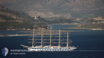
STAR CLIPPER
Passengers Ship
Current Trip
| Time Travelled | 9 h, 37 mins |
|---|---|
| Remaining Time | 8 h, 5 mins |
| Distance Travelled | 68.31 nm |
| Remaining Distance | 51.68 nm |
| AVG Speed | 6.3 Noeuds |
| MAX Speed | 9.1 Noeuds |
| AVG Wind | 12.4 knots |
| MAX Wind | 17 knots |
| MIN Temp | 23°C / 73.4°F |
| MAX Temp | 23.9°C / 75.02°F |
| Tirant d eau | 5.8 m |
| Position reçue | 8 m depuis |
Current Position
| Longitude | --- |
|---|---|
| Latitude | --- |
| Etat | Under way using engine |
| Vitesse | 8.7 Noeuds |
| Parcours | 325.4° |
| Zone | Aegean Sea |
| Station | T-AIS |
| Position reçue | 8 m depuis |
Info
Information
The current position of STAR CLIPPER is in Aegean Sea with coordinates 36.77215° / 24.13754° as reported on 2024-10-04 01:40 by AIS to our vessel tracker app. The vessel's current speed is 8.7 Noeuds and is heading at the port of HYDRA. The estimated time of arrival as calculated by MyShipTracking vessel tracking app is 2024-10-04 09:54 LT
The vessel STAR CLIPPER (IMO: 8915445, MMSI: 248786000) is a Passengers Ship that was built in 1992 ( 32 Age ). It's sailing under the flag of [MT] Malta.
In this page you can find informations about the vessels current position, last detected port calls, and current voyage information. If the vessels is not in coverage by AIS you will find the latest position.
The current position of STAR CLIPPER is detected by our AIS receivers and we are not responsible for the reliability of the data. The last position was recorded while the vessel was in Coverage by the Ais receivers of our vessel tracking app.
The current draught of STAR CLIPPER as reported by AIS is 5.8 meters
Weather
| Temperature | 23.7°C / 74.66°F |
|---|---|
| Wind Speed | 16 knots |
| Direction | 223° SW |
| Pressure | 1014.5 hPa |
| Humidity | 77.2 % |
| Cloud Coverage | --- |
Featured Company
Last Port Calls
| Port | Arrival | Departure | Time In Port |
|---|---|---|---|
| 2024-10-03 13:42 | 2024-10-03 16:12 | 2 h | |
| 2024-10-03 08:36 | 2024-10-03 10:16 | 1 h | |
| 2024-10-01 04:07 | 2024-10-01 15:14 | 11 h | |
| 2024-09-30 07:39 | 2024-09-30 20:04 | 12 h | |
| 2024-09-28 03:52 | 2024-09-28 18:57 | 15 h | |
| 2024-09-25 05:44 | 2024-09-25 15:14 | 9 h | |
| 2024-09-21 00:11 | 2024-09-21 18:57 | 18 h | |
| 2024-09-14 03:27 | 2024-09-14 19:08 | 15 h | |
| 2024-09-12 13:37 | 2024-09-12 16:21 | 2 h | |
| 2024-09-12 08:36 | 2024-09-12 10:41 | 2 h |
Last Trips
| Origin | Departure | Destination | Arrival | Distance | |
|---|---|---|---|---|---|
| 2024-10-03 13:16 | 2024-10-03 16:42 | 14.89 nm | |||
| 2024-10-01 18:14 | 2024-10-03 11:36 | 233.19 nm | |||
| 2024-09-30 23:04 | 2024-10-01 07:07 | 64.37 nm | |||
| 2024-09-28 21:57 | 2024-09-30 10:39 | 254.12 nm | |||
| 2024-09-25 18:14 | 2024-09-28 06:52 | 236.05 nm | |||
| 2024-09-21 21:57 | 2024-09-25 08:44 | 305.55 nm | |||
| 2024-09-14 22:08 | 2024-09-21 03:11 | 642.41 nm | |||
| 2024-09-12 19:21 | 2024-09-14 06:27 | 169.82 nm | |||
| 2024-09-12 13:41 | 2024-09-12 16:37 | 14.09 nm | |||
| 2024-09-10 23:10 | 2024-09-12 11:36 | 208.14 nm |
Events
| Heure | Evenement | Détails | Position/ Destination | Info |
|---|---|---|---|---|
| 2024-10-04 01:25 | Etat Changé | Under way using engine Under way sailing |
36.74619 / 24.16055
HYDRA
|
Vitesse: 4.5 kn Parcours: 314° |
| 2024-10-03 23:19 | Etat Changé | Under way sailing Under way using engine |
36.60736 / 24.27521
HYDRA
|
Vitesse: 3.5 kn Parcours: 321° |
| 2024-10-03 23:10 | Etat Changé | Under way using engine Default |
36.59910 / 24.28259
HYDRA
|
Vitesse: 7.8 kn Parcours: 279° |
| 2024-10-03 22:54 | Dans la zone couverte |
36.59910 / 24.28259
Aegean Sea
HYDRA
|
Vitesse: 7.4 kn Parcours: 291.1° |
|
| 2024-10-03 21:46 | Hors de la zone couverte |
36.57227 / 24.51470
Aegean Sea
HYDRA
|
Vitesse: 7.6 kn Parcours: 279.9° |
|
| 2024-10-03 16:12 | PORT DE DEPART |
|
36.42075 / 25.40796
HYDRA
|
Vitesse: 7.7 kn Parcours: 314° |
| 2024-10-03 16:11 | Démarrage |
36.41897 / 25.41009
[GR] SANTORINI
|
Vitesse: 6.5 kn Parcours: 314° |
|
| 2024-10-03 16:07 | Etat Changé | Under way using engine Default |
36.41686 / 25.41400
[GR] SANTORINI
|
Vitesse: 0.2 kn Parcours: 224° |
| 2024-10-03 15:37 | Etat Changé | Default Under way using engine |
36.41804 / 25.41652
[GR] SANTORINI
|
Vitesse: Parcours: 221° |
| 2024-10-03 15:22 | Etat Changé | Under way using engine Default |
36.41859 / 25.41769
[GR] SANTORINI
|
Vitesse: 0.3 kn Parcours: 196° |