
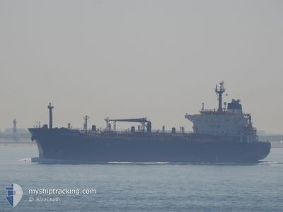
SPRIT
Oil/Chemical Tanker
Current Trip
| Time Travelled | 9 h, 15 mins |
|---|---|
| Remaining Time | 1 day |
| Distance Travelled | 0.94 nm |
| Remaining Distance | 213.08 nm |
| AVG Speed | --- |
| MAX Speed | --- |
| AVG Wind | 6.8 knots |
| MAX Wind | 7 knots |
| MIN Temp | 15.2°C / 59.36°F |
| MAX Temp | 18.2°C / 64.76°F |
| Tirant d eau | 7 m |
| Position reçue | 9 h, 5 m depuis |
Current Position
| Longitude | 37.83737° |
|---|---|
| Latitude | 44.68186° |
| Etat | Under way using engine |
| Vitesse | 6.5 Noeuds |
| Parcours | 166° |
| Zone | Black Sea |
| Station | T-AIS |
| Position reçue | 9 h, 5 m depuis |
Info
Information
The current position of SPRIT is in Black Sea with coordinates 44.68186° / 37.83737° as reported on 2024-05-23 04:58 by AIS to our vessel tracker app. The vessel's current speed is 6.5 Noeuds and is heading at the port of SAMSUN. The estimated time of arrival as calculated by MyShipTracking vessel tracking app is 2024-05-24 18:45 LT
The vessel SPRIT (IMO: 9248796, MMSI: 630001102) is a Oil/Chemical Tanker that was built in 2003 ( 21 Age ). It's sailing under the flag of [GW] Guinea-Bissau.
In this page you can find informations about the vessels current position, last detected port calls, and current voyage information. If the vessels is not in coverage by AIS you will find the latest position.
The current position of SPRIT is detected by our AIS receivers and we are not responsible for the reliability of the data. The last position was recorded while the vessel was in Coverage by the Ais receivers of our vessel tracking app.
The current draught of SPRIT as reported by AIS is 7 meters
Weather
| Temperature | 16.3°C / 61.34°F |
|---|---|
| Wind Speed | 6 knots |
| Direction | 56° NE |
| Pressure | 1012.3 hPa |
| Humidity | 60.1 % |
| Cloud Coverage | 16 % |
Featured Company
Last Port Calls
| Port | Arrival | Departure | Time In Port |
|---|---|---|---|
| 2024-05-21 11:34 | 2024-05-23 07:48 | 1 d | |
| 2024-04-19 00:16 | |||
| 2024-03-31 04:21 | 2024-03-31 05:35 | 1 h |
Most Visited Ports (Last year)
| Port | Arrivals | |
|---|---|---|
| 2 | ||
| 1 |
Last Trips
| Origin | Departure | Destination | Arrival | Distance | |
|---|---|---|---|---|---|
| 2024-04-19 00:16 | 2024-05-21 11:34 | 3093.82 nm |
Events
| Heure | Evenement | Détails | Position/ Destination | Info |
|---|---|---|---|---|
| 2024-05-23 04:58 | Hors de la zone couverte |
44.68186 / 37.83737
Black Sea
SAMSUN
|
Vitesse: 6.5 kn Parcours: 166° |
|
| 2024-05-23 04:48 | PORT DE DEPART |
|
44.69712 / 37.83272
SAMSUN
|
Vitesse: 5 kn Parcours: 170° |
| 2024-05-23 04:44 | Changement de zone | Russian part of the Black Sea Turkish part of the Black Sea |
44.70304 / 37.83089
Black Sea
SAMSUN
|
Vitesse: 3.9 kn Parcours: 171° |
| 2024-05-23 04:42 | Changement d'ETA | 2024/05/24 03:00 2024/05/21 10:00 |
44.70496 / 37.83061
[RU] NOVOROSSIYSK
|
Vitesse: 3.7 kn Parcours: 174° |
| 2024-05-23 04:37 | Démarrage |
44.70833 / 37.83513
[RU] NOVOROSSIYSK
|
Vitesse: 3.3 kn Parcours: 247° |
|
| 2024-05-23 04:35 | Changement de destination | SAMSUN NOVOROSSIYSK |
44.70858 / 37.83671
[RU] NOVOROSSIYSK
|
Vitesse: 2.2 kn Parcours: 256° |
| 2024-05-23 04:35 | Etat Changé | Under way using engine Moored |
44.70872 / 37.83756
[RU] NOVOROSSIYSK
|
Vitesse: 1.2 kn Parcours: 262° |
| 2024-05-22 20:12 | Dans la zone couverte |
44.70942 / 37.83891
Black Sea
[RU] NOVOROSSIYSK
|
Vitesse: 0.1 kn Parcours: 188.2° |
|
| 2024-05-22 18:25 | Hors de la zone couverte |
44.70915 / 37.83946
Black Sea
[RU] NOVOROSSIYSK
|
Vitesse: 2.8 kn Parcours: 73.7° |
|
| 2024-05-22 01:56 | Arret |
44.70933 / 37.83906
[RU] NOVOROSSIYSK
|
Vitesse: 0.1 kn Parcours: 263° |