
SPM NEEL PRATAP 180
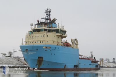
Anchor Handling Vessel
Current Trip
| Trip Time | 13 h, 15 mins |
|---|---|
| Trip Distance | 39.16 nm |
| AVG Speed | 5.8 Noeuds |
| MAX Speed | 10.8 Noeuds |
| Tirant d eau | 0 m |
| AVG Wind | 8 knots |
| MAX Wind | 11.8 knots |
| MIN Temp | 14.5°C / 58.1°F |
| MAX Temp | 20°C / 68°F |
| Position reçue | 1 m depuis |
Current Position
| Longitude | 3.83752° |
|---|---|
| Latitude | 51.27442° |
| Etat | Moored |
| Vitesse | |
| Parcours | 200° |
| Zone | North Sea |
| Station | T-AIS |
| Position reçue | 1 m depuis |
Info
Information
The current position of SPM NEEL PRATAP 180 is in North Sea with coordinates 51.27442° / 3.83752° as reported on 2024-05-07 14:13 by AIS to our vessel tracker app. The vessel's current speed is 0 Noeuds and is currently inside the port of SLUISKIL.
The vessel SPM NEEL PRATAP 180 (IMO: 9388613, MMSI: 636023577) is a Anchor Handling Vessel that was built in 2009 ( 15 Age ). It's sailing under the flag of [LR] Liberia.
In this page you can find informations about the vessels current position, last detected port calls, and current voyage information. If the vessels is not in coverage by AIS you will find the latest position.
The current position of SPM NEEL PRATAP 180 is detected by our AIS receivers and we are not responsible for the reliability of the data. The last position was recorded while the vessel was in Coverage by the Ais receivers of our vessel tracking app.
Weather
| Temperature | 17°C / 62.6°F |
|---|---|
| Wind Speed | 12 knots |
| Direction | 3° N |
| Pressure | 1020.6 hPa |
| Humidity | 61.1 % |
| Cloud Coverage | 35 % |
Featured Company
Most Visited Ports (Last year)
| Port | Arrivals | |
|---|---|---|
| 1 |
Events
| Heure | Evenement | Détails | Position/ Destination | Info |
|---|---|---|---|---|
| 2024-05-01 09:30 | Arret |
51.27462 / 3.83755
[NL] SLUISKIL
|
Vitesse: 0.3 kn Parcours: 205° |
|
| 2024-05-01 09:16 | Démarrage |
51.27453 / 3.84300
[NL] SLUISKIL
|
Vitesse: 3.1 kn Parcours: 346° |
|
| 2024-04-30 22:18 | Arret |
51.27250 / 3.84410
[NL] SLUISKIL
|
Vitesse: 0.2 kn Parcours: 220° |
|
| 2024-04-30 22:18 | Port d'arrivée |
|
51.27250 / 3.84410
[NL] SLUISKIL
|
Vitesse: 1.7 kn Parcours: 171° |
| 2024-04-30 21:31 | Démarrage | 0.39 nm, North West of TERNEUZEN |
51.32511 / 3.81945
|
Vitesse: 3.2 kn Parcours: 152° |
| 2024-04-30 19:29 | Arret | 1.3 nm, North West of TERNEUZEN |
51.33920 / 3.80993
|
Vitesse: Parcours: 178° |
| 2024-04-30 14:27 | Démarrage | 2.31 nm, South of ZEELAND REFINERY |
51.37423 / 3.72644
|
Vitesse: 5.4 kn Parcours: 324.2° |
| 2024-04-30 11:55 | Arret | 2.41 nm, South of ZEELAND REFINERY |
51.37244 / 3.72591
|
Vitesse: 0.1 kn Parcours: 127° |
| 2024-04-30 10:53 | Démarrage | 0.77 nm, North West of TERNEUZEN |
51.33093 / 3.81503
|
Vitesse: 3.9 kn Parcours: 329° |
| 2024-04-30 10:04 | Arret | 0.65 nm, North West of TERNEUZEN |
51.32923 / 3.81660
|
Vitesse: Parcours: 337° |