
SOUTHERN OWL
Tanker C
Current Trip
BRPNG
| Time Travelled | 5 days |
|---|---|
| Remaining Time | --- |
| Distance Travelled | 1699.88 nm |
| Remaining Distance | --- |
| AVG Speed | 13.2 Noeuds |
| MAX Speed | 14.7 Noeuds |
| AVG Wind | 10.8 knots |
| MAX Wind | 17 knots |
| MIN Temp | 21.9°C / 71.42°F |
| MAX Temp | 29.3°C / 84.74°F |
| Tirant d eau | 9.2 m |
| Position reçue | 17 h, 46 m depuis |
Current Position
| Longitude | -34.09434° |
|---|---|
| Latitude | -6.99081° |
| Etat | Under way using engine |
| Vitesse | 12.8 Noeuds |
| Parcours | 21.6° |
| Zone | South Atlantic Ocean |
| Station | T-AIS |
| Position reçue | 17 h, 46 m depuis |
Info
Information
The current position of SOUTHERN OWL is in South Atlantic Ocean with coordinates -6.99081° / -34.09434° as reported on 2024-04-28 22:24 by AIS to our vessel tracker app. The vessel's current speed is 12.8 Noeuds
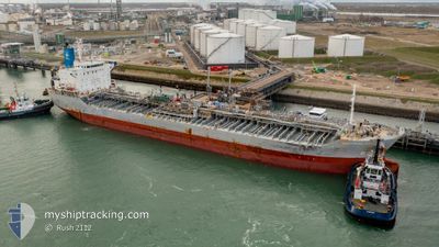
The vessel SOUTHERN OWL (IMO: 9773143, MMSI: 563127200) is a Tanker C It's sailing under the flag of [SG] Singapore.
In this page you can find informations about the vessels current position, last detected port calls, and current voyage information. If the vessels is not in coverage by AIS you will find the latest position.
The current position of SOUTHERN OWL is detected by our AIS receivers and we are not responsible for the reliability of the data. The last position was recorded while the vessel was in Coverage by the Ais receivers of our vessel tracking app.
The current draught of SOUTHERN OWL as reported by AIS is 9.2 meters
Weather
| Temperature | 26.3°C / 79.34°F |
|---|---|
| Wind Speed | 8 knots |
| Direction | 132° SE |
| Pressure | 1010.2 hPa |
| Humidity | 88.3 % |
| Cloud Coverage | 96 % |
Featured Company
Last Port Calls
| Port | Arrival | Departure | Time In Port |
|---|---|---|---|
| 2024-04-22 15:50 | 2024-04-24 05:16 | 1 d | |
| 2024-04-13 00:31 | 2024-04-13 19:37 | 19 h | |
| 2024-04-06 18:51 | 2024-04-12 23:14 | 6 d | |
| 2024-04-05 00:42 | 2024-04-06 03:29 | 1 d | |
| 2024-03-31 10:22 | 2024-04-01 12:14 | 1 d | |
| 2024-03-28 11:31 | 2024-03-28 12:18 | 47 m | |
| 2024-03-25 03:11 | 2024-03-25 04:04 | 52 m | |
| 2024-03-11 17:34 | 2024-03-13 03:33 | 1 d | |
| 2024-03-09 02:49 | 2024-03-10 06:45 | 1 d | |
| 2024-02-26 09:20 | 2024-02-27 14:53 | 1 d |
Most Visited Ports (Last year)
| Port | Arrivals | |
|---|---|---|
| 6 | ||
| 6 | ||
| 6 | ||
| 5 | ||
| 5 | ||
| 4 |
Last Trips
| Origin | Departure | Destination | Arrival | Distance | |
|---|---|---|---|---|---|
| 2024-04-13 16:37 | 2024-04-22 12:50 | 1084.29 nm | |||
| 2024-04-12 20:14 | 2024-04-12 21:31 | 9.49 nm | |||
| 2024-04-06 00:29 | 2024-04-06 15:51 | 149.23 nm | |||
| 2024-04-01 09:14 | 2024-04-04 21:42 | 969.84 nm | |||
| 2024-03-28 09:18 | 2024-03-31 07:22 | 181.44 nm | |||
| 2024-03-25 01:04 | 2024-03-28 08:31 | 29.94 nm | |||
| 2024-03-13 00:33 | 2024-03-25 00:11 | 990.09 nm | |||
| 2024-03-10 03:45 | 2024-03-11 14:34 | 39.59 nm | |||
| 2024-02-27 15:53 | 2024-03-08 23:49 | 3246.72 nm | |||
| 2024-02-22 03:26 | 2024-02-26 10:20 | 332.82 nm |
Events
| Heure | Evenement | Détails | Position/ Destination | Info |
|---|---|---|---|---|
| 2024-04-28 22:26 | Etat Changé | Default Under way using engine |
-6.98241 / -34.09106
BRPNG
|
Vitesse: 12.8 kn Parcours: 21.6° |
| 2024-04-28 22:24 | Etat Changé | Under way using engine Default |
-6.99081 / -34.09434
BRPNG
|
Vitesse: 12.9 kn Parcours: 21° |
| 2024-04-28 22:24 | Hors de la zone couverte |
-6.99081 / -34.09434
South Atlantic Ocean
|
Vitesse: 12.8 kn Parcours: 21.6° |
|
| 2024-04-28 22:19 | Etat Changé | Default Under way using engine |
-7.00753 / -34.10090
BRPNG
|
Vitesse: 12.6 kn Parcours: 22.5° |
| 2024-04-28 22:14 | Etat Changé | Under way using engine Default |
-7.02522 / -34.10811
BRPNG
|
Vitesse: 12.7 kn Parcours: 23° |
| 2024-04-28 21:48 | Etat Changé | Default Under way using engine |
-7.11124 / -34.14324
BRPNG
|
Vitesse: 13 kn Parcours: 22.8° |
| 2024-04-28 21:44 | Etat Changé | Under way using engine Default |
-7.12522 / -34.14877
BRPNG
|
Vitesse: 13.5 kn Parcours: 23° |
| 2024-04-28 21:27 | Etat Changé | Default Under way using engine |
-7.18455 / -34.17256
BRPNG
|
Vitesse: 14 kn Parcours: 19.3° |
| 2024-04-28 21:16 | Etat Changé | Under way using engine Default |
-7.22663 / -34.18950
BRPNG
|
Vitesse: 14.1 kn Parcours: 22° |
| 2024-04-28 21:06 | Etat Changé | Default Under way using engine |
-7.26304 / -34.20404
BRPNG
|
Vitesse: 14.1 kn Parcours: 21.6° |