
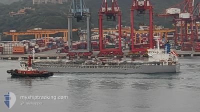
SOUTHERN MERMAID
Tanker B
Current Trip
VN VUT
| Time Travelled | 2 days |
|---|---|
| Remaining Time | --- |
| Distance Travelled | 378.05 nm |
| Remaining Distance | --- |
| AVG Speed | 7.8 Noeuds |
| MAX Speed | 13.6 Noeuds |
| AVG Wind | 22.5 knots |
| MAX Wind | 38 knots |
| MIN Temp | 6.4°C / 43.52°F |
| MAX Temp | 14.3°C / 57.74°F |
| Tirant d eau | 5.3 m |
| Position reçue | 23 d depuis |
Current Position
| Longitude | --- |
|---|---|
| Latitude | --- |
| Etat | Under way using engine |
| Vitesse | 14.8 Noeuds |
| Parcours | 80.6° |
| Zone | Java Sea |
| Station | T-AIS |
| Position reçue | 23 d depuis |
Info
Information
The current position of SOUTHERN MERMAID is in Java Sea with coordinates -4.62705° / 115.35683° as reported on 2025-02-20 08:41 by AIS to our vessel tracker app. The vessel's current speed is 14.8 Noeuds
The vessel SOUTHERN MERMAID (IMO: 9724166, MMSI: 636018879) is a Tanker B It's sailing under the flag of [LR] Liberia.
In this page you can find informations about the vessels current position, last detected port calls, and current voyage information. If the vessels is not in coverage by AIS you will find the latest position.
The current position of SOUTHERN MERMAID is detected by our AIS receivers and we are not responsible for the reliability of the data. The last position was recorded while the vessel was in Coverage by the Ais receivers of our vessel tracking app.
The current draught of SOUTHERN MERMAID as reported by AIS is 5.3 meters
Weather
| Temperature | 11.1°C / 51.98°F |
|---|---|
| Wind Speed | 27 knots |
| Direction | 42° NE |
| Pressure | 1015 hPa |
| Humidity | 80.5 % |
| Cloud Coverage | 100 % |
Featured Company
Last Port Calls
| Port | Arrival | Departure | Time In Port |
|---|---|---|---|
| 2025-03-12 11:12 | 2025-03-13 09:05 | 21 h | |
| 2025-03-09 13:02 | 2025-03-10 07:13 | 18 h | |
| 2025-03-06 18:39 | 2025-03-07 12:13 | 17 h | |
| 2025-02-25 06:41 | 2025-02-26 20:49 | 1 d | |
| 2025-02-25 06:09 | |||
| 2025-02-16 00:16 | 2025-02-18 21:00 | 2 d | |
| 2025-01-22 12:04 | 2025-01-24 07:40 | 1 d | |
| 2025-01-15 08:19 | 2025-01-16 15:09 | 1 d | |
| 2025-01-06 15:57 | 2025-01-09 09:38 | 2 d | |
| 2025-01-03 07:21 | 2025-01-03 16:21 | 8 h |
Last Trips
| Origin | Departure | Destination | Arrival | Distance | |
|---|---|---|---|---|---|
| 2025-03-10 07:13 | 2025-03-12 11:12 | 526.78 nm | |||
| 2025-03-07 12:13 | 2025-03-09 13:02 | 52.53 nm | |||
| 2025-02-26 20:49 | 2025-03-06 18:39 | 2100.80 nm | |||
| 2025-02-25 06:09 | 2025-02-25 06:41 | 0.90 nm | |||
| 2025-01-24 07:40 | 2025-02-16 00:16 | 3577.92 nm | |||
| 2025-01-16 15:09 | 2025-01-22 12:04 | 1622.95 nm | |||
| 2025-01-09 09:38 | 2025-01-15 08:19 | 1079.17 nm | |||
| 2025-01-03 16:21 | 2025-01-06 15:57 | 586.18 nm | |||
| 2024-12-22 08:01 | 2025-01-03 07:21 | 2726.09 nm |
Events
| Heure | Evenement | Détails | Position/ Destination | Info |
|---|---|---|---|---|
| 2025-03-13 00:05 | PORT DE DEPART |
|
35.98099 / 126.55572
VN VUT
|
Vitesse: 8.3 kn Parcours: 276° |
| 2025-03-12 23:57 | Démarrage |
35.97942 / 126.58482
[KR] GUNSAN
|
Vitesse: 8 kn Parcours: 275° |
|
| 2025-03-12 02:12 | Port d'arrivée |
|
35.97739 / 126.59545
[KR] GUNSAN
|
Vitesse: 1.3 kn Parcours: 259° |
| 2025-03-09 22:13 | PORT DE DEPART |
|
35.41359 / 129.37659
VN VUT
|
Vitesse: 3.6 kn Parcours: 115° |
| 2025-03-09 22:01 | Démarrage |
35.43837 / 129.36935
[KR] ONSAN
|
Vitesse: 3.6 kn Parcours: 115° |
|
| 2025-03-09 04:02 | Arret |
35.43770 / 129.36694
[KR] ONSAN
|
Vitesse: Parcours: 25° |
|
| 2025-03-09 04:02 | Port d'arrivée |
|
35.43770 / 129.36694
[KR] ONSAN
|
Vitesse: 1 kn Parcours: 25° |
| 2025-03-09 02:57 | Démarrage | 2.79 nm, East of ONSAN |
35.44321 / 129.43318
VN VUT
|
Vitesse: 3.7 kn Parcours: 230° |
| 2025-03-08 00:45 | Arret | 2.91 nm, East of ONSAN |
35.44397 / 129.43555
VN VUT
|
Vitesse: 0.3 kn Parcours: 197° |
| 2025-03-07 22:10 | Démarrage | 13.1 nm, South East of ONSAN |
35.30085 / 129.58641
VN VUT
|
Vitesse: 10 kn Parcours: 162° |