
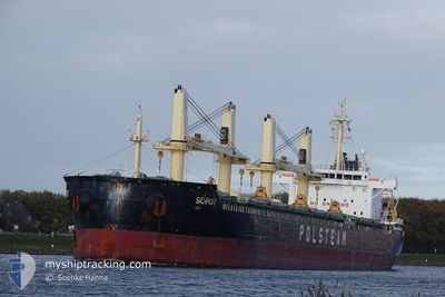
SOPOT
Cargo
Current Trip
| Time Travelled | 17 days |
|---|---|
| Remaining Time | 1 day |
| Distance Travelled | 4517.72 nm |
| Remaining Distance | 371.23 nm |
| AVG Speed | 10.3 Noeuds |
| MAX Speed | 14.8 Noeuds |
| AVG Wind | 16 knots |
| MAX Wind | 32.4 knots |
| MIN Temp | 2.3°C / 36.14°F |
| MAX Temp | 25.1°C / 77.18°F |
| Tirant d eau | 10.2 m |
| Position reçue | 14 m depuis |
Current Position
| Longitude | -2.47648° |
|---|---|
| Latitude | 49.89326° |
| Etat | Under way using engine |
| Vitesse | 7.8 Noeuds |
| Parcours | 73.9° |
| Zone | English Channel |
| Station | T-AIS |
| Position reçue | 14 m depuis |
Info
Information
The current position of SOPOT is in English Channel with coordinates 49.89326° / -2.47648° as reported on 2024-04-28 03:41 by AIS to our vessel tracker app. The vessel's current speed is 7.8 Noeuds and is heading at the port of IMMINGHAM. The estimated time of arrival as calculated by MyShipTracking vessel tracking app is 2024-04-29 19:14 LT
The vessel SOPOT (IMO: 9727522, MMSI: 636017077) is a Cargo It's sailing under the flag of [LR] Liberia.
In this page you can find informations about the vessels current position, last detected port calls, and current voyage information. If the vessels is not in coverage by AIS you will find the latest position.
The current position of SOPOT is detected by our AIS receivers and we are not responsible for the reliability of the data. The last position was recorded while the vessel was in Coverage by the Ais receivers of our vessel tracking app.
The current draught of SOPOT as reported by AIS is 10.2 meters
Weather
| Temperature | 7.9°C / 46.22°F |
|---|---|
| Wind Speed | 27 knots |
| Direction | 338° NNW |
| Pressure | 999.6 hPa |
| Humidity | 87.4 % |
| Cloud Coverage | 100 % |
Featured Company
Last Port Calls
| Port | Arrival | Departure | Time In Port |
|---|---|---|---|
| 2024-04-05 21:46 | 2024-04-10 14:04 | 4 d | |
| 2024-03-29 06:35 | 2024-03-29 21:59 | 15 h | |
| 2024-03-23 22:52 | 2024-03-26 01:57 | 2 d | |
| 2024-03-21 23:40 | 2024-03-23 21:34 | 1 d | |
| 2024-02-27 18:34 | 2024-03-05 02:47 | 6 d | |
| 2024-02-20 12:06 | 2024-02-23 15:42 | 3 d | |
| 2024-02-12 19:57 | 2024-02-13 22:17 | 1 d | |
| 2024-02-06 09:33 | 2024-02-10 20:26 | 4 d | |
| 2024-02-02 17:15 | 2024-02-02 17:43 | 28 m |
Most Visited Ports (Last year)
| Port | Arrivals | |
|---|---|---|
| 5 | ||
| 2 | ||
| 2 | ||
| 1 | ||
| 1 | ||
| 1 |
Last Trips
| Origin | Departure | Destination | Arrival | Distance | |
|---|---|---|---|---|---|
| 2024-03-29 17:59 | 2024-04-05 16:46 | 1024.07 nm | |||
| 2024-03-25 21:57 | 2024-03-29 02:35 | 790.18 nm | |||
| 2024-03-23 17:34 | 2024-03-23 18:52 | 3.99 nm | |||
| 2024-03-05 03:47 | 2024-03-21 19:40 | 4170.25 nm | |||
| 2024-02-23 15:42 | 2024-02-27 19:34 | 725.74 nm | |||
| 2024-02-13 23:17 | 2024-02-20 12:06 | 1790.05 nm | |||
| 2024-02-10 21:26 | 2024-02-12 20:57 | 469.50 nm | |||
| 2024-02-02 18:43 | 2024-02-06 10:33 | 9.81 nm | |||
| 2023-12-29 19:38 | 2024-02-02 18:15 | 2128.74 nm |
Events
| Heure | Evenement | Détails | Position/ Destination | Info |
|---|---|---|---|---|
| 2024-04-28 03:47 | Etat Changé | Default Under way using engine |
49.89619 / -2.45904
GBIMM
|
Vitesse: 7.8 kn Parcours: 73.9° |
| 2024-04-28 03:32 | Etat Changé | Under way using engine Default |
49.88790 / -2.50773
GBIMM
|
Vitesse: 8 kn Parcours: 76° |
| 2024-04-28 03:30 | Etat Changé | Default Under way using engine |
49.88711 / -2.51213
GBIMM
|
Vitesse: 8 kn Parcours: 74.8° |
| 2024-04-28 02:44 | Detecté en mer | Guernsey part of the English Channel |
49.86132 / -2.67025
English Channel
GBIMM
|
Vitesse: 8.5 kn Parcours: 74.3° |
| 2024-04-28 02:43 | Dans la zone couverte |
49.86132 / -2.67025
English Channel
GBIMM
|
Vitesse: 8.5 kn Parcours: 74.3° |
|
| 2024-04-28 02:41 | Etat Changé | Under way using engine Default |
49.85926 / -2.68194
GBIMM
|
Vitesse: 8.5 kn Parcours: 75° |
| 2024-04-27 22:46 | Etat Changé | Default Under way using engine |
49.73266 / -3.65160
GBIMM
|
Vitesse: 10.3 kn Parcours: 74.5° |
| 2024-04-27 22:39 | Hors de la zone couverte |
49.72885 / -3.68321
English Channel
GBIMM
|
Vitesse: 10.3 kn Parcours: 74.5° |
|
| 2024-04-27 22:33 | Etat Changé | Under way using engine Default |
49.72419 / -3.70899
GBIMM
|
Vitesse: 10.5 kn Parcours: 71° |
| 2024-04-27 22:16 | Etat Changé | Default Under way using engine |
49.70853 / -3.78031
GBIMM
|
Vitesse: 10.5 kn Parcours: 71.9° |