

SOMERSET
Not available

Current Trip
SEA
| Time Travelled | 1 day |
|---|---|
| Remaining Time | --- |
| Distance Travelled | 230.24 nm |
| Remaining Distance | --- |
| AVG Speed | 7.1 Noeuds |
| MAX Speed | 15.5 Noeuds |
| AVG Wind | 4.2 knots |
| MAX Wind | 8 knots |
| MIN Temp | 13°C / 55.4°F |
| MAX Temp | 16.3°C / 61.34°F |
| Tirant d eau | 0 m |
| Position reçue | Maintenant |
Current Position
| Longitude | --- |
|---|---|
| Latitude | --- |
| Etat | Restricted manoeuverability |
| Vitesse | 13.7 Noeuds |
| Parcours | 347.1° |
| Zone | North Pacific Ocean |
| Station | T-AIS |
| Position reçue | Maintenant |
Information
The current position of SOMERSET is in North Pacific Ocean with coordinates 32.76266° / -117.67373° as reported on 2025-03-27 04:41 by AIS to our vessel tracker app. The vessel's current speed is 13.7 Noeuds
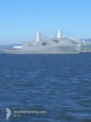
The vessel SOMERSET (MMSI: 369970850) is a Not available It's sailing under the flag of [US] USA.
In this page you can find informations about the vessels current position, last detected port calls, and current voyage information. If the vessels is not in coverage by AIS you will find the latest position.
The current position of SOMERSET is detected by our AIS receivers and we are not responsible for the reliability of the data. The last position was recorded while the vessel was in Coverage by the Ais receivers of our vessel tracking app.
Weather
| Temperature | 14.7°C / 58.46°F |
|---|---|
| Wind Speed | 6 knots |
| Direction | 332° NNW |
| Pressure | 1018.6 hPa |
| Humidity | 78.6 % |
| Cloud Coverage | 4 % |


Featured Company
Most Visited Ports (Last year)
| Port | Arrivals | |
|---|---|---|
| 5 | ||
| 3 | ||
| 2 | ||
| 1 | ||
| 1 |
Events
| Heure | Evenement | Détails | Position/ Destination | Info |
|---|---|---|---|---|
| 2025-03-27 00:18 | Etat Changé | Restricted manoeuverability Under way using engine |
32.75212 / -118.08659
SEA
|
Vitesse: 4.8 kn Parcours: 186.5° |
| 2025-03-27 00:11 | Etat Changé | Under way using engine Restricted manoeuverability |
32.76190 / -118.08488
SEA
|
Vitesse: 4.7 kn Parcours: 189.1° |
| 2025-03-26 23:44 | Etat Changé | Restricted manoeuverability Under way using engine |
32.79628 / -118.07806
SEA
|
Vitesse: 4.7 kn Parcours: 187.7° |
| 2025-03-26 22:11 | Etat Changé | Under way using engine Restricted manoeuverability |
32.92620 / -118.04792
SEA
|
Vitesse: 5.2 kn Parcours: 193.9° |
| 2025-03-26 16:09 | Etat Changé | Restricted manoeuverability Under way using engine |
32.89010 / -117.71418
SEA
|
Vitesse: 6.1 kn Parcours: 316.5° |
| 2025-03-26 03:53 | Etat Changé | Under way using engine Restricted manoeuverability |
32.61200 / -118.10429
SEA
|
Vitesse: 12.3 kn Parcours: 266.3° |
| 2025-03-26 01:43 | Changement de zone | United States part of the North Pacific Ocean Mexican part of the North Pacific Ocean |
32.59739 / -117.84380
North Pacific Ocean
|
Vitesse: 9.5 kn Parcours: 272° |
| 2025-03-26 00:10 | Detecté en mer | Mexican part of the North Pacific Ocean |
32.59811 / -117.54748
North Pacific Ocean
|
Vitesse: 9.9 kn Parcours: 267.5° |
| 2025-03-25 23:07 | Etat Changé | Restricted manoeuverability Under way using engine |
32.60428 / -117.34173
SEA
|
Vitesse: 10.1 kn Parcours: 269.3° |
| 2025-03-25 22:14 | PORT DE DEPART |
|
32.67574 / -117.22919
SEA
|
Vitesse: 11.9 kn Parcours: 174.4° |