
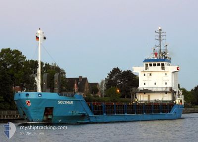
SOLYMAR
General Cargo
Current Trip
| Time Travelled | 14 h, 58 mins |
|---|---|
| Remaining Time | 5 days |
| Distance Travelled | 156.48 nm |
| Remaining Distance | 1329.04 nm |
| AVG Speed | 10 Noeuds |
| MAX Speed | 11.8 Noeuds |
| AVG Wind | 9.8 knots |
| MAX Wind | 12 knots |
| MIN Temp | 17.3°C / 63.14°F |
| MAX Temp | 20.6°C / 69.08°F |
| Tirant d eau | 5 m |
| Position reçue | 1 m depuis |
Current Position
| Longitude | 4.97640° |
|---|---|
| Latitude | 53.45935° |
| Etat | Under way using engine |
| Vitesse | 9.6 Noeuds |
| Parcours | 64.9° |
| Zone | North Sea |
| Station | T-AIS |
| Position reçue | 1 m depuis |
Info
Information
The current position of SOLYMAR is in North Sea with coordinates 53.45935° / 4.97640° as reported on 2024-07-27 03:23 by AIS to our vessel tracker app. The vessel's current speed is 9.6 Noeuds and is heading at the port of ROYTTA. The estimated time of arrival as calculated by MyShipTracking vessel tracking app is 2024-08-01 18:30 LT
The vessel SOLYMAR (IMO: 9167344, MMSI: 209664000) is a General Cargo that was built in 1998 ( 26 Age ). It's sailing under the flag of [CY] Cyprus.
In this page you can find informations about the vessels current position, last detected port calls, and current voyage information. If the vessels is not in coverage by AIS you will find the latest position.
The current position of SOLYMAR is detected by our AIS receivers and we are not responsible for the reliability of the data. The last position was recorded while the vessel was in Coverage by the Ais receivers of our vessel tracking app.
The current draught of SOLYMAR as reported by AIS is 5 meters
Weather
| Temperature | 17.6°C / 63.68°F |
|---|---|
| Wind Speed | 7 knots |
| Direction | 177° S |
| Pressure | 1011.6 hPa |
| Humidity | 75.4 % |
| Cloud Coverage | 49 % |
Featured Company
Last Port Calls
| Port | Arrival | Departure | Time In Port |
|---|---|---|---|
| 2024-07-25 04:07 | 2024-07-26 14:26 | 1 d | |
| 2024-07-23 21:40 | 2024-07-23 23:03 | 1 h | |
| 2024-07-20 05:54 | 2024-07-20 20:06 | 14 h | |
| 2024-07-16 16:06 | 2024-07-19 08:10 | 2 d | |
| 2024-07-13 12:42 | 2024-07-14 06:15 | 17 h | |
| 2024-07-11 12:37 | 2024-07-12 18:53 | 1 d | |
| 2024-07-08 22:58 | 2024-07-08 23:02 | 4 m | |
| 2024-07-06 06:56 | 2024-07-08 10:13 | 2 d | |
| 2024-07-02 23:32 | 2024-07-05 02:20 | 2 d | |
| 2024-06-24 14:20 | 2024-06-26 17:15 | 2 d |
Last Trips
| Origin | Departure | Destination | Arrival | Distance | |
|---|---|---|---|---|---|
| 2024-07-23 23:03 | 2024-07-25 04:07 | 314.80 nm | |||
| 2024-07-20 20:06 | 2024-07-23 21:40 | 789.03 nm | |||
| 2024-07-19 08:10 | 2024-07-20 05:54 | 9.44 nm | |||
| 2024-07-14 06:15 | 2024-07-16 16:06 | 443.96 nm | |||
| 2024-07-12 18:53 | 2024-07-13 12:42 | 68.14 nm | |||
| 2024-07-08 23:02 | 2024-07-11 12:37 | 700.03 nm | |||
| 2024-07-08 10:13 | 2024-07-08 22:58 | 87.23 nm | |||
| 2024-07-05 02:20 | 2024-07-06 06:56 | 329.35 nm | |||
| 2024-06-26 17:15 | 2024-07-02 23:32 | 1328.12 nm | |||
| 2024-06-23 08:07 | 2024-06-24 14:20 | 249.75 nm |
Events
| Heure | Evenement | Détails | Position/ Destination | Info |
|---|---|---|---|---|
| 2024-07-27 02:22 | Etat Changé | Under way using engine Default |
53.39230 / 4.72403
FITOR
|
Vitesse: 10 kn Parcours: 22° |
| 2024-07-27 02:03 | Etat Changé | Default Under way using engine |
53.34714 / 4.68221
FITOR
|
Vitesse: 9.9 kn Parcours: 20.8° |
| 2024-07-27 01:36 | Etat Changé | Under way using engine Default |
53.27761 / 4.63254
FITOR
|
Vitesse: 10.2 kn Parcours: 24° |
| 2024-07-27 01:36 | Dans la zone couverte |
53.28259 / 4.63681
North Sea
FITOR
|
Vitesse: 10 kn Parcours: 28.1° |
|
| 2024-07-27 00:41 | Etat Changé | Default Under way using engine |
53.13648 / 4.51824
FITOR
|
Vitesse: 10.3 kn Parcours: 34.3° |
| 2024-07-27 00:24 | Hors de la zone couverte |
53.09649 / 4.46952
North Sea
FITOR
|
Vitesse: 10.3 kn Parcours: 34.3° |
|
| 2024-07-26 23:05 | Etat Changé | Under way using engine Default |
52.89573 / 4.30218
FITOR
|
Vitesse: 10.5 kn Parcours: 19° |
| 2024-07-26 22:58 | Dans la zone couverte |
52.89712 / 4.30302
North Sea
FITOR
|
Vitesse: 10.7 kn Parcours: 21.5° |
|
| 2024-07-26 16:33 | Etat Changé | Default Under way using engine |
51.96472 / 3.10475
FITOR
|
Vitesse: 11 kn Parcours: 356.1° |
| 2024-07-26 16:30 | Hors de la zone couverte |
51.95536 / 3.10516
North Sea
FITOR
|
Vitesse: 11 kn Parcours: 356.1° |