
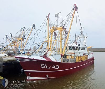
SL-49 JAN SENIOR
Trawler
Current Trip
Unknown
| Time Travelled | 1 day |
|---|---|
| Remaining Time | --- |
| Distance Travelled | 168.98 nm |
| Remaining Distance | --- |
| AVG Speed | 4.1 Noeuds |
| MAX Speed | 12.1 Noeuds |
| AVG Wind | 8.7 knots |
| MAX Wind | 15 knots |
| MIN Temp | 13.1°C / 55.58°F |
| MAX Temp | 19.9°C / 67.82°F |
| Tirant d eau | 2 m |
| Position reçue | 1 m depuis |
Current Position
| Longitude | 4.49704° |
|---|---|
| Latitude | 52.41181° |
| Etat | Under way using engine |
| Vitesse | 0.5 Noeuds |
| Parcours | --- |
| Zone | North Sea |
| Station | T-AIS |
| Position reçue | 1 m depuis |
Info
Information
The current position of SL-49 JAN SENIOR is in North Sea with coordinates 52.41181° / 4.49704° as reported on 2024-05-14 18:43 by AIS to our vessel tracker app. The vessel's current speed is 0.5 Noeuds
The vessel SL-49 JAN SENIOR (IMO: 9168427, MMSI: 245933000) is a Trawler that was built in 1997 ( 27 Age ). It's sailing under the flag of [NL] Netherlands.
In this page you can find informations about the vessels current position, last detected port calls, and current voyage information. If the vessels is not in coverage by AIS you will find the latest position.
The current position of SL-49 JAN SENIOR is detected by our AIS receivers and we are not responsible for the reliability of the data. The last position was recorded while the vessel was in Coverage by the Ais receivers of our vessel tracking app.
The current draught of SL-49 JAN SENIOR as reported by AIS is 2 meters
Weather
| Temperature | 14.3°C / 57.74°F |
|---|---|
| Wind Speed | 7 knots |
| Direction | 242° WSW |
| Pressure | 1004.6 hPa |
| Humidity | 98.7 % |
| Cloud Coverage | 44 % |
Featured Company
Last Port Calls
| Port | Arrival | Departure | Time In Port |
|---|---|---|---|
| 2024-05-08 19:55 | 2024-05-13 00:56 | 4 d | |
| 2024-05-03 03:25 | 2024-05-06 01:18 | 2 d | |
| 2024-05-01 13:32 | 2024-05-01 14:19 | 47 m | |
| 2024-04-26 05:37 | 2024-04-29 01:34 | 2 d | |
| 2024-04-19 05:01 | 2024-04-22 01:13 | 2 d | |
| 2024-04-12 06:03 | 2024-04-16 15:39 | 4 d | |
| 2024-04-05 04:53 | 2024-04-08 01:20 | 2 d | |
| 2024-03-29 06:02 | 2024-04-01 17:02 | 3 d | |
| 2024-03-22 00:25 | 2024-03-25 01:29 | 3 d | |
| 2024-03-21 14:51 | 2024-03-21 21:22 | 6 h |
Most Visited Ports (Last year)
| Port | Arrivals | |
|---|---|---|
| 28 | ||
| 21 | ||
| 9 | ||
| 6 | ||
| 2 | ||
| 2 |
Last Trips
| Origin | Departure | Destination | Arrival | Distance | |
|---|---|---|---|---|---|
| 2024-05-06 03:18 | 2024-05-08 21:55 | 262.25 nm | |||
| 2024-05-01 16:19 | 2024-05-03 05:25 | 162.81 nm | |||
| 2024-04-29 03:34 | 2024-05-01 15:32 | 245.51 nm | |||
| 2024-04-22 03:13 | 2024-04-26 07:37 | 413.11 nm | |||
| 2024-04-16 17:39 | 2024-04-19 07:01 | 260.74 nm | |||
| 2024-04-08 03:20 | 2024-04-12 08:03 | 397.78 nm | |||
| 2024-04-01 19:02 | 2024-04-05 06:53 | 356.04 nm | |||
| 2024-03-25 02:29 | 2024-03-29 07:02 | 396.73 nm | |||
| 2024-03-21 22:22 | 2024-03-22 01:25 | 29.17 nm | |||
| 2024-03-18 01:02 | 2024-03-21 15:51 | 456.12 nm |
Events
| Heure | Evenement | Détails | Position/ Destination | Info |
|---|---|---|---|---|
| 2024-05-14 18:40 | Arret | 4.67 nm, South West of IJMUIDEN |
52.41186 / 4.49702
|
Vitesse: 0.3 kn Parcours: 511° |
| 2024-05-13 18:54 | Démarrage | 3.71 nm, South West of HARGEN |
52.67319 / 4.61331
|
Vitesse: 7 kn Parcours: 205.4° |
| 2024-05-13 18:50 | Arret | 3.54 nm, South West of HARGEN |
52.67594 / 4.61497
|
Vitesse: 0.3 kn Parcours: 511° |
| 2024-05-13 13:05 | Dans la zone couverte |
53.02148 / 4.64103
North Sea
|
Vitesse: 10 kn Parcours: 215.4° |
|
| 2024-05-13 10:59 | Hors de la zone couverte |
53.20016 / 4.79658
North Sea
|
Vitesse: 3.9 kn Parcours: 205.2° |
|
| 2024-05-13 10:08 | Démarrage | 8.88 nm, South West of VLIELAND |
53.23598 / 4.85635
|
Vitesse: 4.6 kn Parcours: 319.1° |
| 2024-05-13 10:03 | Arret | 9.08 nm, South West of VLIELAND |
53.23478 / 4.85114
|
Vitesse: 0.3 kn Parcours: 511° |
| 2024-05-13 07:39 | Dans la zone couverte |
53.19691 / 4.79559
North Sea
|
Vitesse: 4.5 kn Parcours: 14.6° |
|
| 2024-05-13 06:34 | Hors de la zone couverte |
53.12471 / 4.75386
North Sea
|
Vitesse: 4.4 kn Parcours: 36.6° |
|
| 2024-05-13 00:56 | PORT DE DEPART |
|
52.96710 / 4.78667
|
Vitesse: 7.3 kn Parcours: 352.9° |