
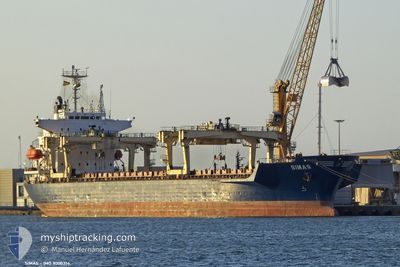
SIMAS
General Cargo
Current Trip
TR TUZ>IT RAN
| Time Travelled | 6 h, 27 mins |
|---|---|
| Remaining Time | --- |
| Distance Travelled | 3.68 nm |
| Remaining Distance | --- |
| AVG Speed | 6 Noeuds |
| MAX Speed | 7.5 Noeuds |
| AVG Wind | 9.2 knots |
| MAX Wind | 10 knots |
| MIN Temp | 6.2°C / 43.16°F |
| MAX Temp | 6.7°C / 44.06°F |
| Tirant d eau | 8.8 m |
| Position reçue | 5 h, 53 m depuis |
Current Position
| Longitude | --- |
|---|---|
| Latitude | --- |
| Etat | Under way using engine |
| Vitesse | 5.3 Noeuds |
| Parcours | 62.9° |
| Zone | Adriatic Sea |
| Station | T-AIS |
| Position reçue | 5 h, 53 m depuis |
Info
Information
The current position of SIMAS is in Adriatic Sea with coordinates 44.52124° / 12.39669° as reported on 2025-02-18 11:33 by AIS to our vessel tracker app. The vessel's current speed is 5.3 Noeuds
The vessel SIMAS (IMO: 9000314, MMSI: 271049726) is a General Cargo that was built in 1991 ( 34 Age ). It's sailing under the flag of [TR] Turkey.
In this page you can find informations about the vessels current position, last detected port calls, and current voyage information. If the vessels is not in coverage by AIS you will find the latest position.
The current position of SIMAS is detected by our AIS receivers and we are not responsible for the reliability of the data. The last position was recorded while the vessel was in Coverage by the Ais receivers of our vessel tracking app.
The current draught of SIMAS as reported by AIS is 8.8 meters
Weather
| Temperature | 6.5°C / 43.7°F |
|---|---|
| Wind Speed | 8 knots |
| Direction | 86° E |
| Pressure | 1023.3 hPa |
| Humidity | 68.6 % |
| Cloud Coverage | 64 % |
Featured Company
Last Port Calls
| Port | Arrival | Departure | Time In Port |
|---|---|---|---|
| 2025-02-14 12:16 | 2025-02-18 11:00 | 3 d | |
| 2025-02-03 16:58 | 2025-02-06 16:53 | 2 d | |
| 2025-01-11 12:42 | 2025-01-14 16:02 | 3 d | |
| 2024-12-25 09:37 | 2025-01-07 16:21 | 13 d | |
| 2024-12-11 16:20 | 2024-12-18 16:09 | 6 d | |
| 2024-12-06 05:32 | 2024-12-07 11:00 | 1 d |
Last Trips
| Origin | Departure | Destination | Arrival | Distance | |
|---|---|---|---|---|---|
| 2025-02-06 19:53 | 2025-02-14 13:16 | 1157.12 nm | |||
| 2025-01-14 18:02 | 2025-02-03 19:58 | 851.49 nm | |||
| 2025-01-07 19:21 | 2025-01-11 14:42 | 395.16 nm | |||
| 2024-12-18 17:09 | 2024-12-25 12:37 | 1560.81 nm | |||
| 2024-12-07 12:00 | 2024-12-11 17:20 | 480.31 nm | |||
| 2024-11-27 13:01 | 2024-12-06 06:32 | 1491.35 nm |
Events
| Heure | Evenement | Détails | Position/ Destination | Info |
|---|---|---|---|---|
| 2025-02-18 12:07 | Arret | 7.06 nm, East of MARINA ROMEA |
44.50579 / 12.43891
TR TUZ>IT RAN
|
Vitesse: 0.1 kn Parcours: 128° |
| 2025-02-18 11:39 | Etat Changé | Default Under way using engine |
44.52090 / 12.40574
TR TUZ>IT RAN
|
Vitesse: 5.3 kn Parcours: 62.9° |
| 2025-02-18 11:33 | Etat Changé | Under way using engine Default |
44.52124 / 12.39669
TR TUZ>IT RAN
|
Vitesse: 6.5 kn Parcours: 35° |
| 2025-02-18 11:33 | Dans la zone couverte |
44.52124 / 12.39669
Adriatic Sea
|
Vitesse: 5.3 kn Parcours: 62.9° |
|
| 2025-02-18 11:33 | Hors de la zone couverte |
44.52124 / 12.39669
Adriatic Sea
|
Vitesse: 5.3 kn Parcours: 62.9° |
|
| 2025-02-18 11:00 | PORT DE DEPART |
|
44.49649 / 12.31605
TR TUZ>IT RAN
|
Vitesse: 7.5 kn Parcours: 80° |
| 2025-02-18 10:44 | Démarrage |
44.49149 / 12.27625
[IT] RAVENNA
|
Vitesse: 6 kn Parcours: 64° |
|
| 2025-02-14 12:56 | Arret |
44.47030 / 12.25762
[IT] RAVENNA
|
Vitesse: 0.1 kn Parcours: 210° |
|
| 2025-02-14 12:16 | Port d'arrivée |
|
44.49602 / 12.30860
[IT] RAVENNA
|
Vitesse: 7.2 kn Parcours: 264° |
| 2025-02-14 10:28 | Démarrage | 12.89 nm, East of MARINA ROMEA |
44.47636 / 12.56896
TR TUZ>IT RAN
|
Vitesse: 4.1 kn Parcours: 240° |