
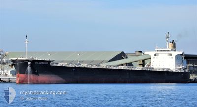
SILVERMINE
Cargo
Current Trip
| Time Travelled | 18 days |
|---|---|
| Remaining Time | 11 days |
| Distance Travelled | 5114.08 nm |
| Remaining Distance | 3395.82 nm |
| AVG Speed | 11.8 Noeuds |
| MAX Speed | 16.1 Noeuds |
| AVG Wind | 14.8 knots |
| MAX Wind | 25.5 knots |
| MIN Temp | 16.2°C / 61.16°F |
| MAX Temp | 29.8°C / 85.64°F |
| Tirant d eau | 8.3 m |
| Position reçue | 4 h, 11 m depuis |
Current Position
| Longitude | 18.00983° |
|---|---|
| Latitude | -34.73526° |
| Etat | Under way using engine |
| Vitesse | 11.7 Noeuds |
| Parcours | 278.7° |
| Zone | South Atlantic Ocean |
| Station | T-AIS |
| Position reçue | 4 h, 11 m depuis |
Info
Information
The current position of SILVERMINE is in South Atlantic Ocean with coordinates -34.73526° / 18.00983° as reported on 2024-05-15 01:18 by AIS to our vessel tracker app. The vessel's current speed is 11.7 Noeuds and is heading at the port of SANTOS. The estimated time of arrival as calculated by MyShipTracking vessel tracking app is 2024-05-26 21:29 LT
The vessel SILVERMINE (IMO: 9609536, MMSI: 477637100) is a Cargo It's sailing under the flag of [HK] Hong Kong.
In this page you can find informations about the vessels current position, last detected port calls, and current voyage information. If the vessels is not in coverage by AIS you will find the latest position.
The current position of SILVERMINE is detected by our AIS receivers and we are not responsible for the reliability of the data. The last position was recorded while the vessel was in Coverage by the Ais receivers of our vessel tracking app.
The current draught of SILVERMINE as reported by AIS is 8.3 meters
Weather
| Temperature | 17.6°C / 63.68°F |
|---|---|
| Wind Speed | 5 knots |
| Direction | 204° SSW |
| Pressure | 1020.4 hPa |
| Humidity | 65.5 % |
| Cloud Coverage | 100 % |
Featured Company
Last Port Calls
Last Trips
| Origin | Departure | Destination | Arrival | Distance | |
|---|---|---|---|---|---|
| 2024-04-05 11:24 | 2024-04-18 13:29 | 2841.69 nm | |||
| 2024-04-04 15:45 | 2024-04-04 16:21 | 2.10 nm | |||
| 2024-03-28 17:17 | 2024-04-02 21:23 | 341.50 nm | |||
| 2024-03-04 09:50 | 2024-03-21 17:07 | 5126.60 nm | |||
| 2024-02-12 18:47 | 2024-03-01 15:10 | 3775.94 nm |
Events
| Heure | Evenement | Détails | Position/ Destination | Info |
|---|---|---|---|---|
| 2024-05-15 01:21 | Etat Changé | Default Under way using engine |
-34.73353 / 17.99738
BRSSZ
|
Vitesse: 11.7 kn Parcours: 278.7° |
| 2024-05-15 01:18 | Hors de la zone couverte |
-34.73526 / 18.00983
South Atlantic Ocean
BRSSZ
|
Vitesse: 11.7 kn Parcours: 278.7° |
|
| 2024-05-15 00:09 | Etat Changé | Under way using engine Default |
-34.75771 / 18.28211
BRSSZ
|
Vitesse: 11.9 kn Parcours: 278° |
| 2024-05-15 00:05 | Etat Changé | Default Under way using engine |
-34.75887 / 18.29584
BRSSZ
|
Vitesse: 12 kn Parcours: 276.3° |
| 2024-05-14 23:59 | Etat Changé | Under way using engine Default |
-34.76116 / 18.31978
BRSSZ
|
Vitesse: 11.9 kn Parcours: 275° |
| 2024-05-14 23:54 | Etat Changé | Default Under way using engine |
-34.76301 / 18.33994
BRSSZ
|
Vitesse: 12.2 kn Parcours: 277.8° |
| 2024-05-14 23:31 | Changement d'ETA | 2024/05/26 20:00 2024/05/26 13:00 |
-34.77474 / 18.43468
BRSSZ
|
Vitesse: 12.1 kn Parcours: 281.5° |
| 2024-05-14 23:10 | Etat Changé | Under way using engine Default |
-34.78913 / 18.51610
BRSSZ
|
Vitesse: 11.8 kn Parcours: 281° |
| 2024-05-14 22:55 | Dans la zone couverte |
-34.78913 / 18.51610
South Atlantic Ocean
BRSSZ
|
Vitesse: 12 kn Parcours: 281.4° |
|
| 2024-05-14 22:01 | Hors de la zone couverte |
-34.83250 / 18.78827
South Atlantic Ocean
BRSSZ
|
Vitesse: 12 kn Parcours: 280.1° |