
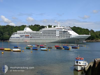
SILVER SHADOW
Passengers Ship
Current Trip
JVD BVI
| Time Travelled | 1 day |
|---|---|
| Remaining Time | --- |
| Distance Travelled | 263.18 nm |
| Remaining Distance | --- |
| AVG Speed | 11.9 Noeuds |
| MAX Speed | 14 Noeuds |
| AVG Wind | 14.3 knots |
| MAX Wind | 19.7 knots |
| MIN Temp | 25.6°C / 78.08°F |
| MAX Temp | 27.5°C / 81.5°F |
| Tirant d eau | 6.2 m |
| Position reçue | 11 m depuis |
Current Position
| Longitude | --- |
|---|---|
| Latitude | --- |
| Etat | At anchor |
| Vitesse | |
| Parcours | 34° |
| Zone | Caribbean Sea |
| Station | T-AIS |
| Position reçue | 11 m depuis |
Info
Information
The current position of SILVER SHADOW is in Caribbean Sea with coordinates 18.43122° / -64.74736° as reported on 2024-12-13 11:59 by AIS to our vessel tracker app. The vessel's current speed is 0 Noeuds
The vessel SILVER SHADOW (IMO: 9192167, MMSI: 308628000) is a Passengers Ship that was built in 2000 ( 24 Age ). It's sailing under the flag of [BS] Bahamas.
In this page you can find informations about the vessels current position, last detected port calls, and current voyage information. If the vessels is not in coverage by AIS you will find the latest position.
The current position of SILVER SHADOW is detected by our AIS receivers and we are not responsible for the reliability of the data. The last position was recorded while the vessel was in Coverage by the Ais receivers of our vessel tracking app.
The current draught of SILVER SHADOW as reported by AIS is 6.2 meters
Weather
| Temperature | 26.8°C / 80.24°F |
|---|---|
| Wind Speed | 14 knots |
| Direction | 18° NNE |
| Pressure | 1011.8 hPa |
| Humidity | 70.7 % |
| Cloud Coverage | 2 % |
Featured Company
Last Port Calls
| Port | Arrival | Departure | Time In Port |
|---|---|---|---|
| 2024-12-11 07:15 | 2024-12-11 18:06 | 10 h | |
| 2024-12-10 06:38 | 2024-12-10 19:06 | 12 h | |
| 2024-12-06 14:32 | 2024-12-07 14:30 | 23 h | |
| 2024-12-03 05:55 | 2024-12-03 19:19 | 13 h | |
| 2024-11-12 19:54 | 2024-12-02 14:02 | 19 d | |
| 2024-11-12 06:26 | 2024-11-12 15:06 | 8 h | |
| 2024-11-06 06:58 | 2024-11-06 23:00 | 16 h | |
| 2024-10-28 04:58 | 2024-10-28 19:57 | 14 h | |
| 2024-10-26 07:07 | 2024-10-26 17:55 | 10 h | |
| 2024-10-25 05:58 | 2024-10-25 21:24 | 15 h |
Most Visited Ports (Last year)
| Port | Arrivals | |
|---|---|---|
| 12 | ||
| 12 | ||
| 12 | ||
| 7 | ||
| 7 | ||
| 7 |
Last Trips
| Origin | Departure | Destination | Arrival | Distance | |
|---|---|---|---|---|---|
| 2024-12-10 19:06 | 2024-12-11 07:15 | 128.59 nm | |||
| 2024-12-07 14:30 | 2024-12-10 06:38 | 468.29 nm | |||
| 2024-12-03 19:19 | 2024-12-06 14:32 | 990.53 nm | |||
| 2024-12-02 14:02 | 2024-12-03 05:55 | 155.30 nm | |||
| 2024-11-12 15:06 | 2024-11-12 19:54 | 77.60 nm | |||
| 2024-11-06 23:00 | 2024-11-12 06:26 | 1378.66 nm | |||
| 2024-10-28 19:57 | 2024-11-06 06:58 | 2133.26 nm | |||
| 2024-10-26 17:55 | 2024-10-28 04:58 | 277.54 nm | |||
| 2024-10-25 21:24 | 2024-10-26 07:07 | 115.21 nm | |||
| 2024-10-24 00:23 | 2024-10-25 05:58 | 340.65 nm |
Events
| Heure | Evenement | Détails | Position/ Destination | Info |
|---|---|---|---|---|
| 2024-12-13 11:13 | Etat Changé | At anchor Not under command |
18.43158 / -64.74660
JVD BVI
|
Vitesse: 0.3 kn Parcours: 335° |
| 2024-12-13 11:12 | Etat Changé | Not under command Under way using engine |
18.43159 / -64.74660
JVD BVI
|
Vitesse: 0.5 kn Parcours: 336° |
| 2024-12-13 11:08 | Arret | 0.74 nm, South East of JOST VAN DYKE |
18.43084 / -64.74580
JVD BVI
|
Vitesse: Parcours: 342° |
| 2024-12-13 07:15 | Changement de zone | British Virgin Islands part of the Caribbean Sea Anguilla part of the Caribbean Sea |
18.21519 / -64.06517
Caribbean Sea
JVD BVI
|
Vitesse: 13.7 kn Parcours: 285.4° |
| 2024-12-13 07:15 | Etat Changé | Under way using engine Default |
18.21519 / -64.06517
JVD BVI
|
Vitesse: 13.5 kn Parcours: 286° |
| 2024-12-13 07:15 | Dans la zone couverte |
18.21519 / -64.06517
Caribbean Sea
JVD BVI
|
Vitesse: 13.7 kn Parcours: 285.4° |
|
| 2024-12-13 05:32 | Etat Changé | Default Under way using engine |
18.10797 / -63.67383
JVD BVI
|
Vitesse: 13.8 kn Parcours: 286.2° |
| 2024-12-13 05:24 | Etat Changé | Under way using engine Default |
18.09936 / -63.64248
JVD BVI
|
Vitesse: 13.7 kn Parcours: 286° |
| 2024-12-13 05:24 | Hors de la zone couverte |
18.09936 / -63.64248
Caribbean Sea
JVD BVI
|
Vitesse: 13.8 kn Parcours: 286.2° |
|
| 2024-12-13 05:14 | Etat Changé | Default Under way using engine |
18.08882 / -63.60413
JVD BVI
|
Vitesse: 13.6 kn Parcours: 286.2° |