
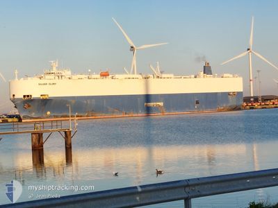
SILVER GLORY
Vehicles Carrier
Current Trip
| Time Travelled | 7 days |
|---|---|
| Remaining Time | 5 days |
| Distance Travelled | 2396.64 nm |
| Remaining Distance | 1812.21 nm |
| AVG Speed | 12.3 Noeuds |
| MAX Speed | 15.9 Noeuds |
| AVG Wind | 18 knots |
| MAX Wind | 30.3 knots |
| MIN Temp | 8.2°C / 46.76°F |
| MAX Temp | 20.8°C / 69.44°F |
| Tirant d eau | 8.8 m |
| Position reçue | 5 h, 8 m depuis |
Current Position
| Longitude | -17.95226° |
|---|---|
| Latitude | 19.25075° |
| Etat | Under way using engine |
| Vitesse | 13.6 Noeuds |
| Parcours | 178.6° |
| Zone | North Atlantic Ocean |
| Station | T-AIS |
| Position reçue | 5 h, 8 m depuis |
Info
Information
The current position of SILVER GLORY is in North Atlantic Ocean with coordinates 19.25075° / -17.95226° as reported on 2024-05-05 21:03 by AIS to our vessel tracker app. The vessel's current speed is 13.6 Noeuds and is heading at the port of LOME. The estimated time of arrival as calculated by MyShipTracking vessel tracking app is 2024-05-11 14:48 LT
The vessel SILVER GLORY (IMO: 9070474, MMSI: 355989000) is a Vehicles Carrier that was built in 1994 ( 30 Age ). It's sailing under the flag of [PA] Panama.
In this page you can find informations about the vessels current position, last detected port calls, and current voyage information. If the vessels is not in coverage by AIS you will find the latest position.
The current position of SILVER GLORY is detected by our AIS receivers and we are not responsible for the reliability of the data. The last position was recorded while the vessel was in Coverage by the Ais receivers of our vessel tracking app.
The current draught of SILVER GLORY as reported by AIS is 8.8 meters
Weather
| Temperature | 20.8°C / 69.44°F |
|---|---|
| Wind Speed | 15 knots |
| Direction | 351° N |
| Pressure | 1009.8 hPa |
| Humidity | 82.4 % |
| Cloud Coverage | --- |
Featured Company
Last Port Calls
| Port | Arrival | Departure | Time In Port |
|---|---|---|---|
| 2024-04-26 10:53 | 2024-04-28 10:25 | 1 d | |
| 2024-04-25 15:52 | 2024-04-26 02:42 | 10 h | |
| 2024-04-23 15:14 | 2024-04-24 14:38 | 23 h | |
| 2024-04-21 14:28 | 2024-04-22 15:54 | 1 d | |
| 2024-04-15 09:43 | 2024-04-15 18:45 | 9 h | |
| 2024-04-10 05:12 | 2024-04-10 17:51 | 12 h | |
| 2024-04-08 08:18 | 2024-04-10 04:34 | 1 d | |
| 2024-04-07 15:22 | 2024-04-08 07:17 | 15 h | |
| 2024-03-23 04:50 | 2024-03-24 06:08 | 1 d | |
| 2024-03-19 02:20 | 2024-03-20 00:17 | 21 h |
Most Visited Ports (Last year)
| Port | Arrivals | |
|---|---|---|
| 6 | ||
| 5 | ||
| 4 | ||
| 4 | ||
| 3 | ||
| 3 |
Last Trips
| Origin | Departure | Destination | Arrival | Distance | |
|---|---|---|---|---|---|
| 2024-04-26 04:42 | 2024-04-26 12:53 | 45.55 nm | |||
| 2024-04-24 16:38 | 2024-04-25 17:52 | 311.12 nm | |||
| 2024-04-22 17:54 | 2024-04-23 17:14 | 319.26 nm | |||
| 2024-04-15 20:45 | 2024-04-21 16:28 | 1844.46 nm | |||
| 2024-04-10 20:51 | 2024-04-15 11:43 | 1558.77 nm | |||
| 2024-04-10 07:34 | 2024-04-10 08:12 | 4.92 nm | |||
| 2024-04-08 10:17 | 2024-04-08 11:18 | 9.28 nm | |||
| 2024-03-24 07:08 | 2024-04-07 18:22 | 3647.85 nm | |||
| 2024-03-20 00:17 | 2024-03-23 05:50 | 848.46 nm | |||
| 2024-03-11 03:52 | 2024-03-19 02:20 | 592.92 nm |
Events
| Heure | Evenement | Détails | Position/ Destination | Info |
|---|---|---|---|---|
| 2024-05-05 21:03 | Etat Changé | Default Under way using engine |
19.25017 / -17.95226
TGLFW
|
Vitesse: 13.6 kn Parcours: 178.6° |
| 2024-05-05 21:03 | Hors de la zone couverte |
19.25075 / -17.95226
North Atlantic Ocean
TGLFW
|
Vitesse: 13.6 kn Parcours: 178.6° |
|
| 2024-05-05 20:14 | Etat Changé | Under way using engine Default |
19.43890 / -17.95463
TGLFW
|
Vitesse: 13.7 kn Parcours: 177° |
| 2024-05-05 20:08 | Etat Changé | Default Under way using engine |
19.46123 / -17.95532
TGLFW
|
Vitesse: 13.8 kn Parcours: 178.1° |
| 2024-05-05 19:45 | Etat Changé | Under way using engine Default |
19.54915 / -17.95919
TGLFW
|
Vitesse: 13.4 kn Parcours: 177° |
| 2024-05-05 19:34 | Etat Changé | Default Under way using engine |
19.58900 / -17.96117
TGLFW
|
Vitesse: 13.3 kn Parcours: 175.3° |
| 2024-05-05 19:27 | Etat Changé | Under way using engine Default |
19.61566 / -17.96284
TGLFW
|
Vitesse: 13.4 kn Parcours: 177° |
| 2024-05-05 18:54 | Etat Changé | Default Under way using engine |
19.75041 / -17.96801
TGLFW
|
Vitesse: 13.2 kn Parcours: 178.7° |
| 2024-05-05 18:49 | Detecté en mer | Mauritanian part of the North Atlantic Ocean |
19.75908 / -17.96794
North Atlantic Ocean
TGLFW
|
Vitesse: 13.2 kn Parcours: 178.7° |
| 2024-05-05 18:48 | Etat Changé | Under way using engine Default |
19.76085 / -17.96796
TGLFW
|
Vitesse: 13.1 kn Parcours: 178° |