
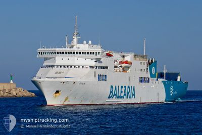
SICILIA
Ro-Ro/Passenger Ship
Current Trip
| Time Travelled | 17 h, 28 mins |
|---|---|
| Remaining Time | 18 h, 35 mins |
| Distance Travelled | 328.91 nm |
| Remaining Distance | 382.91 nm |
| AVG Speed | 19.5 Noeuds |
| MAX Speed | 20 Noeuds |
| AVG Wind | 18 knots |
| MAX Wind | 21.8 knots |
| MIN Temp | 18.5°C / 65.3°F |
| MAX Temp | 19.9°C / 67.82°F |
| Tirant d eau | 6.1 m |
| Position reçue | 9 h, 28 m depuis |
Current Position
| Longitude | -14.18352° |
|---|---|
| Latitude | 30.33297° |
| Etat | Under way using engine |
| Vitesse | 19.2 Noeuds |
| Parcours | 44.3° |
| Zone | North Atlantic Ocean |
| Station | T-AIS |
| Position reçue | 9 h, 28 m depuis |
Info
Information
The current position of SICILIA is in North Atlantic Ocean with coordinates 30.33297° / -14.18352° as reported on 2024-05-13 01:36 by AIS to our vessel tracker app. The vessel's current speed is 19.2 Noeuds and is heading at the port of HUELVA. The estimated time of arrival as calculated by MyShipTracking vessel tracking app is 2024-05-14 05:40 LT
The vessel SICILIA (IMO: 9261542, MMSI: 209115000) is a Ro-Ro/Passenger Ship that was built in 2002 ( 22 Age ). It's sailing under the flag of [CY] Cyprus.
In this page you can find informations about the vessels current position, last detected port calls, and current voyage information. If the vessels is not in coverage by AIS you will find the latest position.
The current position of SICILIA is detected by our AIS receivers and we are not responsible for the reliability of the data. The last position was recorded while the vessel was in Coverage by the Ais receivers of our vessel tracking app.
The current draught of SICILIA as reported by AIS is 6.1 meters
Weather
| Temperature | 18.6°C / 65.48°F |
|---|---|
| Wind Speed | 19 knots |
| Direction | 18° NNE |
| Pressure | 1018.4 hPa |
| Humidity | 81.7 % |
| Cloud Coverage | 98 % |
Featured Company
Last Port Calls
| Port | Arrival | Departure | Time In Port |
|---|---|---|---|
| 2024-05-12 14:31 | 2024-05-12 17:37 | 3 h | |
| 2024-05-12 08:06 | 2024-05-12 11:49 | 3 h | |
| 2024-05-09 06:36 | 2024-05-10 22:13 | 1 d | |
| 2024-05-07 16:36 | 2024-05-07 19:50 | 3 h | |
| 2024-05-06 06:23 | 2024-05-07 13:49 | 1 d | |
| 2024-05-05 22:42 | 2024-05-06 03:05 | 4 h | |
| 2024-05-04 05:39 | 2024-05-04 12:08 | 6 h | |
| 2024-05-02 11:02 | 2024-05-02 14:46 | 3 h | |
| 2024-05-02 03:46 | 2024-05-02 08:18 | 4 h | |
| 2024-04-30 06:47 | 2024-04-30 14:44 | 7 h |
Last Trips
| Origin | Departure | Destination | Arrival | Distance | |
|---|---|---|---|---|---|
| 2024-05-12 12:49 | 2024-05-12 15:31 | 53.26 nm | |||
| 2024-05-11 00:13 | 2024-05-12 09:06 | 693.67 nm | |||
| 2024-05-07 20:50 | 2024-05-09 08:36 | 705.51 nm | |||
| 2024-05-07 14:49 | 2024-05-07 17:36 | 54.54 nm | |||
| 2024-05-06 04:05 | 2024-05-06 07:23 | 54.11 nm | |||
| 2024-05-04 14:08 | 2024-05-05 23:42 | 703.79 nm | |||
| 2024-05-02 15:46 | 2024-05-04 07:39 | 704.49 nm | |||
| 2024-05-02 09:18 | 2024-05-02 12:02 | 54.04 nm | |||
| 2024-04-30 16:44 | 2024-05-02 04:46 | 693.50 nm | |||
| 2024-04-28 19:49 | 2024-04-30 08:47 | 706.03 nm |
Events
| Heure | Evenement | Détails | Position/ Destination | Info |
|---|---|---|---|---|
| 2024-05-13 01:41 | Etat Changé | Default Under way using engine |
30.35261 / -14.16184
ES HUV
|
Vitesse: 19.2 kn Parcours: 44.3° |
| 2024-05-13 01:36 | Hors de la zone couverte |
30.33297 / -14.18352
North Atlantic Ocean
ES HUV
|
Vitesse: 19.2 kn Parcours: 44.3° |
|
| 2024-05-13 01:36 | Etat Changé | Under way using engine Default |
30.32987 / -14.18692
ES HUV
|
Vitesse: 19.3 kn Parcours: 44° |
| 2024-05-13 01:19 | Etat Changé | Default Under way using engine |
30.26717 / -14.25586
ES HUV
|
Vitesse: 19.3 kn Parcours: 43.7° |
| 2024-05-13 01:15 | Etat Changé | Under way using engine Default |
30.24953 / -14.27507
ES HUV
|
Vitesse: 19.4 kn Parcours: 42° |
| 2024-05-13 00:46 | Etat Changé | Default Under way using engine |
30.13715 / -14.39845
ES HUV
|
Vitesse: 19.5 kn Parcours: 43.2° |
| 2024-05-13 00:44 | Etat Changé | Under way using engine Default |
30.12955 / -14.40649
ES HUV
|
Vitesse: 19.2 kn Parcours: 43° |
| 2024-05-13 00:31 | Etat Changé | Default Under way using engine |
30.07370 / -14.46392
ES HUV
|
Vitesse: 19.2 kn Parcours: 41.5° |
| 2024-05-12 23:53 | Changement de zone | Spanish (Canary Islands) part of the North Atlantic Ocean Portuguese (Madeira) part of the North Atlantic Ocean |
29.92093 / -14.61858
North Atlantic Ocean
ES HUV
|
Vitesse: 19.5 kn Parcours: 43.5° |
| 2024-05-12 21:08 | Changement de zone | Portuguese (Madeira) part of the North Atlantic Ocean Spanish (Canary Islands) part of the North Atlantic Ocean |
29.26761 / -15.31440
North Atlantic Ocean
ES HUV
|
Vitesse: 19.5 kn Parcours: 43.4° |