
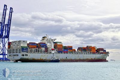
SFL HAWAII
Cargo
Current Trip
| Time Travelled | 11 days |
|---|---|
| Remaining Time | --- |
| Distance Travelled | 3668.53 nm |
| Remaining Distance | --- |
| AVG Speed | 13.9 Noeuds |
| MAX Speed | 20.6 Noeuds |
| AVG Wind | 16 knots |
| MAX Wind | 31 knots |
| MIN Temp | -3.7°C / 25.34°F |
| MAX Temp | 21.5°C / 70.7°F |
| Tirant d eau | 12 m |
| Position reçue | 3 d depuis |
Current Position
| Longitude | --- |
|---|---|
| Latitude | --- |
| Etat | Under way using engine |
| Vitesse | 17.4 Noeuds |
| Parcours | 257.8° |
| Zone | North Atlantic Ocean |
| Station | T-AIS |
| Position reçue | 3 d depuis |
Info
Information
The current position of SFL HAWAII is in North Atlantic Ocean with coordinates 35.82182° / -28.48636° as reported on 2025-02-26 11:51 by AIS to our vessel tracker app. The vessel's current speed is 17.4 Noeuds and is heading at the port of VERACRUZ. The estimated time of arrival as calculated by MyShipTracking vessel tracking app is 2025-03-07 02:45 LT
The vessel SFL HAWAII (IMO: 9679555, MMSI: 636021040) is a Cargo It's sailing under the flag of [LR] Liberia.
In this page you can find informations about the vessels current position, last detected port calls, and current voyage information. If the vessels is not in coverage by AIS you will find the latest position.
The current position of SFL HAWAII is detected by our AIS receivers and we are not responsible for the reliability of the data. The last position was recorded while the vessel was in Coverage by the Ais receivers of our vessel tracking app.
The current draught of SFL HAWAII as reported by AIS is 12 meters
Weather
| Temperature | 21.4°C / 70.52°F |
|---|---|
| Wind Speed | 10 knots |
| Direction | 176° S |
| Pressure | 1022.2 hPa |
| Humidity | 90.6 % |
| Cloud Coverage | 96 % |
Featured Company
Last Port Calls
| Port | Arrival | Departure | Time In Port |
|---|---|---|---|
| 2025-02-17 02:42 | 2025-02-18 03:44 | 1 d | |
| 2025-02-14 12:24 | 2025-02-15 12:50 | 1 d | |
| 2025-02-11 19:50 | 2025-02-12 13:34 | 17 h | |
| 2025-02-09 07:48 | 2025-02-10 13:45 | 1 d | |
| 2025-02-07 15:07 | 2025-02-08 04:40 | 13 h | |
| 2025-01-26 18:59 | 2025-01-28 00:35 | 1 d |
Last Trips
| Origin | Departure | Destination | Arrival | Distance | |
|---|---|---|---|---|---|
| 2025-02-15 13:50 | 2025-02-17 03:42 | 176.02 nm | |||
| 2025-02-12 14:34 | 2025-02-14 13:24 | 370.51 nm | |||
| 2025-02-10 14:45 | 2025-02-11 20:50 | 154.76 nm | |||
| 2025-02-08 04:40 | 2025-02-09 08:48 | 277.77 nm | |||
| 2025-01-28 01:35 | 2025-02-07 15:07 | 2352.72 nm | |||
| 2024-12-24 01:15 | 2025-01-26 19:59 | 12018.56 nm |
Events
| Heure | Evenement | Détails | Position/ Destination | Info |
|---|---|---|---|---|
| 2025-02-26 11:55 | Etat Changé | Default Under way using engine |
35.81698 / -28.51091
VERACRUZ MX
|
Vitesse: 17.4 kn Parcours: 257.8° |
| 2025-02-26 11:51 | Etat Changé | Under way using engine Default |
35.82182 / -28.48636
VERACRUZ MX
|
Vitesse: 17.3 kn Parcours: 257° |
| 2025-02-26 11:51 | Hors de la zone couverte |
35.82182 / -28.48636
North Atlantic Ocean
VERACRUZ MX
|
Vitesse: 17.4 kn Parcours: 257.8° |
|
| 2025-02-26 11:46 | Etat Changé | Default Under way using engine |
35.82764 / -28.45615
VERACRUZ MX
|
Vitesse: 17.6 kn Parcours: 256.5° |
| 2025-02-26 11:41 | Etat Changé | Under way using engine Default |
35.83278 / -28.43114
VERACRUZ MX
|
Vitesse: 17.4 kn Parcours: 258° |
| 2025-02-26 11:35 | Dans la zone couverte |
35.83278 / -28.43114
North Atlantic Ocean
VERACRUZ MX
|
Vitesse: 17.6 kn Parcours: 256.5° |
|
| 2025-02-26 09:42 | Etat Changé | Default Under way using engine |
35.96481 / -27.73355
VERACRUZ MX
|
Vitesse: 17.1 kn Parcours: 255.8° |
| 2025-02-26 09:38 | Hors de la zone couverte |
35.97010 / -27.70899
North Atlantic Ocean
VERACRUZ MX
|
Vitesse: 17.1 kn Parcours: 255.8° |
|
| 2025-02-26 09:33 | Etat Changé | Under way using engine Default |
35.97606 / -27.68132
VERACRUZ MX
|
Vitesse: 17.3 kn Parcours: 255° |
| 2025-02-26 09:30 | Etat Changé | Default Under way using engine |
35.98002 / -27.66361
VERACRUZ MX
|
Vitesse: 17.4 kn Parcours: 253.7° |