
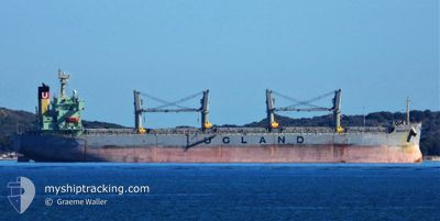
SENORITA
Bulk Carrier
Current Trip
| Time Travelled | 31 days |
|---|---|
| Remaining Time | --- |
| Distance Travelled | 4005.61 nm |
| Remaining Distance | --- |
| AVG Speed | 10.6 Noeuds |
| MAX Speed | 10.6 Noeuds |
| AVG Wind | 8.1 knots |
| MAX Wind | 22 knots |
| MIN Temp | 12.4°C / 54.32°F |
| MAX Temp | 30.2°C / 86.36°F |
| Tirant d eau | 6.5 m |
| Position reçue | 5 d depuis |
Current Position
| Longitude | 29.23314° |
|---|---|
| Latitude | 41.49955° |
| Etat | Under way using engine |
| Vitesse | 10.5 Noeuds |
| Parcours | 4.9° |
| Zone | Black Sea |
| Station | T-AIS |
| Position reçue | 5 d depuis |
Info
Information
The current position of SENORITA is in Black Sea with coordinates 41.49955° / 29.23314° as reported on 2024-04-26 01:06 by AIS to our vessel tracker app. The vessel's current speed is 10.5 Noeuds
The vessel SENORITA (IMO: 9284257, MMSI: 511101262) is a Bulk Carrier that was built in 2005 ( 19 Age ). It's sailing under the flag of [PW] Palau.
In this page you can find informations about the vessels current position, last detected port calls, and current voyage information. If the vessels is not in coverage by AIS you will find the latest position.
The current position of SENORITA is detected by our AIS receivers and we are not responsible for the reliability of the data. The last position was recorded while the vessel was in Coverage by the Ais receivers of our vessel tracking app.
The current draught of SENORITA as reported by AIS is 6.5 meters
Weather
| Temperature | 13.9°C / 57.02°F |
|---|---|
| Wind Speed | 13 knots |
| Direction | 33° NNE |
| Pressure | 1017.1 hPa |
| Humidity | 75.5 % |
| Cloud Coverage | 100 % |
Featured Company
Last Port Calls
| Port | Arrival | Departure | Time In Port |
|---|---|---|---|
| 2024-04-20 03:52 | 2024-04-20 12:40 | 8 h | |
| 2024-03-24 08:30 | 2024-03-31 13:04 | 7 d | |
| 2024-03-07 05:06 | 2024-03-07 14:17 | 9 h | |
| 2024-03-02 01:44 | 2024-03-02 03:06 | 1 h |
Most Visited Ports (Last year)
| Port | Arrivals | |
|---|---|---|
| 3 | ||
| 2 | ||
| 1 | ||
| 1 | ||
| 1 | ||
| 1 |
Last Trips
| Origin | Departure | Destination | Arrival | Distance | |
|---|---|---|---|---|---|
| 2024-03-31 18:34 | 2024-04-20 05:52 | 2928.11 nm | |||
| 2024-03-02 06:06 | 2024-03-24 14:00 | 3826.56 nm | |||
| 2024-03-02 06:06 | 2024-03-07 07:06 | 821.26 nm | |||
| 2024-02-25 10:06 | 2024-03-02 04:44 | 395.92 nm |
Events
| Heure | Evenement | Détails | Position/ Destination | Info |
|---|---|---|---|---|
| 2024-04-27 23:30 | Arret | 13.49 nm, East of SFANTU GHEORGHE |
44.88823 / 29.90579
RO CND
|
Vitesse: 0.2 kn Parcours: 322° |
| 2024-04-26 21:28 | Arret | 14.69 nm, East of SFANTU GHEORGHE |
44.86036 / 29.93078
RO CND
|
Vitesse: Parcours: 359° |
| 2024-04-26 01:12 | Etat Changé | Default Under way using engine |
41.51831 / 29.23557
RO CND
|
Vitesse: 10.5 kn Parcours: 4.9° |
| 2024-04-26 01:06 | Hors de la zone couverte |
41.49955 / 29.23314
Black Sea
RO CND
|
Vitesse: 10.5 kn Parcours: 4.9° |
|
| 2024-04-25 23:37 | Changement de zone | Turkish part of the Black Sea Turkish part of the Sea of Marmara |
41.23414 / 29.14301
Black Sea
RO CND
|
Vitesse: 11.1 kn Parcours: 34.8° |
| 2024-04-25 19:39 | Démarrage | 15.77 nm, West of YALOVA |
40.68934 / 28.93166
RO CND
|
Vitesse: 3.4 kn Parcours: 336° |
| 2024-04-25 09:50 | Arret | 13 nm, South of YESILKOY |
40.75503 / 28.93492
RO CND
|
Vitesse: 0.3 kn Parcours: 178° |
| 2024-04-25 03:22 | Démarrage | 1.49 nm, South East of YESILKOY |
40.93921 / 28.85047
RO CND
|
Vitesse: 3.1 kn Parcours: 145° |
| 2024-04-25 02:53 | Etat Changé | Under way using engine At anchor |
40.94030 / 28.85136
RO CND
|
Vitesse: 0.2 kn Parcours: 7° |
| 2024-04-25 02:51 | Changement de destination | RO CND TR IST |
40.94033 / 28.85158
RO CND
|
Vitesse: 0.2 kn Parcours: 7° |