
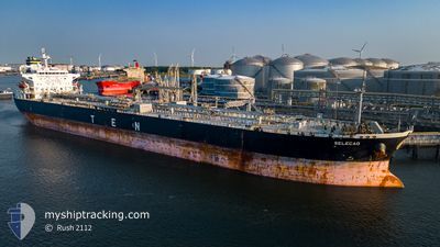
SELECAO
Crude Oil Tanker
Current Trip
LAST UPDATE TIME
| Time Travelled | --- |
|---|---|
| Remaining Time | --- |
| Distance Travelled | 5485.44 nm |
| Remaining Distance | --- |
| AVG Speed | 12.5 Noeuds |
| MAX Speed | 14.5 Noeuds |
| AVG Wind | 8.8 knots |
| MAX Wind | 20 knots |
| MIN Temp | 15.6°C / 60.08°F |
| MAX Temp | 29.9°C / 85.82°F |
| Tirant d eau | 8 m |
| Position reçue | 3 d depuis |
Current Position
| Longitude | --- |
|---|---|
| Latitude | --- |
| Etat | Under way using engine |
| Vitesse | 10.2 Noeuds |
| Parcours | 207.9° |
| Zone | South Atlantic Ocean |
| Station | T-AIS |
| Position reçue | 3 d depuis |
Information
The current position of SELECAO is in South Atlantic Ocean with coordinates -55.93941° / -66.01445° as reported on 2025-03-20 20:36 by AIS to our vessel tracker app. The vessel's current speed is 10.2 Noeuds
The vessel SELECAO (IMO: 9388297, MMSI: 636013614) is a Crude Oil Tanker that was built in 2008 ( 17 Age ). It's sailing under the flag of [LR] Liberia.
In this page you can find informations about the vessels current position, last detected port calls, and current voyage information. If the vessels is not in coverage by AIS you will find the latest position.
The current position of SELECAO is detected by our AIS receivers and we are not responsible for the reliability of the data. The last position was recorded while the vessel was in Coverage by the Ais receivers of our vessel tracking app.
The current draught of SELECAO as reported by AIS is 8 meters
Weather
| Temperature | 11°C / 51.8°F |
|---|---|
| Wind Speed | 12 knots |
| Direction | 275° W |
| Pressure | 1027.6 hPa |
| Humidity | 95 % |
| Cloud Coverage | 100 % |
Featured Company
Last Port Calls
Most Visited Ports (Last year)
| Port | Arrivals | |
|---|---|---|
| 2 | ||
| 1 | ||
| 1 | ||
| 1 | ||
| 1 | ||
| 1 |
Last Trips
| Origin | Departure | Destination | Arrival | Distance |
|---|
Events
| Heure | Evenement | Détails | Position/ Destination | Info |
|---|---|---|---|---|
| 2025-03-20 20:50 | Etat Changé | Default Under way using engine |
-55.97630 / -66.04679
LAST UPDATE TIME
|
Vitesse: 10.2 kn Parcours: 207.9° |
| 2025-03-20 20:36 | Hors de la zone couverte |
-55.93941 / -66.01445
South Atlantic Ocean
|
Vitesse: 10.2 kn Parcours: 207.9° |
|
| 2025-03-20 18:38 | Changement de zone | Chilean (disputed - Chilean point of view) part of the South Atlantic Ocean Argentinean part of the South Atlantic Ocean |
-55.63760 / -65.73351
South Atlantic Ocean
|
Vitesse: 10.3 kn Parcours: 203.8° |
| 2025-03-20 17:12 | Etat Changé | Under way using engine Default |
-55.41319 / -65.52922
LAST UPDATE TIME
|
Vitesse: 10.5 kn Parcours: 208° |
| 2025-03-20 17:12 | Dans la zone couverte |
-55.41848 / -65.53427
South Atlantic Ocean
|
Vitesse: 10.8 kn Parcours: 208.2° |
|
| 2025-03-18 02:52 | Etat Changé | Default Under way using engine |
-48.41415 / -63.25245
LAST UPDATE TIME
|
Vitesse: 11.6 kn Parcours: 188.4° |
| 2025-03-18 02:42 | Hors de la zone couverte |
-48.38319 / -63.24600
South Atlantic Ocean
|
Vitesse: 11.6 kn Parcours: 188.4° |
|
| 2025-03-18 02:37 | Changement de zone | Argentinean part of the South Atlantic Ocean Panamanian part of the North Pacific Ocean |
-48.36616 / -63.24237
South Atlantic Ocean
|
Vitesse: 11.6 kn Parcours: 187.4° |
| 2025-03-18 02:37 | Etat Changé | Under way using engine Default |
-48.36616 / -63.24237
LAST UPDATE TIME
|
Vitesse: 11.6 kn Parcours: 189° |
| 2025-03-18 02:25 | Dans la zone couverte |
-48.36616 / -63.24237
South Atlantic Ocean
|
Vitesse: 11.6 kn Parcours: 187.4° |