

SEAWAYS STAR
Oil/Chemical Tanker

Current Trip
PR SJU
| Time Travelled | 10 days |
|---|---|
| Remaining Time | --- |
| Distance Travelled | 2092.27 nm |
| Remaining Distance | --- |
| AVG Speed | 10.9 Noeuds |
| MAX Speed | 14.9 Noeuds |
| AVG Wind | 18.5 knots |
| MAX Wind | 29.8 knots |
| MIN Temp | 5.1°C / 41.18°F |
| MAX Temp | 26.6°C / 79.88°F |
| Tirant d eau | 9.3 m |
| Position reçue | 14 h, 56 m depuis |
Current Position
| Longitude | --- |
|---|---|
| Latitude | --- |
| Etat | At anchor |
| Vitesse | 0.2 Noeuds |
| Parcours | 39° |
| Zone | Gulf of Mexico |
| Station | T-AIS |
| Position reçue | 14 h, 56 m depuis |
Information
The current position of SEAWAYS STAR is in Gulf of Mexico with coordinates 27.81500° / -96.95807° as reported on 2025-02-21 12:20 by AIS to our vessel tracker app. The vessel's current speed is 0.2 Noeuds
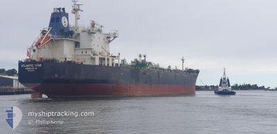
The vessel SEAWAYS STAR (IMO: 9337523, MMSI: 477047800) is a Oil/Chemical Tanker that was built in 2008 ( 17 Age ). It's sailing under the flag of [HK] Hong Kong.
In this page you can find informations about the vessels current position, last detected port calls, and current voyage information. If the vessels is not in coverage by AIS you will find the latest position.
The current position of SEAWAYS STAR is detected by our AIS receivers and we are not responsible for the reliability of the data. The last position was recorded while the vessel was in Coverage by the Ais receivers of our vessel tracking app.
The current draught of SEAWAYS STAR as reported by AIS is 9.3 meters
Weather
| Temperature | 9.6°C / 49.28°F |
|---|---|
| Wind Speed | 24 knots |
| Direction | 36° NE |
| Pressure | 1030.2 hPa |
| Humidity | 85.7 % |
| Cloud Coverage | 100 % |


Featured Company
Last Port Calls
| Port | Arrival | Departure | Time In Port |
|---|---|---|---|
| 2025-02-09 04:06 | 2025-02-11 18:00 | 2 d | |
| 2025-01-30 16:06 | 2025-02-03 13:45 | 3 d | |
| 2025-01-22 03:37 | |||
| 2025-01-09 16:11 | 2025-01-10 03:53 | 11 h | |
| 2024-12-15 06:20 | 2024-12-15 15:08 | 8 h | |
| 2024-12-06 00:40 | 2024-12-06 21:53 | 21 h |
Most Visited Ports (Last year)
| Port | Arrivals | |
|---|---|---|
| 4 | ||
| 4 | ||
| 3 | ||
| 2 | ||
| 1 | ||
| 1 |
Last Trips
| Origin | Departure | Destination | Arrival | Distance | |
|---|---|---|---|---|---|
| 2025-02-03 08:45 | 2025-02-09 00:06 | 900.71 nm | |||
| 2025-01-09 22:53 | 2025-01-30 11:06 | 2594.32 nm | |||
| 2025-01-09 22:53 | 2025-01-21 21:37 | 1232.73 nm | |||
| 2024-12-15 09:08 | 2025-01-09 11:11 | 4211.82 nm | |||
| 2024-12-06 15:53 | 2024-12-15 00:20 | 183.41 nm | |||
| 2024-11-29 16:25 | 2024-12-05 18:40 | 103.43 nm |
Events
| Heure | Evenement | Détails | Position/ Destination | Info |
|---|---|---|---|---|
| 2025-02-21 17:19 | Démarrage | 6.19 nm, East of PORT ARANSAS |
27.81395 / -96.95486
PR SJU
|
Vitesse: 3.4 kn Parcours: 50° |
| 2025-02-21 12:26 | Etat Changé | Default At anchor |
27.81493 / -96.95802
PR SJU
|
Vitesse: 0.2 kn Parcours: 39° |
| 2025-02-21 12:20 | Hors de la zone couverte |
27.81500 / -96.95807
Gulf of Mexico
|
Vitesse: 0.2 kn Parcours: 264.1° |
|
| 2025-02-21 12:17 | Etat Changé | At anchor Default |
27.81499 / -96.95805
PR SJU
|
Vitesse: 0.1 kn Parcours: 33° |
| 2025-02-21 12:11 | Dans la zone couverte |
27.81499 / -96.95805
Gulf of Mexico
|
Vitesse: 0.2 kn Parcours: 283.8° |
|
| 2025-02-21 11:14 | Etat Changé | Default At anchor |
27.81485 / -96.95786
PR SJU
|
Vitesse: 0.1 kn Parcours: 37° |
| 2025-02-21 11:08 | Etat Changé | At anchor Default |
27.81505 / -96.95814
PR SJU
|
Vitesse: 0.2 kn Parcours: 39° |
| 2025-02-21 11:08 | Hors de la zone couverte |
27.81505 / -96.95814
Gulf of Mexico
|
Vitesse: 0.1 kn Parcours: 238.7° |
|
| 2025-02-21 11:06 | Etat Changé | Default At anchor |
27.81506 / -96.95814
PR SJU
|
Vitesse: 0.2 kn Parcours: 36° |
| 2025-02-21 11:02 | Etat Changé | At anchor Default |
27.81506 / -96.95812
PR SJU
|
Vitesse: 0.2 kn Parcours: 30° |