

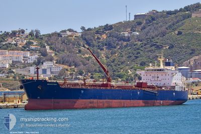
SEAVICTORY
Oil/Chemical Tanker

Current Trip
| Time Travelled | 8 days |
|---|---|
| Remaining Time | 10 h, 22 mins |
| Distance Travelled | 1102.22 nm |
| Remaining Distance | 64.77 nm |
| AVG Speed | 8.9 Noeuds |
| MAX Speed | 13.6 Noeuds |
| AVG Wind | 7.9 knots |
| MAX Wind | 20 knots |
| MIN Temp | 2.7°C / 36.86°F |
| MAX Temp | 15.4°C / 59.72°F |
| Tirant d eau | 8 m |
| Position reçue | 2 h, 4 m depuis |
Current Position
| Longitude | --- |
|---|---|
| Latitude | --- |
| Etat | Under way using engine |
| Vitesse | 1.2 Noeuds |
| Parcours | 291° |
| Zone | Black Sea |
| Station | T-AIS |
| Position reçue | 2 h, 4 m depuis |
Information
The current position of SEAVICTORY is in Black Sea with coordinates 42.30183° / 28.71042° as reported on 2025-03-27 22:06 by AIS to our vessel tracker app. The vessel's current speed is 1.2 Noeuds and is heading at the port of VARNA. The estimated time of arrival as calculated by MyShipTracking vessel tracking app is 2025-03-28 10:33 LT
The vessel SEAVICTORY (IMO: 9315783, MMSI: 248299000) is a Oil/Chemical Tanker that was built in 2007 ( 18 Age ). It's sailing under the flag of [MT] Malta.
In this page you can find informations about the vessels current position, last detected port calls, and current voyage information. If the vessels is not in coverage by AIS you will find the latest position.
The current position of SEAVICTORY is detected by our AIS receivers and we are not responsible for the reliability of the data. The last position was recorded while the vessel was in Coverage by the Ais receivers of our vessel tracking app.
The current draught of SEAVICTORY as reported by AIS is 8 meters
Weather
| Temperature | 10.6°C / 51.08°F |
|---|---|
| Wind Speed | 19 knots |
| Direction | 63° ENE |
| Pressure | 1007 hPa |
| Humidity | 79.7 % |
| Cloud Coverage | 100 % |


Featured Company
Last Trips
Events
| Heure | Evenement | Détails | Position/ Destination | Info |
|---|---|---|---|---|
| 2025-03-27 22:14 | Etat Changé | Default Under way using engine |
42.30108 / 28.70735
BGVAR
|
Vitesse: 1.2 kn Parcours: 291° |
| 2025-03-27 22:06 | Hors de la zone couverte |
42.30183 / 28.71042
Black Sea
BGVAR
|
Vitesse: 1.2 kn Parcours: 257° |
|
| 2025-03-27 22:04 | Etat Changé | Under way using engine Default |
42.30200 / 28.71133
BGVAR
|
Vitesse: 1.3 kn Parcours: 293° |
| 2025-03-27 21:40 | Etat Changé | Default Under way using engine |
42.30260 / 28.72330
BGVAR
|
Vitesse: 1.1 kn Parcours: 306° |
| 2025-03-27 21:19 | Etat Changé | Under way using engine Default |
42.30562 / 28.73137
BGVAR
|
Vitesse: 0.9 kn Parcours: 287° |
| 2025-03-27 21:14 | Etat Changé | Default Under way using engine |
42.30638 / 28.73297
BGVAR
|
Vitesse: 0.9 kn Parcours: 287° |
| 2025-03-27 20:26 | Etat Changé | Under way using engine Default |
42.31410 / 28.74215
BGVAR
|
Vitesse: 0.2 kn Parcours: 324° |
| 2025-03-27 20:06 | Etat Changé | Default Under way using engine |
42.31395 / 28.74480
BGVAR
|
Vitesse: 0.9 kn Parcours: 328° |
| 2025-03-27 15:28 | Etat Changé | Under way using engine Default |
42.30800 / 28.83580
BGVAR
|
Vitesse: 0.5 kn Parcours: 333° |
| 2025-03-27 15:26 | Etat Changé | Default Under way using engine |
42.30805 / 28.83622
BGVAR
|
Vitesse: 0.5 kn Parcours: 332° |