
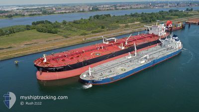
SEARANGER
Crude Oil Tanker
Current Trip
SGSIN>>EOPL
| Time Travelled | 9 days |
|---|---|
| Remaining Time | --- |
| Distance Travelled | 1008.18 nm |
| Remaining Distance | --- |
| AVG Speed | 9.6 Noeuds |
| MAX Speed | 14.7 Noeuds |
| AVG Wind | 11.8 knots |
| MAX Wind | 28 knots |
| MIN Temp | 25.5°C / 77.9°F |
| MAX Temp | 29.5°C / 85.1°F |
| Tirant d eau | 8.2 m |
| Position reçue | 6 d depuis |
Current Position
| Longitude | --- |
|---|---|
| Latitude | --- |
| Etat | Under way using engine |
| Vitesse | 12.6 Noeuds |
| Parcours | 42.1° |
| Zone | South China Sea |
| Station | T-AIS |
| Position reçue | 6 d depuis |
Info
Information
The current position of SEARANGER is in South China Sea with coordinates 1.31672° / 104.36485° as reported on 2025-03-04 14:26 by AIS to our vessel tracker app. The vessel's current speed is 12.6 Noeuds
The vessel SEARANGER (IMO: 9442158, MMSI: 477192100) is a Crude Oil Tanker that was built in 2009 ( 16 Age ). It's sailing under the flag of [HK] Hong Kong.
In this page you can find informations about the vessels current position, last detected port calls, and current voyage information. If the vessels is not in coverage by AIS you will find the latest position.
The current position of SEARANGER is detected by our AIS receivers and we are not responsible for the reliability of the data. The last position was recorded while the vessel was in Coverage by the Ais receivers of our vessel tracking app.
The current draught of SEARANGER as reported by AIS is 8.2 meters
Weather
| Temperature | 26.7°C / 80.06°F |
|---|---|
| Wind Speed | 15 knots |
| Direction | 52° NE |
| Pressure | 1007.4 hPa |
| Humidity | 90.2 % |
| Cloud Coverage | 98 % |
Featured Company
Last Port Calls
| Port | Arrival | Departure | Time In Port |
|---|---|---|---|
| 2025-02-28 14:10 | 2025-03-02 06:58 | 1 d | |
| 2025-01-03 06:53 |
Most Visited Ports (Last year)
| Port | Arrivals | |
|---|---|---|
| 4 | ||
| 3 | ||
| 2 | ||
| 2 | ||
| 1 | ||
| 1 |
Last Trips
| Origin | Departure | Destination | Arrival | Distance | |
|---|---|---|---|---|---|
| 2025-01-03 14:53 | 2025-02-28 22:10 | 12589.97 nm |
Events
| Heure | Evenement | Détails | Position/ Destination | Info |
|---|---|---|---|---|
| 2025-03-06 13:23 | Démarrage |
1.88162 / 104.65448
SGSIN>>EOPL
|
Vitesse: 7.1 kn Parcours: 358° |
|
| 2025-03-04 18:10 | Arret |
1.87253 / 104.65297
SGSIN>>EOPL
|
Vitesse: 0.3 kn Parcours: 20° |
|
| 2025-03-04 14:33 | Etat Changé | Default Under way using engine |
1.33559 / 104.38199
SGSIN>>EOPL
|
Vitesse: 12.6 kn Parcours: 42.1° |
| 2025-03-04 14:26 | Changement de zone | Malaysian part of the South China Sea Indonesian part of the Singapore Strait |
1.31672 / 104.36485
South China Sea
SGSIN>>EOPL
|
Vitesse: 12.6 kn Parcours: 42.1° |
| 2025-03-04 14:26 | Etat Changé | Under way using engine Default |
1.31672 / 104.36485
SGSIN>>EOPL
|
Vitesse: 12.5 kn Parcours: 42° |
| 2025-03-04 14:26 | Hors de la zone couverte |
1.31672 / 104.36485
South China Sea
SGSIN>>EOPL
|
Vitesse: 12.6 kn Parcours: 42.1° |
|
| 2025-03-04 13:38 | Etat Changé | Default Under way using engine |
1.25772 / 104.21475
SGSIN>>EOPL
|
Vitesse: 13.2 kn Parcours: 83.7° |
| 2025-03-04 12:32 | Changement de zone | Indonesian part of the Singapore Strait Singaporean part of the Singapore Strait |
1.24283 / 103.97648
Singapore Strait
SGSIN>>EOPL
|
Vitesse: 12.7 kn Parcours: 121.3° |
| 2025-03-04 11:56 | Démarrage | 4.46 nm, East of SINGAPORE |
1.25866 / 103.92880
SGSIN>>EOPL
|
Vitesse: 3.1 kn Parcours: 95° |
| 2025-03-04 11:41 | Changement de destination | SGSIN>>EOPL SGSIN>AEPA |
1.25733 / 103.92493
SGSIN>>EOPL
|
Vitesse: 0.9 kn Parcours: 350° |