
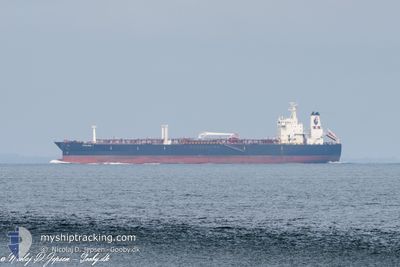
SEALION I
Tanker
Current Trip
OPL LESVOS
| Time Travelled | 1 day |
|---|---|
| Remaining Time | --- |
| Distance Travelled | 441.98 nm |
| Remaining Distance | --- |
| AVG Speed | 10 Noeuds |
| MAX Speed | 11.5 Noeuds |
| AVG Wind | 12.5 knots |
| MAX Wind | 17 knots |
| MIN Temp | 7.1°C / 44.78°F |
| MAX Temp | 14.7°C / 58.46°F |
| Tirant d eau | 10.3 m |
| Position reçue | 1 m depuis |
Current Position
| Longitude | --- |
|---|---|
| Latitude | --- |
| Etat | Under way using engine |
| Vitesse | 4.2 Noeuds |
| Parcours | 294° |
| Zone | Black Sea |
| Station | T-AIS |
| Position reçue | 1 m depuis |
Info
Information
The current position of SEALION I is in Black Sea with coordinates 41.46441° / 29.18273° as reported on 2024-11-11 17:08 by AIS to our vessel tracker app. The vessel's current speed is 4.2 Noeuds
The vessel SEALION I (IMO: 9234501, MMSI: 374024000) is a Tanker It's sailing under the flag of [PA] Panama.
In this page you can find informations about the vessels current position, last detected port calls, and current voyage information. If the vessels is not in coverage by AIS you will find the latest position.
The current position of SEALION I is detected by our AIS receivers and we are not responsible for the reliability of the data. The last position was recorded while the vessel was in Coverage by the Ais receivers of our vessel tracking app.
The current draught of SEALION I as reported by AIS is 10.3 meters
Weather
| Temperature | 14.3°C / 57.74°F |
|---|---|
| Wind Speed | 17 knots |
| Direction | 65° ENE |
| Pressure | 1022.9 hPa |
| Humidity | 82.1 % |
| Cloud Coverage | 100 % |
Featured Company
Last Port Calls
| Port | Arrival | Departure | Time In Port |
|---|---|---|---|
| 2024-11-09 05:32 | 2024-11-09 19:44 | 14 h | |
| 2024-10-22 09:34 | 2024-10-25 12:24 | 3 d | |
| 2024-10-08 13:49 | 2024-10-10 17:41 | 2 d | |
| 2024-09-23 07:36 | 2024-09-23 10:33 | 2 h | |
| 2024-09-23 07:29 | |||
| 2024-09-22 22:52 | |||
| 2024-09-22 21:21 | |||
| 2024-09-22 18:34 | |||
| 2024-09-22 17:26 | |||
| 2024-09-22 02:05 |
Most Visited Ports (Last year)
| Port | Arrivals | |
|---|---|---|
| 20 | ||
| 2 | ||
| 2 | ||
| 1 | ||
| 1 | ||
| 1 |
Last Trips
| Origin | Departure | Destination | Arrival | Distance | |
|---|---|---|---|---|---|
| 2024-10-25 14:24 | 2024-11-09 08:32 | 1625.11 nm | |||
| 2024-10-10 20:41 | 2024-10-22 11:34 | 1472.12 nm | |||
| 2024-09-23 13:33 | 2024-10-08 16:49 | 1700.13 nm | |||
| 2024-09-23 10:29 | 2024-09-23 10:36 | 1.36 nm | |||
| 2024-09-22 20:26 | 2024-09-23 00:21 | 110.98 nm | |||
| 2024-09-22 05:05 | 2024-09-22 21:34 | 107.67 nm | |||
| 2024-09-22 05:05 | 2024-09-22 03:09 | --- | |||
| 2024-09-21 23:01 | 2024-09-22 01:08 | 55.58 nm | |||
| 2024-09-05 18:31 | 2024-09-21 11:01 | 840.82 nm |
Events
| Heure | Evenement | Détails | Position/ Destination | Info |
|---|---|---|---|---|
| 2024-11-11 15:50 | Tirant d'eau modifié | 10.3 8.2 |
41.49293 / 29.45591
OPL LESVOS
|
Vitesse: 9.4 kn Parcours: 261.9° |
| 2024-11-11 15:50 | Changement de destination | OPL LESVOS RU NVS |
41.49293 / 29.45591
OPL LESVOS
|
Vitesse: 9.4 kn Parcours: 261.9° |
| 2024-11-11 15:50 | Changement d'ETA | 2024/11/13 09:00 2024/11/03 17:00 |
41.49293 / 29.45591
OPL LESVOS
|
Vitesse: 9.4 kn Parcours: 261.9° |
| 2024-11-11 15:44 | Etat Changé | Under way using engine Default |
41.49568 / 29.47349
RU NVS
|
Vitesse: 9.4 kn Parcours: 236° |
| 2024-11-11 15:44 | Dans la zone couverte |
41.49568 / 29.47349
Black Sea
|
Vitesse: 9.5 kn Parcours: 250.2° |
|
| 2024-11-09 19:44 | PORT DE DEPART |
|
44.68864 / 37.82286
RU NVS
|
Vitesse: 7.9 kn Parcours: 152° |
| 2024-11-09 19:24 | Démarrage |
44.72573 / 37.79326
[RU] NOVOROSSIYSK
|
Vitesse: 4.7 kn Parcours: 116° |
|
| 2024-11-09 05:32 | Port d'arrivée |
|
44.72818 / 37.78310
[RU] NOVOROSSIYSK
|
Vitesse: 53.5 kn Parcours: 77° |
| 2024-11-08 05:25 | Démarrage | 6.6 nm, North of ANAPA |
45.00403 / 37.34893
RU NVS
|
Vitesse: 8.6 kn Parcours: 95° |
| 2024-11-08 05:00 | Arret | 6.54 nm, North of ANAPA |
45.00512 / 37.33817
RU NVS
|
Vitesse: 0.1 kn Parcours: 315° |