
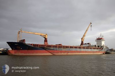
SEADRAGON
General Cargo
Current Trip
LBMIS
| Time Travelled | 3 days |
|---|---|
| Remaining Time | --- |
| Distance Travelled | 643.65 nm |
| Remaining Distance | --- |
| AVG Speed | 10.2 Noeuds |
| MAX Speed | 11.3 Noeuds |
| AVG Wind | 11.9 knots |
| MAX Wind | 27 knots |
| MIN Temp | 13.1°C / 55.58°F |
| MAX Temp | 17.7°C / 63.86°F |
| Tirant d eau | 6.5 m |
| Position reçue | 1 d depuis |
Current Position
| Longitude | --- |
|---|---|
| Latitude | --- |
| Etat | Under way using engine |
| Vitesse | 10.6 Noeuds |
| Parcours | 236.4° |
| Zone | Mediterranean Sea - Eastern Basin |
| Station | T-AIS |
| Position reçue | 1 d depuis |
Information
The current position of SEADRAGON is in Mediterranean Sea - Eastern Basin with coordinates 35.72187° / 23.32610° as reported on 2025-03-26 07:48 by AIS to our vessel tracker app. The vessel's current speed is 10.6 Noeuds
The vessel SEADRAGON (IMO: 9239288, MMSI: 636022026) is a General Cargo that was built in 2001 ( 24 Age ). It's sailing under the flag of [LR] Liberia.
In this page you can find informations about the vessels current position, last detected port calls, and current voyage information. If the vessels is not in coverage by AIS you will find the latest position.
The current position of SEADRAGON is detected by our AIS receivers and we are not responsible for the reliability of the data. The last position was recorded while the vessel was in Coverage by the Ais receivers of our vessel tracking app.
The current draught of SEADRAGON as reported by AIS is 6.5 meters
Weather
| Temperature | 16.9°C / 62.42°F |
|---|---|
| Wind Speed | 17 knots |
| Direction | 285° WNW |
| Pressure | 1013.1 hPa |
| Humidity | 67.2 % |
| Cloud Coverage | --- |
Featured Company
Last Port Calls
| Port | Arrival | Departure | Time In Port |
|---|---|---|---|
| 2025-03-24 13:12 | 2025-03-25 02:56 | 13 h | |
| 2025-03-23 03:58 | 2025-03-23 09:29 | 5 h | |
| 2025-03-21 04:03 | 2025-03-21 21:11 | 17 h | |
| 2025-03-20 06:27 | 2025-03-20 07:44 | 1 h | |
| 2025-03-17 01:59 | 2025-03-18 00:30 | 22 h | |
| 2025-03-14 22:17 | 2025-03-14 23:45 | 1 h | |
| 2025-03-13 06:46 | 2025-03-14 11:05 | 1 d | |
| 2025-03-05 23:48 | 2025-03-08 01:32 | 2 d | |
| 2025-03-02 10:00 | 2025-03-02 18:16 | 8 h | |
| 2025-02-28 21:49 | 2025-03-01 04:25 | 6 h |
Last Trips
| Origin | Departure | Destination | Arrival | Distance | |
|---|---|---|---|---|---|
| 2025-03-23 12:29 | 2025-03-24 16:12 | 290.30 nm | |||
| 2025-03-22 00:11 | 2025-03-23 06:58 | 121.35 nm | |||
| 2025-03-20 10:44 | 2025-03-21 07:03 | 22.21 nm | |||
| 2025-03-18 03:30 | 2025-03-20 09:27 | 450.04 nm | |||
| 2025-03-15 02:45 | 2025-03-17 04:59 | 517.18 nm | |||
| 2025-03-14 14:05 | 2025-03-15 01:17 | 26.28 nm | |||
| 2025-03-08 03:32 | 2025-03-13 09:46 | 993.73 nm | |||
| 2025-03-02 21:16 | 2025-03-06 01:48 | 749.48 nm | |||
| 2025-03-01 07:25 | 2025-03-02 13:00 | 289.39 nm | |||
| 2025-02-28 19:14 | 2025-03-01 00:49 | 45.39 nm |
Events
| Heure | Evenement | Détails | Position/ Destination | Info |
|---|---|---|---|---|
| 2025-03-26 08:02 | Etat Changé | Default Under way using engine |
35.69934 / 23.28220
LBMIS
|
Vitesse: 10.6 kn Parcours: 236.4° |
| 2025-03-26 07:48 | Hors de la zone couverte |
35.72187 / 23.32610
Mediterranean Sea - Eastern Basin
LBMIS
|
Vitesse: 10.6 kn Parcours: 236.4° |
|
| 2025-03-26 07:16 | Changement de zone | Greek part of the Mediterranean Sea - Eastern Basin Greek part of the Aegean Sea |
35.77898 / 23.41622
Mediterranean Sea - Eastern Basin
LBMIS
|
Vitesse: 10.8 kn Parcours: 231° |
| 2025-03-26 05:39 | Etat Changé | Under way using engine Default |
35.94384 / 23.70830
LBMIS
|
Vitesse: 10.5 kn Parcours: 237° |
| 2025-03-26 05:36 | Etat Changé | Default Under way using engine |
35.94904 / 23.71849
LBMIS
|
Vitesse: 10.5 kn Parcours: 237° |
| 2025-03-26 03:32 | Etat Changé | Under way using engine Default |
36.16928 / 24.06820
LBMIS
|
Vitesse: 10.3 kn Parcours: 228° |
| 2025-03-26 03:21 | Etat Changé | Default Under way using engine |
36.19017 / 24.09716
LBMIS
|
Vitesse: 10.2 kn Parcours: 229° |
| 2025-03-26 03:07 | Etat Changé | Under way using engine Default |
36.21631 / 24.13368
LBMIS
|
Vitesse: 10.3 kn Parcours: 228° |
| 2025-03-26 02:15 | Etat Changé | Default Under way using engine |
36.31708 / 24.26829
LBMIS
|
Vitesse: 10 kn Parcours: 226° |
| 2025-03-25 07:07 | Changement de zone | Greek part of the Aegean Sea Turkish part of the Aegean Sea |
38.73696 / 26.26635
Aegean Sea
LBMIS
|
Vitesse: 10.5 kn Parcours: 255° |