
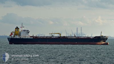
SEACONGER
Oil Products Tanker
Current Trip
| Time Travelled | 1 day |
|---|---|
| Remaining Time | 1 day |
| Distance Travelled | 342.93 nm |
| Remaining Distance | 487.22 nm |
| AVG Speed | 12.4 Noeuds |
| MAX Speed | 14.6 Noeuds |
| AVG Wind | 16.1 knots |
| MAX Wind | 21.3 knots |
| MIN Temp | 12.1°C / 53.78°F |
| MAX Temp | 18.4°C / 65.12°F |
| Tirant d eau | 9.7 m |
| Position reçue | 22 m depuis |
Current Position
| Longitude | -1.23645° |
|---|---|
| Latitude | 37.02599° |
| Etat | Under way using engine |
| Vitesse | 11.6 Noeuds |
| Parcours | 46° |
| Zone | Mediterranean Sea - Western Basin |
| Station | T-AIS |
| Position reçue | 22 m depuis |
Info
Information
The current position of SEACONGER is in Mediterranean Sea - Western Basin with coordinates 37.02599° / -1.23645° as reported on 2024-05-17 00:21 by AIS to our vessel tracker app. The vessel's current speed is 11.6 Noeuds and is heading at the port of FOS. The estimated time of arrival as calculated by MyShipTracking vessel tracking app is 2024-05-18 17:31 LT
The vessel SEACONGER (IMO: 9352298, MMSI: 211822000) is a Oil Products Tanker that was built in 2005 ( 19 Age ). It's sailing under the flag of [DE] Germany.
In this page you can find informations about the vessels current position, last detected port calls, and current voyage information. If the vessels is not in coverage by AIS you will find the latest position.
The current position of SEACONGER is detected by our AIS receivers and we are not responsible for the reliability of the data. The last position was recorded while the vessel was in Coverage by the Ais receivers of our vessel tracking app.
The current draught of SEACONGER as reported by AIS is 9.7 meters
Weather
| Temperature | 18.3°C / 64.94°F |
|---|---|
| Wind Speed | 12 knots |
| Direction | 212° SSW |
| Pressure | 1009.1 hPa |
| Humidity | 85 % |
| Cloud Coverage | --- |
Featured Company
Last Port Calls
| Port | Arrival | Departure | Time In Port |
|---|---|---|---|
| 2024-05-13 13:48 | 2024-05-15 22:50 | 2 d | |
| 2024-05-09 01:45 | 2024-05-10 17:36 | 1 d | |
| 2024-05-01 09:51 | 2024-05-03 01:28 | 1 d | |
| 2024-04-26 12:49 | 2024-04-28 08:26 | 1 d | |
| 2024-04-23 11:24 | 2024-04-26 00:36 | 2 d | |
| 2024-04-18 10:16 | 2024-04-19 17:56 | 1 d | |
| 2024-04-17 01:44 | 2024-04-17 18:43 | 16 h | |
| 2024-04-13 18:19 | 2024-04-15 14:32 | 1 d | |
| 2024-03-19 12:08 | 2024-03-21 10:40 | 1 d | |
| 2024-03-13 04:59 | 2024-03-15 22:33 | 2 d |
Last Trips
| Origin | Departure | Destination | Arrival | Distance | |
|---|---|---|---|---|---|
| 2024-05-10 17:36 | 2024-05-13 13:48 | 619.48 nm | |||
| 2024-05-03 01:28 | 2024-05-09 01:45 | 14.96 nm | |||
| 2024-04-28 08:26 | 2024-05-01 09:51 | 134.66 nm | |||
| 2024-04-26 00:36 | 2024-04-26 12:49 | 131.61 nm | |||
| 2024-04-19 17:56 | 2024-04-23 11:24 | 299.95 nm | |||
| 2024-04-17 18:43 | 2024-04-18 10:16 | 174.81 nm | |||
| 2024-04-15 14:32 | 2024-04-17 01:44 | 137.13 nm | |||
| 2024-03-21 10:40 | 2024-04-13 18:19 | 1679.93 nm | |||
| 2024-03-15 22:33 | 2024-03-19 12:08 | 1025.36 nm | |||
| 2024-03-09 20:05 | 2024-03-13 04:59 | 629.95 nm |
Events
| Heure | Evenement | Détails | Position/ Destination | Info |
|---|---|---|---|---|
| 2024-05-17 00:31 | Etat Changé | Default Under way using engine |
37.05667 / -1.20333
FRFOS
|
Vitesse: 11.6 kn Parcours: 46° |
| 2024-05-17 00:21 | Etat Changé | Under way using engine Default |
37.02599 / -1.23645
FRFOS
|
Vitesse: 12 kn Parcours: 46° |
| 2024-05-17 00:16 | Etat Changé | Default Under way using engine |
37.02167 / -1.24333
FRFOS
|
Vitesse: 11.6 kn Parcours: 46.3° |
| 2024-05-16 23:29 | Etat Changé | Under way using engine Default |
36.91931 / -1.38755
FRFOS
|
Vitesse: 12 kn Parcours: 50° |
| 2024-05-16 23:01 | Etat Changé | Default Under way using engine |
36.86167 / -1.47667
FRFOS
|
Vitesse: 12.5 kn Parcours: 49.7° |
| 2024-05-16 22:35 | Etat Changé | Under way using engine Default |
36.76931 / -1.61530
FRFOS
|
Vitesse: 13 kn Parcours: 49° |
| 2024-05-16 22:35 | Dans la zone couverte |
36.76931 / -1.61530
Mediterranean Sea - Western Basin
FRFOS
|
Vitesse: 12.5 kn Parcours: 49.6° |
|
| 2024-05-16 20:49 | Etat Changé | Default Under way using engine |
36.55235 / -1.88942
FRFOS
|
Vitesse: 12.3 kn Parcours: 34.9° |
| 2024-05-16 20:43 | Changement de zone | Spanish part of the Mediterranean Sea - Western Basin Spanish part of the Alboran Sea |
36.53278 / -1.90637
Mediterranean Sea - Western Basin
FRFOS
|
Vitesse: 12.3 kn Parcours: 34.9° |
| 2024-05-16 20:43 | Hors de la zone couverte |
36.53278 / -1.90637
Mediterranean Sea - Western Basin
FRFOS
|
Vitesse: 12.3 kn Parcours: 34.9° |