
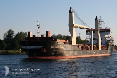
SEA DISCOVERY
General Cargo
Current Trip
TRMER
| Time Travelled | 2 days |
|---|---|
| Remaining Time | --- |
| Distance Travelled | 626.12 nm |
| Remaining Distance | --- |
| AVG Speed | 11.3 Noeuds |
| MAX Speed | 12.3 Noeuds |
| AVG Wind | 9.1 knots |
| MAX Wind | 19.8 knots |
| MIN Temp | 14.8°C / 58.64°F |
| MAX Temp | 17.8°C / 64.04°F |
| Tirant d eau | 5.6 m |
| Position reçue | 2 m depuis |
Current Position
| Longitude | --- |
|---|---|
| Latitude | --- |
| Etat | At anchor |
| Vitesse | |
| Parcours | 198° |
| Zone | Mediterranean Sea - Eastern Basin |
| Station | T-AIS |
| Position reçue | 2 m depuis |
Information
The current position of SEA DISCOVERY is in Mediterranean Sea - Eastern Basin with coordinates 36.72315° / 34.64050° as reported on 2025-03-30 10:09 by AIS to our vessel tracker app. The vessel's current speed is 0 Noeuds
The vessel SEA DISCOVERY (IMO: 9516131, MMSI: 257167000) is a General Cargo that was built in 2012 ( 13 Age ). It's sailing under the flag of [NO] Norway.
In this page you can find informations about the vessels current position, last detected port calls, and current voyage information. If the vessels is not in coverage by AIS you will find the latest position.
The current position of SEA DISCOVERY is detected by our AIS receivers and we are not responsible for the reliability of the data. The last position was recorded while the vessel was in Coverage by the Ais receivers of our vessel tracking app.
The current draught of SEA DISCOVERY as reported by AIS is 5.6 meters
Weather
| Temperature | 18.2°C / 64.76°F |
|---|---|
| Wind Speed | 9 knots |
| Direction | 190° S |
| Pressure | 1008.4 hPa |
| Humidity | 62.5 % |
| Cloud Coverage | 7 % |
Featured Company
Last Port Calls
| Port | Arrival | Departure | Time In Port |
|---|---|---|---|
| 2025-03-27 10:55 | 2025-03-28 02:44 | 15 h | |
| 2025-03-22 15:19 | 2025-03-24 05:37 | 1 d | |
| 2025-03-20 17:09 | 2025-03-21 13:29 | 20 h | |
| 2025-03-16 03:54 | 2025-03-16 14:15 | 10 h | |
| 2025-03-04 17:45 | 2025-03-05 20:05 | 1 d | |
| 2025-02-25 03:33 | 2025-02-28 23:29 | 3 d | |
| 2025-02-21 01:37 | 2025-02-22 20:38 | 1 d | |
| 2025-02-11 23:36 | 2025-02-13 09:31 | 1 d | |
| 2025-02-09 06:59 | 2025-02-11 11:13 | 2 d | |
| 2025-02-02 08:19 | 2025-02-02 11:55 | 3 h |
Most Visited Ports (Last year)
| Port | Arrivals | |
|---|---|---|
| 3 | ||
| 3 | ||
| 3 | ||
| 3 | ||
| 3 | ||
| 2 |
Last Trips
| Origin | Departure | Destination | Arrival | Distance | |
|---|---|---|---|---|---|
| 2025-03-24 06:37 | 2025-03-27 13:55 | 829.88 nm | |||
| 2025-03-21 14:29 | 2025-03-22 16:19 | 195.11 nm | |||
| 2025-03-16 15:15 | 2025-03-20 18:09 | 1045.00 nm | |||
| 2025-03-05 22:05 | 2025-03-16 04:54 | 2430.02 nm | |||
| 2025-03-01 00:29 | 2025-03-04 19:45 | 354.61 nm | |||
| 2025-02-22 21:38 | 2025-02-25 04:33 | 571.94 nm | |||
| 2025-02-13 10:31 | 2025-02-21 02:37 | 1982.71 nm | |||
| 2025-02-11 12:13 | 2025-02-12 00:36 | 144.90 nm | |||
| 2025-02-02 12:55 | 2025-02-09 07:59 | 1682.62 nm | |||
| 2025-01-30 14:29 | 2025-02-02 09:19 | 697.17 nm |
Events
| Heure | Evenement | Détails | Position/ Destination | Info |
|---|---|---|---|---|
| 2025-03-30 10:03 | Etat Changé | At anchor Default |
36.72315 / 34.64041
TRMER
|
Vitesse: Parcours: 198° |
| 2025-03-30 09:48 | Etat Changé | Default At anchor |
36.72320 / 34.64039
TRMER
|
Vitesse: 0.1 kn Parcours: 176° |
| 2025-03-30 09:48 | Dans la zone couverte |
36.72315 / 34.64041
Mediterranean Sea - Eastern Basin
|
Vitesse: 0.1 kn Parcours: 186.6° |
|
| 2025-03-30 08:57 | Hors de la zone couverte |
36.72316 / 34.63997
Mediterranean Sea - Eastern Basin
|
Vitesse: 0.1 kn Parcours: 186.6° |
|
| 2025-03-30 08:33 | Arret | 4.42 nm, South of MERSIN |
36.72330 / 34.64004
TRMER
|
Vitesse: 0.3 kn Parcours: 181° |
| 2025-03-30 08:09 | Etat Changé | At anchor Under way using engine |
36.72111 / 34.63859
TRMER
|
Vitesse: 0.9 kn Parcours: 44° |
| 2025-03-30 06:44 | Changement d'ETA | 2025/03/28 08:00 2025/03/28 08:30 |
36.50604 / 34.60338
TRMER
|
Vitesse: 11.7 kn Parcours: 39.4° |
| 2025-03-30 06:09 | Detecté en mer | Turkish part of the Mediterranean Sea - Eastern Basin |
36.42061 / 34.50602
Mediterranean Sea - Eastern Basin
|
Vitesse: 11.9 kn Parcours: 43.4° |
| 2025-03-30 06:09 | Etat Changé | Under way using engine Default |
36.42061 / 34.50602
TRMER
|
Vitesse: 11.8 kn Parcours: 43° |
| 2025-03-30 06:09 | Dans la zone couverte |
36.42061 / 34.50602
Mediterranean Sea - Eastern Basin
|
Vitesse: 11.9 kn Parcours: 43.4° |