

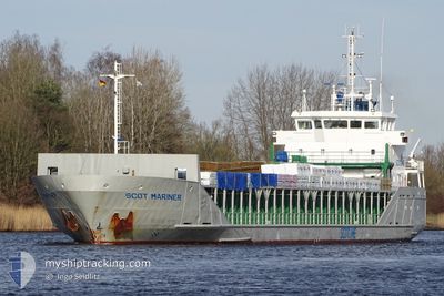
SCOT MARINER
General Cargo

Current Trip
| Time Travelled | 6 days |
|---|---|
| Remaining Time | --- |
| Distance Travelled | 1607.57 nm |
| Remaining Distance | 24.36 nm |
| AVG Speed | 11 Noeuds |
| MAX Speed | 15.2 Noeuds |
| AVG Wind | 18.6 knots |
| MAX Wind | 31 knots |
| MIN Temp | 0.8°C / 33.44°F |
| MAX Temp | 10.7°C / 51.26°F |
| Tirant d eau | 5.1 m |
| Position reçue | 11 h, 23 m depuis |
Current Position
| Longitude | --- |
|---|---|
| Latitude | --- |
| Etat | Under way using engine |
| Vitesse | 9.4 Noeuds |
| Parcours | 138.8° |
| Zone | Inner Seas off the West Coast of Scotland |
| Station | T-AIS |
| Position reçue | 11 h, 23 m depuis |
Information
The current position of SCOT MARINER is in Inner Seas off the West Coast of Scotland with coordinates 54.64615° / -5.01783° as reported on 2025-03-27 16:09 by AIS to our vessel tracker app. The vessel's current speed is 9.4 Noeuds and is heading at the port of WORKINGTON. The estimated time of arrival as calculated by MyShipTracking vessel tracking app is 2025-03-27 21:00 LT
The vessel SCOT MARINER (IMO: 9243916, MMSI: 235002520) is a General Cargo that was built in 2001 ( 24 Age ). It's sailing under the flag of [GB] United Kingdom.
In this page you can find informations about the vessels current position, last detected port calls, and current voyage information. If the vessels is not in coverage by AIS you will find the latest position.
The current position of SCOT MARINER is detected by our AIS receivers and we are not responsible for the reliability of the data. The last position was recorded while the vessel was in Coverage by the Ais receivers of our vessel tracking app.
The current draught of SCOT MARINER as reported by AIS is 5.1 meters
Weather
| Temperature | 7.6°C / 45.68°F |
|---|---|
| Wind Speed | 19 knots |
| Direction | 252° WSW |
| Pressure | 1005.6 hPa |
| Humidity | 82.9 % |
| Cloud Coverage | 62 % |


Featured Company
Last Port Calls
| Port | Arrival | Departure | Time In Port |
|---|---|---|---|
| 2025-03-20 16:47 | 2025-03-21 20:05 | 1 d | |
| 2025-03-19 08:53 | 2025-03-20 05:36 | 20 h | |
| 2025-03-12 09:44 | 2025-03-13 08:44 | 23 h | |
| 2025-03-10 07:46 | 2025-03-11 18:23 | 1 d | |
| 2025-03-03 07:54 | 2025-03-05 13:42 | 2 d | |
| 2025-02-24 17:58 | 2025-02-25 18:05 | 1 d | |
| 2025-02-22 08:45 | 2025-02-24 11:40 | 2 d | |
| 2025-02-19 08:47 | 2025-02-20 15:13 | 1 d | |
| 2025-02-17 04:47 | 2025-02-17 15:12 | 10 h | |
| 2025-02-16 15:11 | 2025-02-17 04:25 | 13 h |
Last Trips
| Origin | Departure | Destination | Arrival | Distance | |
|---|---|---|---|---|---|
| 2025-03-20 05:36 | 2025-03-20 16:47 | 125.85 nm | |||
| 2025-03-13 08:44 | 2025-03-19 08:53 | 1518.54 nm | |||
| 2025-03-11 18:23 | 2025-03-12 09:44 | 72.35 nm | |||
| 2025-03-05 13:42 | 2025-03-10 07:46 | 1089.19 nm | |||
| 2025-02-25 18:05 | 2025-03-03 07:54 | 1220.61 nm | |||
| 2025-02-24 11:40 | 2025-02-24 17:58 | 76.23 nm | |||
| 2025-02-20 15:13 | 2025-02-22 08:45 | 276.00 nm | |||
| 2025-02-17 15:12 | 2025-02-19 08:47 | 411.52 nm | |||
| 2025-02-17 04:25 | 2025-02-17 04:47 | 2.78 nm | |||
| 2025-02-12 19:06 | 2025-02-16 15:11 | 762.19 nm |
Events
| Heure | Evenement | Détails | Position/ Destination | Info |
|---|---|---|---|---|
| 2025-03-27 16:16 | Etat Changé | Default Under way using engine |
54.63180 / -4.99489
GBWOR
|
Vitesse: 9.4 kn Parcours: 138.8° |
| 2025-03-27 16:09 | Hors de la zone couverte |
54.64615 / -5.01783
Inner Seas off the West Coast of Scotland
GBWOR
|
Vitesse: 9.4 kn Parcours: 138.8° |
|
| 2025-03-27 13:44 | Etat Changé | Under way using engine Default |
54.94801 / -5.39207
GBWOR
|
Vitesse: 9 kn Parcours: 139° |
| 2025-03-27 13:44 | Etat Changé | Default Under way using engine |
54.94931 / -5.39390
GBWOR
|
Vitesse: 9.2 kn Parcours: 141° |
| 2025-03-27 13:36 | Etat Changé | Under way using engine Default |
54.96382 / -5.41455
GBWOR
|
Vitesse: 9.2 kn Parcours: 141° |
| 2025-03-27 13:36 | Etat Changé | Default Under way using engine |
54.96515 / -5.41641
GBWOR
|
Vitesse: 9.3 kn Parcours: 140.8° |
| 2025-03-27 13:22 | Changement d'ETA | 2025/03/27 21:00 2025/03/27 22:00 |
54.99339 / -5.45627
GBWOR
|
Vitesse: 8.9 kn Parcours: 140.9° |
| 2025-03-27 13:16 | Etat Changé | Under way using engine Default |
55.00309 / -5.46969
GBWOR
|
Vitesse: 8.9 kn Parcours: 142° |
| 2025-03-27 13:16 | Dans la zone couverte |
55.00309 / -5.46969
Inner Seas off the West Coast of Scotland
GBWOR
|
Vitesse: 8.7 kn Parcours: 143° |
|
| 2025-03-27 03:43 | Hors de la zone couverte |
56.35420 / -5.68108
Inner Seas off the West Coast of Scotland
GBWOR
|
Vitesse: 10 kn Parcours: 213° |