

SCI DELHI
Cargo A

Current Trip
| Time Travelled | 12 days |
|---|---|
| Remaining Time | --- |
| Distance Travelled | 3848.83 nm |
| Remaining Distance | --- |
| AVG Speed | 13 Noeuds |
| MAX Speed | 16.9 Noeuds |
| AVG Wind | 15.9 knots |
| MAX Wind | 45 knots |
| MIN Temp | -0.5°C / 31.1°F |
| MAX Temp | 28.7°C / 83.66°F |
| Tirant d eau | 13.9 m |
| Position reçue | 3 d depuis |
Current Position
| Longitude | --- |
|---|---|
| Latitude | --- |
| Etat | Under way using engine |
| Vitesse | 13.9 Noeuds |
| Parcours | 170.3° |
| Zone | North Atlantic Ocean |
| Station | T-AIS |
| Position reçue | 3 d depuis |
Information
The current position of SCI DELHI is in North Atlantic Ocean with coordinates 12.22339° / -17.68946° as reported on 2025-03-24 19:35 by AIS to our vessel tracker app. The vessel's current speed is 13.9 Noeuds and is heading at the port of NHAVA SHEVA. The estimated time of arrival as calculated by MyShipTracking vessel tracking app is 2025-04-18 16:00 LT
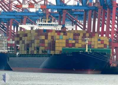
The vessel SCI DELHI (IMO: 9699127, MMSI: 636093197) is a Cargo A It's sailing under the flag of [LR] Liberia.
In this page you can find informations about the vessels current position, last detected port calls, and current voyage information. If the vessels is not in coverage by AIS you will find the latest position.
The current position of SCI DELHI is detected by our AIS receivers and we are not responsible for the reliability of the data. The last position was recorded while the vessel was in Coverage by the Ais receivers of our vessel tracking app.
The current draught of SCI DELHI as reported by AIS is 13.9 meters
Weather
| Temperature | 27.4°C / 81.32°F |
|---|---|
| Wind Speed | 13 knots |
| Direction | 152° SSE |
| Pressure | 1009.5 hPa |
| Humidity | 75.4 % |
| Cloud Coverage | 100 % |


Featured Company
Last Port Calls
| Port | Arrival | Departure | Time In Port |
|---|---|---|---|
| 2025-03-15 00:54 | 2025-03-16 02:18 | 1 d | |
| 2025-03-11 10:12 | 2025-03-13 07:45 | 1 d | |
| 2025-03-08 23:25 | 2025-03-10 11:07 | 1 d | |
| 2025-03-04 12:08 | 2025-03-05 19:31 | 1 d | |
| 2025-03-02 19:18 | 2025-03-04 01:41 | 1 d | |
| 2025-02-28 06:43 | 2025-03-01 09:12 | 1 d | |
| 2025-02-25 18:49 | 2025-02-27 09:36 | 1 d | |
| 2025-01-24 04:51 | 2025-01-26 04:58 | 2 d | |
| 2025-01-20 03:32 | 2025-01-21 08:47 | 1 d |
Most Visited Ports (Last year)
| Port | Arrivals | |
|---|---|---|
| 5 | ||
| 4 | ||
| 4 | ||
| 4 | ||
| 4 | ||
| 4 |
Last Trips
| Origin | Departure | Destination | Arrival | Distance | |
|---|---|---|---|---|---|
| 2025-03-13 07:45 | 2025-03-15 00:54 | 263.64 nm | |||
| 2025-03-10 11:07 | 2025-03-11 10:12 | 267.85 nm | |||
| 2025-03-05 19:31 | 2025-03-08 23:25 | 361.30 nm | |||
| 2025-03-04 01:41 | 2025-03-04 12:08 | 134.98 nm | |||
| 2025-03-01 09:12 | 2025-03-02 19:18 | 303.34 nm | |||
| 2025-02-27 09:36 | 2025-02-28 06:43 | 119.75 nm | |||
| 2025-01-26 04:58 | 2025-02-25 18:49 | 10897.00 nm | |||
| 2025-01-21 08:47 | 2025-01-24 04:51 | 564.13 nm | |||
| 2024-12-23 15:14 | 2025-01-20 03:32 | 11060.30 nm |
Events
| Heure | Evenement | Détails | Position/ Destination | Info |
|---|---|---|---|---|
| 2025-03-26 11:15 | Démarrage |
4.92791 / -13.30599
GBLGP>INNSA
|
Vitesse: 8.6 kn Parcours: 149° |
|
| 2025-03-26 08:53 | Arret |
4.93342 / -13.30875
GBLGP>INNSA
|
Vitesse: 0.3 kn Parcours: 224° |
|
| 2025-03-24 19:44 | Etat Changé | Default Under way using engine |
12.19130 / -17.68347
GBLGP>INNSA
|
Vitesse: 13.9 kn Parcours: 170.3° |
| 2025-03-24 19:35 | Hors de la zone couverte |
12.22339 / -17.68946
North Atlantic Ocean
GBLGP>INNSA
|
Vitesse: 13.9 kn Parcours: 170.3° |
|
| 2025-03-24 18:10 | Detecté en mer | Senegalese part of the North Atlantic Ocean |
12.54796 / -17.73854
North Atlantic Ocean
GBLGP>INNSA
|
Vitesse: 13.8 kn Parcours: 171.8° |
| 2025-03-24 18:10 | Etat Changé | Under way using engine Default |
12.54853 / -17.73862
GBLGP>INNSA
|
Vitesse: 13.8 kn Parcours: 171° |
| 2025-03-24 18:04 | Dans la zone couverte |
12.54796 / -17.73854
North Atlantic Ocean
GBLGP>INNSA
|
Vitesse: 13.8 kn Parcours: 171.8° |
|
| 2025-03-21 22:59 | Etat Changé | Default Under way using engine |
27.55508 / -15.19825
GBLGP>INNSA
|
Vitesse: 14.5 kn Parcours: 193.5° |
| 2025-03-21 22:52 | Hors de la zone couverte |
27.58205 / -15.19035
North Atlantic Ocean
GBLGP>INNSA
|
Vitesse: 14.5 kn Parcours: 193.5° |
|
| 2025-03-21 22:51 | Etat Changé | Under way using engine Default |
27.58635 / -15.18910
GBLGP>INNSA
|
Vitesse: 14.5 kn Parcours: 196° |