
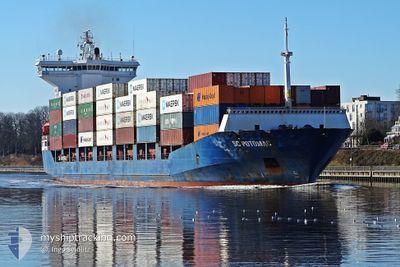
SC POTOMAC
Container Ship
Current Trip
| Time Travelled | 10 h, 59 mins |
|---|---|
| Remaining Time | 3 days |
| Distance Travelled | 147.00 nm |
| Remaining Distance | 1042.09 nm |
| AVG Speed | 13.2 Noeuds |
| MAX Speed | 14.4 Noeuds |
| AVG Wind | 11.2 knots |
| MAX Wind | 16.3 knots |
| MIN Temp | 7.7°C / 45.86°F |
| MAX Temp | 14.2°C / 57.56°F |
| Tirant d eau | 7.3 m |
| Position reçue | 1 m depuis |
Current Position
| Longitude | --- |
|---|---|
| Latitude | --- |
| Etat | Under way using engine |
| Vitesse | 13.1 Noeuds |
| Parcours | 174.5° |
| Zone | Tyrrhenian Sea |
| Station | T-AIS |
| Position reçue | 1 m depuis |
Info
Information
The current position of SC POTOMAC is in Tyrrhenian Sea with coordinates 38.36431° / 15.67415° as reported on 2024-12-27 05:57 by AIS to our vessel tracker app. The vessel's current speed is 13.1 Noeuds and is heading at the port of ASHDOD. The estimated time of arrival as calculated by MyShipTracking vessel tracking app is 2024-12-30 15:39 LT
The vessel SC POTOMAC (IMO: 9236274, MMSI: 636020662) is a Container Ship that was built in 2002 ( 22 Age ). It's sailing under the flag of [LR] Liberia.
In this page you can find informations about the vessels current position, last detected port calls, and current voyage information. If the vessels is not in coverage by AIS you will find the latest position.
The current position of SC POTOMAC is detected by our AIS receivers and we are not responsible for the reliability of the data. The last position was recorded while the vessel was in Coverage by the Ais receivers of our vessel tracking app.
The current draught of SC POTOMAC as reported by AIS is 7.3 meters
Weather
| Temperature | 9.9°C / 49.82°F |
|---|---|
| Wind Speed | 5 knots |
| Direction | 255° WSW |
| Pressure | 1024.4 hPa |
| Humidity | 80.5 % |
| Cloud Coverage | 55 % |
Featured Company
Last Port Calls
| Port | Arrival | Departure | Time In Port |
|---|---|---|---|
| 2024-12-26 06:58 | 2024-12-26 18:59 | 12 h | |
| 2024-12-22 17:36 | 2024-12-23 18:50 | 1 d | |
| 2024-12-17 09:45 | 2024-12-17 21:38 | 11 h | |
| 2024-12-09 09:08 | 2024-12-10 12:29 | 1 d | |
| 2024-12-03 00:37 | 2024-12-03 18:39 | 18 h | |
| 2024-12-01 17:11 | 2024-12-02 03:33 | 10 h | |
| 2024-11-22 07:40 | |||
| 2024-11-18 21:42 | 2024-11-19 17:40 | 19 h | |
| 2024-11-16 01:30 | 2024-11-16 22:35 | 21 h | |
| 2024-11-14 22:23 | 2024-11-15 12:04 | 13 h |
Last Trips
| Origin | Departure | Destination | Arrival | Distance | |
|---|---|---|---|---|---|
| 2024-12-23 19:50 | 2024-12-26 07:58 | 392.08 nm | |||
| 2024-12-17 22:38 | 2024-12-22 18:36 | 334.39 nm | |||
| 2024-12-10 14:29 | 2024-12-17 10:45 | 1643.55 nm | |||
| 2024-12-03 19:39 | 2024-12-09 11:08 | 1529.85 nm | |||
| 2024-12-02 04:33 | 2024-12-03 01:37 | 236.99 nm | |||
| 2024-11-19 19:40 | 2024-11-22 09:40 | 696.47 nm | |||
| 2024-11-17 00:35 | 2024-11-18 23:42 | 567.78 nm | |||
| 2024-11-15 14:04 | 2024-11-16 03:30 | 58.89 nm | |||
| 2024-11-14 01:02 | 2024-11-15 00:23 | 214.43 nm | |||
| 2024-11-11 03:46 | 2024-11-13 06:10 | 536.67 nm |
Events
| Heure | Evenement | Détails | Position/ Destination | Info |
|---|---|---|---|---|
| 2024-12-27 04:13 | Changement d'ETA | 2025/01/01 04:00 2024/12/30 06:00 |
38.73713 / 15.61521
ILASH
|
Vitesse: 12.3 kn Parcours: 168.7° |
| 2024-12-27 03:12 | Etat Changé | Under way using engine Default |
38.93186 / 15.51239
ILASH
|
Vitesse: 13.8 kn Parcours: 157° |
| 2024-12-27 03:03 | Etat Changé | Default Under way using engine |
38.96210 / 15.49489
ILASH
|
Vitesse: 13.9 kn Parcours: 155° |
| 2024-12-27 02:51 | Etat Changé | Under way using engine Default |
39.00473 / 15.47166
ILASH
|
Vitesse: 14.1 kn Parcours: 157° |
| 2024-12-27 02:36 | Dans la zone couverte |
39.00401 / 15.47204
Tyrrhenian Sea
ILASH
|
Vitesse: 14 kn Parcours: 157.4° |
|
| 2024-12-26 21:25 | Etat Changé | Default Under way using engine |
40.14075 / 14.75470
ILASH
|
Vitesse: 13.6 kn Parcours: 149.7° |
| 2024-12-26 21:24 | Etat Changé | Under way using engine Default |
40.14185 / 14.75385
ILASH
|
Vitesse: 13.6 kn Parcours: 153° |
| 2024-12-26 21:24 | Hors de la zone couverte |
40.14185 / 14.75385
Tyrrhenian Sea
ILASH
|
Vitesse: 13.6 kn Parcours: 149.7° |
|
| 2024-12-26 21:21 | Etat Changé | Default Under way using engine |
40.15427 / 14.74556
ILASH
|
Vitesse: 13.7 kn Parcours: 155.5° |
| 2024-12-26 20:57 | Etat Changé | Under way using engine Default |
40.23839 / 14.70755
ILASH
|
Vitesse: 14.1 kn Parcours: 182° |