
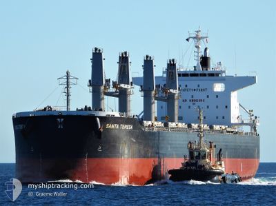
SANTA TERESA
Cargo
Current Trip
| Time Travelled | 1 day |
|---|---|
| Remaining Time | 10 days |
| Distance Travelled | 407.06 nm |
| Remaining Distance | 3526.48 nm |
| AVG Speed | 13 Noeuds |
| MAX Speed | 15.6 Noeuds |
| AVG Wind | 11.1 knots |
| MAX Wind | 17.3 knots |
| MIN Temp | 22.7°C / 72.86°F |
| MAX Temp | 28.9°C / 84.02°F |
| Tirant d eau | 6.9 m |
| Position reçue | 19 h, 31 m depuis |
Current Position
| Longitude | --- |
|---|---|
| Latitude | --- |
| Etat | Under way using engine |
| Vitesse | 14.9 Noeuds |
| Parcours | 83.1° |
| Zone | Singapore Strait |
| Station | T-AIS |
| Position reçue | 19 h, 31 m depuis |
Info
Information
The current position of SANTA TERESA is in Singapore Strait with coordinates 1.26510° / 104.24914° as reported on 2026-01-03 08:24 by AIS to our vessel tracker app. The vessel's current speed is 14.9 Noeuds and is heading at the port of ADELAIDE. The estimated time of arrival as calculated by MyShipTracking vessel tracking app is 2026-01-15 02:22 LT
The vessel SANTA TERESA (IMO: 9852664, MMSI: 374356000) is a Cargo It's sailing under the flag of [PA] Panama.
In this page you can find informations about the vessels current position, last detected port calls, and current voyage information. If the vessels is not in coverage by AIS you will find the latest position.
The current position of SANTA TERESA is detected by our AIS receivers and we are not responsible for the reliability of the data. The last position was recorded while the vessel was in Coverage by the Ais receivers of our vessel tracking app.
The current draught of SANTA TERESA as reported by AIS is 6.9 meters
Weather
| Temperature | 27.1°C / 80.78°F |
|---|---|
| Wind Speed | 10 knots |
| Direction | 335° NNW |
| Pressure | 1011.8 hPa |
| Humidity | 80 % |
| Cloud Coverage | 96 % |
Featured Company
Most Visited Ports (Last year)
| Port | Arrivals | |
|---|---|---|
| 2 | ||
| 2 | ||
| 1 | ||
| 1 | ||
| 1 | ||
| 1 |
Events
| Heure | Evenement | Détails | Position/ Destination | Info |
|---|---|---|---|---|
| 2026-01-03 08:29 | Etat Changé | Default Under way using engine |
1.26769 / 104.26949
AU ADL
|
Vitesse: 14.9 kn Parcours: 83.1° |
| 2026-01-03 08:24 | Hors de la zone couverte |
1.26510 / 104.24914
Singapore Strait
AU ADL
|
Vitesse: 14.9 kn Parcours: 83.1° |
|
| 2026-01-03 08:06 | Changement de zone | Malaysian part of the Singapore Strait Indonesian part of the Singapore Strait |
1.25656 / 104.17523
Singapore Strait
AU ADL
|
Vitesse: 14.7 kn Parcours: 83.1° |
| 2026-01-03 05:46 | Changement de zone | Indonesian part of the Singapore Strait Indonesian part of the South China Sea |
1.04022 / 103.67015
Singapore Strait
AU ADL
|
Vitesse: 11.6 kn Parcours: 50.3° |
| 2026-01-03 05:44 | Changement de zone | Indonesian part of the South China Sea Indonesian part of the Singapore Strait |
1.03662 / 103.66474
South China Sea
AU ADL
|
Vitesse: 11.6 kn Parcours: 81.2° |
| 2026-01-03 05:04 | Etat Changé | Under way using engine Default |
1.10348 / 103.54690
AU ADL
|
Vitesse: 12.4 kn Parcours: 118° |
| 2026-01-03 05:01 | Etat Changé | Default Under way using engine |
1.11002 / 103.53669
AU ADL
|
Vitesse: 12.3 kn Parcours: 113.6° |
| 2026-01-03 04:30 | Changement de zone | Indonesian part of the Singapore Strait Indonesian part of the Malacca Strait |
1.15362 / 103.44234
Singapore Strait
AU ADL
|
Vitesse: 12.5 kn Parcours: 130.3° |
| 2026-01-03 04:30 | Etat Changé | Under way using engine Default |
1.15362 / 103.44234
AU ADL
|
Vitesse: 12.6 kn Parcours: 134° |
| 2026-01-03 04:29 | Dans la zone couverte |
1.15362 / 103.44234
Singapore Strait
AU ADL
|
Vitesse: 12.5 kn Parcours: 130.3° |