
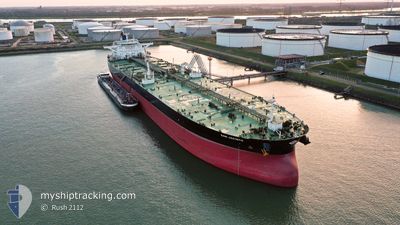
SAN JACINTO
Tanker
Current Trip
FPSO LIZA DESTINY
| Time Travelled | 5 days |
|---|---|
| Remaining Time | --- |
| Distance Travelled | 1576.05 nm |
| Remaining Distance | --- |
| AVG Speed | 11.4 Noeuds |
| MAX Speed | 14.1 Noeuds |
| AVG Wind | 12.2 knots |
| MAX Wind | 24.8 knots |
| MIN Temp | 13.3°C / 55.94°F |
| MAX Temp | 19.6°C / 67.28°F |
| Tirant d eau | 9.3 m |
| Position reçue | 1 h, 22 m depuis |
Current Position
| Longitude | -22.78510° |
|---|---|
| Latitude | 35.46667° |
| Etat | Under way using engine |
| Vitesse | 11.4 Noeuds |
| Parcours | 229.4° |
| Zone | North Atlantic Ocean |
| Station | T-AIS |
| Position reçue | 1 h, 22 m depuis |
Info
Information
The current position of SAN JACINTO is in North Atlantic Ocean with coordinates 35.46667° / -22.78510° as reported on 2024-06-27 01:37 by AIS to our vessel tracker app. The vessel's current speed is 11.4 Noeuds
The vessel SAN JACINTO (IMO: 973073, MMSI: 538006700) is a Tanker It's sailing under the flag of [MH] Marshall Is.
In this page you can find informations about the vessels current position, last detected port calls, and current voyage information. If the vessels is not in coverage by AIS you will find the latest position.
The current position of SAN JACINTO is detected by our AIS receivers and we are not responsible for the reliability of the data. The last position was recorded while the vessel was in Coverage by the Ais receivers of our vessel tracking app.
The current draught of SAN JACINTO as reported by AIS is 9.3 meters
Weather
| Temperature | 19.5°C / 67.1°F |
|---|---|
| Wind Speed | 11 knots |
| Direction | 11° N |
| Pressure | 1024.6 hPa |
| Humidity | 70.2 % |
| Cloud Coverage | 1 % |
Featured Company
Last Port Calls
| Port | Arrival | Departure | Time In Port |
|---|---|---|---|
| 2024-06-20 15:02 | 2024-06-21 11:02 | 19 h | |
| 2024-06-18 19:56 | 2024-06-20 14:40 | 1 d | |
| 2024-05-27 07:58 | 2024-05-28 09:40 | 1 d |
Events
| Heure | Evenement | Détails | Position/ Destination | Info |
|---|---|---|---|---|
| 2024-06-27 01:41 | Etat Changé | Default Under way using engine |
35.45688 / -22.79909
FPSO LIZA DESTINY
|
Vitesse: 11.4 kn Parcours: 229.4° |
| 2024-06-27 01:37 | Hors de la zone couverte |
35.46667 / -22.78510
North Atlantic Ocean
FPSO LIZA DESTINY
|
Vitesse: 11.4 kn Parcours: 229.4° |
|
| 2024-06-27 01:29 | Etat Changé | Under way using engine Default |
35.48130 / -22.76401
FPSO LIZA DESTINY
|
Vitesse: 11.3 kn Parcours: 230° |
| 2024-06-27 01:26 | Etat Changé | Default Under way using engine |
35.48835 / -22.75384
FPSO LIZA DESTINY
|
Vitesse: 11.3 kn Parcours: 230.1° |
| 2024-06-27 01:19 | Etat Changé | Under way using engine Default |
35.50244 / -22.73332
FPSO LIZA DESTINY
|
Vitesse: 11.4 kn Parcours: 230° |
| 2024-06-27 01:15 | Etat Changé | Default Under way using engine |
35.51089 / -22.72095
FPSO LIZA DESTINY
|
Vitesse: 11.4 kn Parcours: 232.1° |
| 2024-06-26 22:50 | Etat Changé | Under way using engine Default |
35.81837 / -22.30964
FPSO LIZA DESTINY
|
Vitesse: 11.3 kn Parcours: 226° |
| 2024-06-26 22:30 | Etat Changé | Default Under way using engine |
35.85981 / -22.25627
FPSO LIZA DESTINY
|
Vitesse: 11.5 kn Parcours: 227.5° |
| 2024-06-26 22:25 | Etat Changé | Under way using engine Default |
35.87212 / -22.23976
FPSO LIZA DESTINY
|
Vitesse: 11.5 kn Parcours: 227° |
| 2024-06-26 22:14 | Etat Changé | Default Under way using engine |
35.89476 / -22.20931
FPSO LIZA DESTINY
|
Vitesse: 11.5 kn Parcours: 228.5° |