
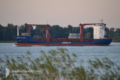
SAMSKIP CHALLENGER
General Cargo
Current Trip
| Time Travelled | 20 h, 33 mins |
|---|---|
| Remaining Time | 9 h, 16 mins |
| Distance Travelled | 258.07 nm |
| Remaining Distance | 129.38 nm |
| AVG Speed | 12.6 Noeuds |
| MAX Speed | 17.4 Noeuds |
| AVG Wind | 12.7 knots |
| MAX Wind | 21.4 knots |
| MIN Temp | 12.1°C / 53.78°F |
| MAX Temp | 17°C / 62.6°F |
| Tirant d eau | 4.1 m |
| Position reçue | 2 m depuis |
Current Position
| Longitude | 6.48288° |
|---|---|
| Latitude | 56.97638° |
| Etat | Under way using engine |
| Vitesse | 13.6 Noeuds |
| Parcours | 343.9° |
| Zone | North Sea |
| Station | T-AIS |
| Position reçue | 2 m depuis |
Info
Information
The current position of SAMSKIP CHALLENGER is in North Sea with coordinates 56.97638° / 6.48288° as reported on 2024-07-06 18:44 by AIS to our vessel tracker app. The vessel's current speed is 13.6 Noeuds and is heading at the port of TANANGER. The estimated time of arrival as calculated by MyShipTracking vessel tracking app is 2024-07-07 04:02 LT
The vessel SAMSKIP CHALLENGER (IMO: 9114787, MMSI: 314238000) is a General Cargo that was built in 1995 ( 29 Age ). It's sailing under the flag of [BB] Barbados.
In this page you can find informations about the vessels current position, last detected port calls, and current voyage information. If the vessels is not in coverage by AIS you will find the latest position.
The current position of SAMSKIP CHALLENGER is detected by our AIS receivers and we are not responsible for the reliability of the data. The last position was recorded while the vessel was in Coverage by the Ais receivers of our vessel tracking app.
The current draught of SAMSKIP CHALLENGER as reported by AIS is 4.1 meters
Weather
| Temperature | 13.1°C / 55.58°F |
|---|---|
| Wind Speed | 17 knots |
| Direction | 59° ENE |
| Pressure | 989.7 hPa |
| Humidity | 90.5 % |
| Cloud Coverage | 99 % |
Featured Company
Last Port Calls
| Port | Arrival | Departure | Time In Port |
|---|---|---|---|
| 2024-07-05 03:41 | 2024-07-05 22:13 | 18 h | |
| 2024-07-03 07:01 | 2024-07-03 09:57 | 2 h | |
| 2024-07-02 04:00 | 2024-07-02 05:15 | 1 h | |
| 2024-07-01 09:59 | 2024-07-01 16:44 | 6 h | |
| 2024-06-30 04:28 | 2024-06-30 05:25 | 57 m | |
| 2024-06-28 03:56 | 2024-06-28 21:57 | 18 h | |
| 2024-06-26 10:00 | 2024-06-26 13:42 | 3 h | |
| 2024-06-25 07:16 | 2024-06-25 09:35 | 2 h | |
| 2024-06-25 04:44 | 2024-06-25 06:09 | 1 h | |
| 2024-06-24 10:52 | 2024-06-24 17:09 | 6 h |
Last Trips
| Origin | Departure | Destination | Arrival | Distance | |
|---|---|---|---|---|---|
| 2024-07-03 11:57 | 2024-07-05 05:41 | 449.84 nm | |||
| 2024-07-02 07:15 | 2024-07-03 09:01 | 298.50 nm | |||
| 2024-07-01 18:44 | 2024-07-02 06:00 | 120.27 nm | |||
| 2024-06-30 07:25 | 2024-07-01 11:59 | 375.81 nm | |||
| 2024-06-28 23:57 | 2024-06-30 06:28 | 384.08 nm | |||
| 2024-06-26 15:42 | 2024-06-28 05:56 | 451.72 nm | |||
| 2024-06-25 11:35 | 2024-06-26 12:00 | 294.91 nm | |||
| 2024-06-25 08:09 | 2024-06-25 09:16 | 12.52 nm | |||
| 2024-06-24 19:09 | 2024-06-25 06:44 | 120.51 nm | |||
| 2024-06-23 07:48 | 2024-06-24 12:52 | 375.41 nm |
Events
| Heure | Evenement | Détails | Position/ Destination | Info |
|---|---|---|---|---|
| 2024-07-06 18:25 | Etat Changé | Under way using engine Default |
56.90799 / 6.52006
TANANGER..NORWEGEN
|
Vitesse: 13.7 kn Parcours: 341° |
| 2024-07-06 18:16 | Dans la zone couverte |
56.90799 / 6.52006
North Sea
TANANGER..NORWEGEN
|
Vitesse: 13.6 kn Parcours: 343° |
|
| 2024-07-06 17:10 | Hors de la zone couverte |
56.63621 / 6.67563
North Sea
TANANGER..NORWEGEN
|
Vitesse: 13.6 kn Parcours: 341.3° |
|
| 2024-07-06 10:11 | Changement de zone | Danish part of the North Sea German part of the North Sea |
55.17766 / 7.56944
North Sea
TANANGER..NORWEGEN
|
Vitesse: 13.1 kn Parcours: 339.4° |
| 2024-07-06 05:12 | Etat Changé | Under way using engine Default |
54.20939 / 8.15663
TANANGER..NORWEGEN
|
Vitesse: 13.6 kn Parcours: 346° |
| 2024-07-06 04:38 | Etat Changé | Default Under way using engine |
54.08440 / 8.21838
TANANGER..NORWEGEN
|
Vitesse: 13.5 kn Parcours: 341.9° |
| 2024-07-06 04:32 | Etat Changé | Under way using engine Default |
54.06401 / 8.22888
TANANGER..NORWEGEN
|
Vitesse: 14 kn Parcours: 340° |
| 2024-07-06 04:30 | Etat Changé | Default Under way using engine |
54.05587 / 8.23396
TANANGER..NORWEGEN
|
Vitesse: 13.2 kn Parcours: 338.3° |
| 2024-07-05 22:13 | PORT DE DEPART |
|
53.54598 / 9.85604
TANANGER..NORWEGEN
|
Vitesse: 9.5 kn Parcours: 288° |
| 2024-07-05 21:44 | Démarrage |
53.50961 / 9.93914
[DE] HAMBURG
|
Vitesse: 8 kn Parcours: 358° |