
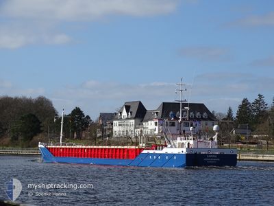
SAMIRA
General Cargo
Current Trip
| Time Travelled | 1 day |
|---|---|
| Remaining Time | --- |
| Distance Travelled | 295.24 nm |
| Remaining Distance | --- |
| AVG Speed | 10.5 Noeuds |
| MAX Speed | 14.2 Noeuds |
| AVG Wind | 13.7 knots |
| MAX Wind | 32.5 knots |
| MIN Temp | 7.1°C / 44.78°F |
| MAX Temp | 15.1°C / 59.18°F |
| Tirant d eau | 3.6 m |
| Position reçue | 1 h, 1 m depuis |
Current Position
| Longitude | 1.21159° |
|---|---|
| Latitude | 53.58118° |
| Etat | Under way using engine |
| Vitesse | 8.8 Noeuds |
| Parcours | 273° |
| Zone | North Sea |
| Station | T-AIS |
| Position reçue | 1 h, 1 m depuis |
Info
Information
The current position of SAMIRA is in North Sea with coordinates 53.58118° / 1.21159° as reported on 2024-04-28 23:15 by AIS to our vessel tracker app. The vessel's current speed is 8.8 Noeuds and is heading at the port of GOOLE. The estimated time of arrival as calculated by MyShipTracking vessel tracking app is 2024-04-29 12:00 LT
The vessel SAMIRA (IMO: 9240744, MMSI: 245015000) is a General Cargo that was built in 2004 ( 20 Age ). It's sailing under the flag of [NL] Netherlands.
In this page you can find informations about the vessels current position, last detected port calls, and current voyage information. If the vessels is not in coverage by AIS you will find the latest position.
The current position of SAMIRA is detected by our AIS receivers and we are not responsible for the reliability of the data. The last position was recorded while the vessel was in Coverage by the Ais receivers of our vessel tracking app.
The current draught of SAMIRA as reported by AIS is 3.6 meters
Weather
| Temperature | 8.2°C / 46.76°F |
|---|---|
| Wind Speed | 17 knots |
| Direction | 211° SSW |
| Pressure | 1011.1 hPa |
| Humidity | 85.6 % |
| Cloud Coverage | 79 % |
Featured Company
Last Port Calls
| Port | Arrival | Departure | Time In Port |
|---|---|---|---|
| 2024-04-27 03:41 | 2024-04-27 15:20 | 11 h | |
| 2024-04-25 15:17 | 2024-04-26 12:49 | 21 h | |
| 2024-04-21 17:26 | 2024-04-23 17:39 | 2 d | |
| 2024-04-17 10:38 | 2024-04-18 19:55 | 1 d | |
| 2024-04-14 23:08 | 2024-04-16 10:13 | 1 d | |
| 2024-04-11 18:29 | 2024-04-13 00:47 | 1 d | |
| 2024-04-07 17:16 | 2024-04-09 05:43 | 1 d | |
| 2024-04-04 14:42 | 2024-04-05 19:22 | 1 d | |
| 2024-03-30 21:04 | 2024-04-02 23:31 | 3 d | |
| 2024-03-29 08:33 | 2024-03-29 17:46 | 9 h |
Most Visited Ports (Last year)
| Port | Arrivals | |
|---|---|---|
| 25 | ||
| 16 | ||
| 12 | ||
| 10 | ||
| 8 | ||
| 4 |
Last Trips
| Origin | Departure | Destination | Arrival | Distance | |
|---|---|---|---|---|---|
| 2024-04-26 14:49 | 2024-04-27 05:41 | 125.99 nm | |||
| 2024-04-23 18:39 | 2024-04-25 17:17 | 424.76 nm | |||
| 2024-04-18 21:55 | 2024-04-21 18:26 | 248.33 nm | |||
| 2024-04-16 11:13 | 2024-04-17 12:38 | 229.13 nm | |||
| 2024-04-13 02:47 | 2024-04-15 00:08 | 379.88 nm | |||
| 2024-04-09 06:43 | 2024-04-11 20:29 | 394.11 nm | |||
| 2024-04-05 21:22 | 2024-04-07 18:16 | 386.55 nm | |||
| 2024-04-03 00:31 | 2024-04-04 16:42 | 371.72 nm | |||
| 2024-03-29 18:46 | 2024-03-30 21:04 | 249.89 nm | |||
| 2024-03-27 18:35 | 2024-03-29 09:33 | 260.05 nm |
Events
| Heure | Evenement | Détails | Position/ Destination | Info |
|---|---|---|---|---|
| 2024-04-28 23:36 | Etat Changé | Default Under way using engine |
53.58530 / 1.13470
GOOLE
|
Vitesse: 8.8 kn Parcours: 273° |
| 2024-04-28 19:30 | Detecté en mer | United Kingdom part of the North Sea |
53.50675 / 2.02489
North Sea
GOOLE
|
Vitesse: 7.9 kn Parcours: 282.3° |
| 2024-04-28 19:30 | Etat Changé | Under way using engine Default |
53.50675 / 2.02489
GOOLE
|
Vitesse: 8.2 kn Parcours: 287° |
| 2024-04-28 19:30 | Dans la zone couverte |
53.50675 / 2.02489
North Sea
GOOLE
|
Vitesse: 7.9 kn Parcours: 282.3° |
|
| 2024-04-28 07:10 | Hors de la zone couverte |
53.50160 / 4.79505
North Sea
GOOLE
|
Vitesse: 8.3 kn Parcours: 247.8° |
|
| 2024-04-28 06:18 | Etat Changé | Under way using engine Default |
53.54085 / 4.98190
GOOLE
|
Vitesse: 9.2 kn Parcours: 254° |
| 2024-04-28 05:43 | Etat Changé | Default Under way using engine |
53.57040 / 5.12452
GOOLE
|
Vitesse: 9.8 kn Parcours: 248.7° |
| 2024-04-28 05:38 | Etat Changé | Under way using engine Default |
53.57568 / 5.14965
GOOLE
|
Vitesse: 10.5 kn Parcours: 252° |
| 2024-04-28 05:13 | Etat Changé | Default Under way using engine |
53.59961 / 5.26058
GOOLE
|
Vitesse: 10.5 kn Parcours: 248.4° |
| 2024-04-28 04:23 | Etat Changé | Under way using engine Default |
53.64972 / 5.49727
GOOLE
|
Vitesse: 11.1 kn Parcours: 257° |